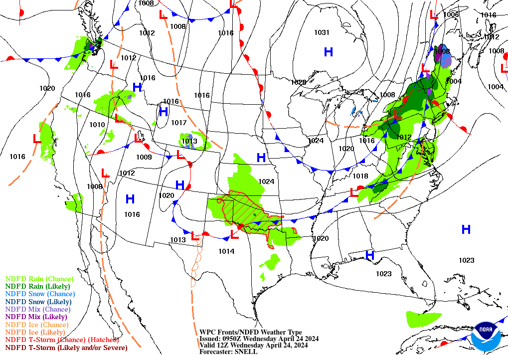
On the other side of a yesterday’s rain-making cold front today.
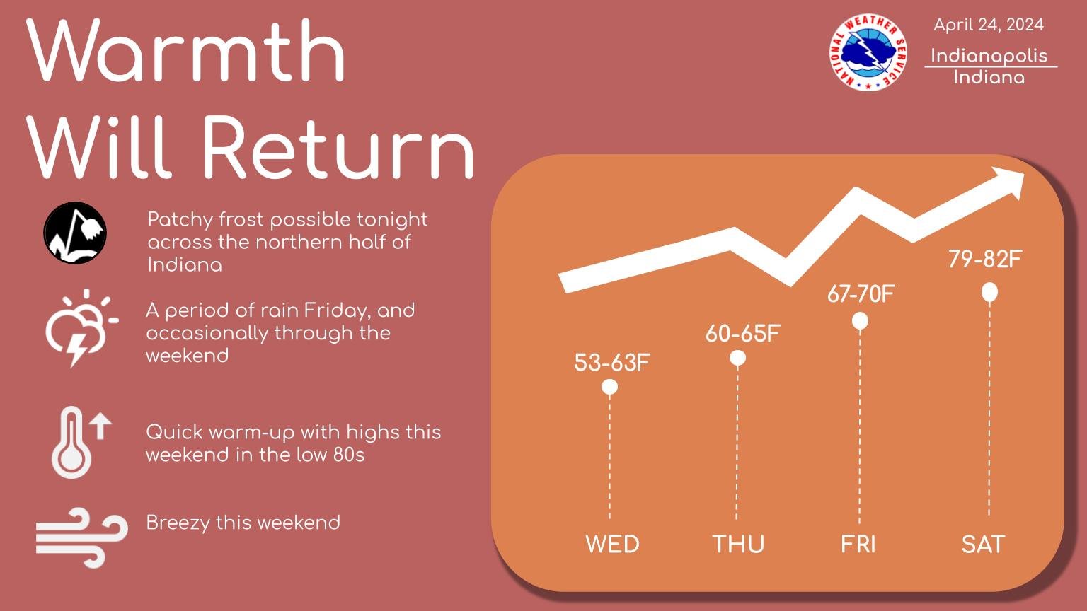
Hang on. Heat’s on its way!
Rainfall totals from yesterday afternoon and evening:
1.10″ LAFAYETTE (Boiler up?)
0.26″ MUNCIE & TERRE HAUTE
0.16″ INDIANAPOLIS
0.09″ BLOOMINGTON
Another inch is possible from Friday through Monday.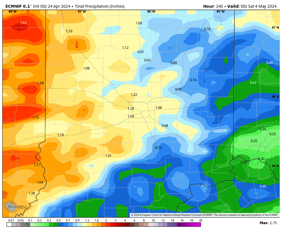
The rain Friday will be in the afternoon and evening, and scattered around any time Saturday. Won’t rain all day…but there’s a chance all day. We may get a break Sunday, before a soggy Monday. Monday is also the biggest chance of strong to severe weather.
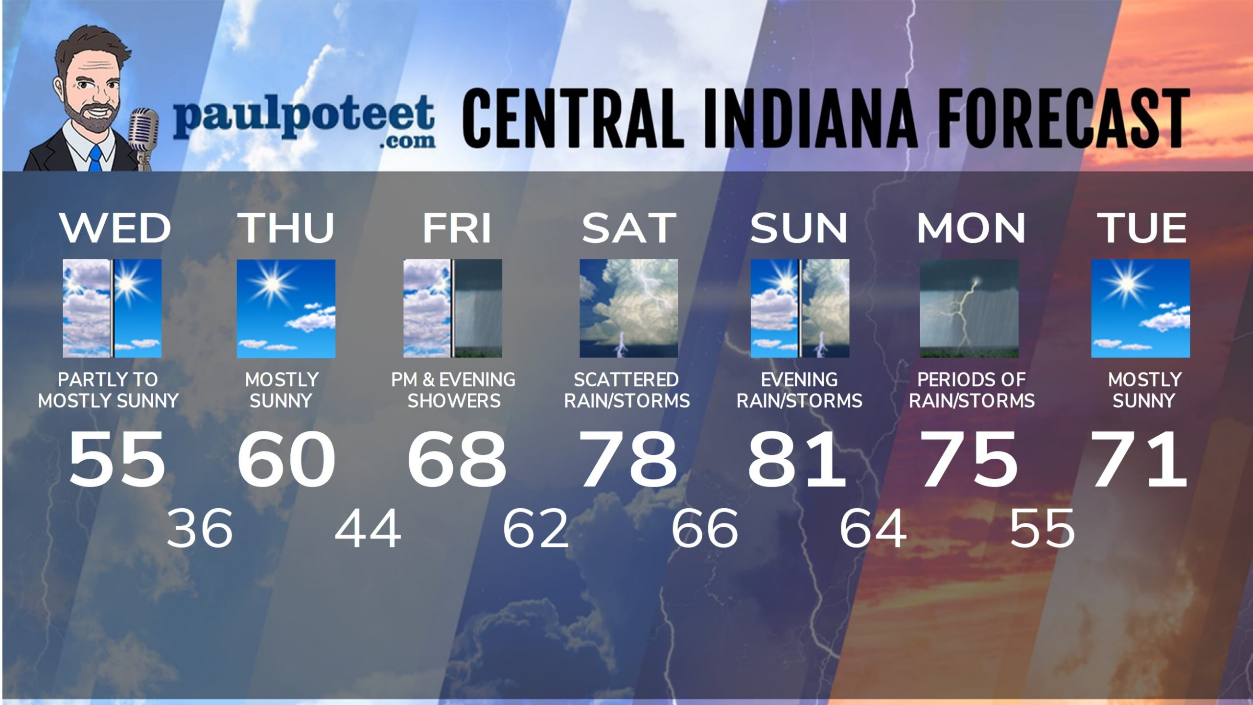
INDY SEVEN DAY FORECAST
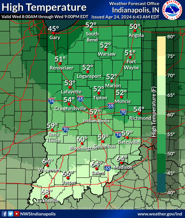
Today: Partly to mostly sunny. High 55.
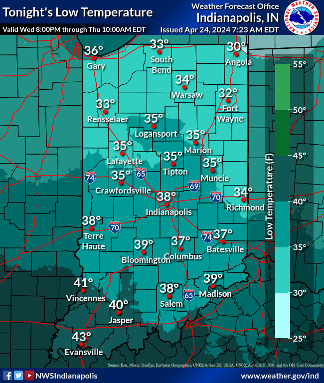
Tonight: Clearing and colder. Patches of light frost possible. Low 36.
Thursday: Mostly sunny. High 60.
Thursday Night: Mostly clear evening. Partly cloudy overnight. Low 44.
Friday: Mostly cloudy. Scattered showers in the afternoon and evening. High 68.
Friday Night: Scattered showers, with thunder possible. Low 62.
Saturday: Partly to mostly cloudy, with scattered showers and storms. High 78.
Saturday Night: Partly to mostly cloudy, with scattered showers and storms. Low 66.
Sunday: Partly sunny. High 81.
Sunday Night: Partly to mostly cloudy, with scattered showers and storms. Low 64.
Monday: Mostly cloudy. Periods of showers and storms. High 75.
Monday Night: Evening showers and storms. Partly cloudy late. Low 55.
Tuesday: Sunshine returns. High 71.
Never miss me! Subscribe for free. My Huge Radar has real-time weather tracking, current temperatures, and severe weather watches and warnings. Get detailed Indiana conditions by clicking here. Click here to see my central Indiana 7-Day Forecast. Follow these links to get my forecasts for Lafayette, Muncie, Hendricks County, and Hamilton County. Need a second opinion? Click here for central Indiana National Weather Service forecasts. (Some charts via WeatherBELL.)


Leave a Reply