…Wet weekend in store for the Central/Southern Plains and adjacent
Rockies…
…Heavy rainfall and flash flooding possible for parts of the South and
Southeast Sunday through Tuesday…
…Above average temperatures forecast for the West and north-central U.S.
this weekend…
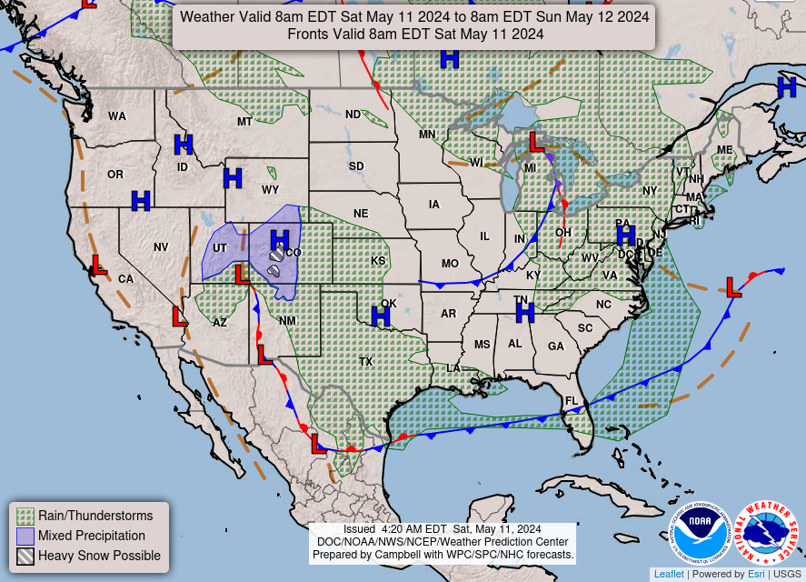
Precipitation chances will continue today for portions of the
central/southern Plains and adjacent Rockies, and coverage is expected to
increase with widespread showers and thunderstorms forecast to impact the
Plains today. Locally heavy rainfall and isolated severe thunderstorms
will be possible east of a stalled frontal boundary draped up against the
Rockies. Potential storm hazards will include hail, strong wind gusts, and
isolated flash flooding. In the higher elevations west of the frontal
boundary, wintry precipitation is expected, and some of the higher peaks
in Colorado and northern New Mexico could receive a few additional inches
of snow.
The surface front is expected to remain in place through tonight, then the
front will begin to lift north as a warm front across Texas and the Lower
Mississippi Valley on Sunday while low pressure deepens over the Plains.
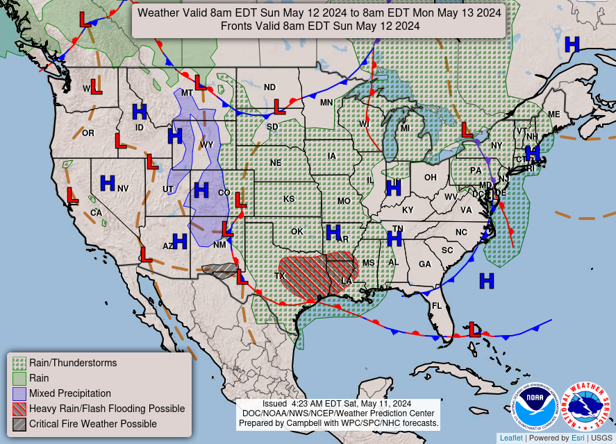
Another round of widespread showers and thunderstorms will develop on
Sunday, and the threat of heavy rainfall will increase as warm Gulf air
moves into the region. There is a Slight Risk of Excessive Rainfall (level
2/4) from central Texas east to the Mississippi River. Scattered instances
of flash flooding will be possible, especially where soils are still moist
after recent heavy rains. The developing low pressure system is forecast
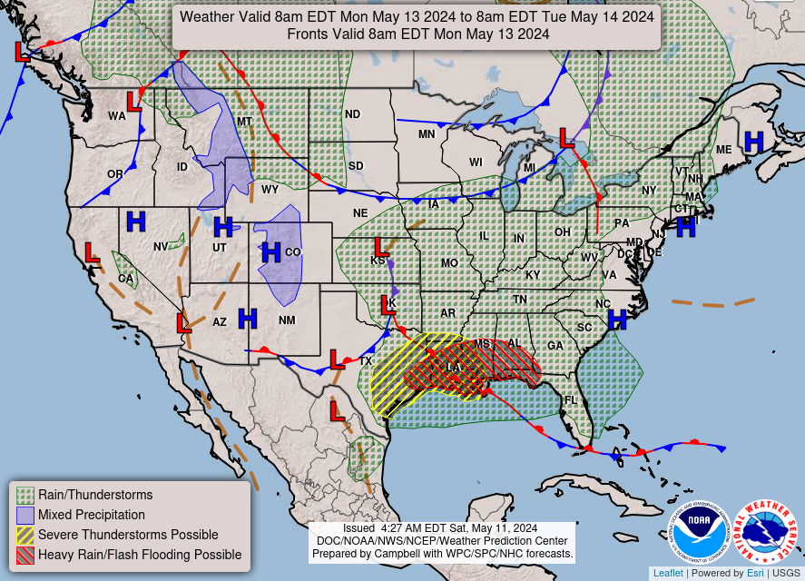
to push east across the Lower Mississippi Valley towards the Southeast on
Monday and Tuesday, and the heavy rainfall/flash flood threat will shift
east across the northern Gulf Coast states.
To the east, precipitation chances will return to the Mid-Atlantic and
Great Lakes regions today as an occluded frontal system pushes towards the
East Coast. Showers and thunderstorms will linger into Sunday morning
before the system moves offshore Sunday afternoon. Another frontal system
will drop south into the north-central U.S. over the weekend, which may
renew precipitation chances near the western Great Lakes on Sunday. Other
areas of the country should remain mostly dry through Monday.
Upper-level ridging over the West Coast and north-central U.S. will lead
to well-above average temperatures in these regions through the weekend.
High temperatures this afternoon will range from the 80s to lower 90s in
California and the Pacific Northwest and from the 70s to lower 80s in the
northern Plains. The focus for warmer temperatures will shift more into
the Interior West/Great Basin and Upper Midwest on Sunday. Below average
temperatures are forecast elsewhere across the eastern and central U.S.
through the weekend, but temperature will trend back towards normal early
in the work week.
Dolan
Graphics available at
https://www.wpc.ncep.noaa.gov/basicwx/basicwx_ndfd.php


Leave a Reply