Weather
Rains on parts of the Plains, upper Midwest
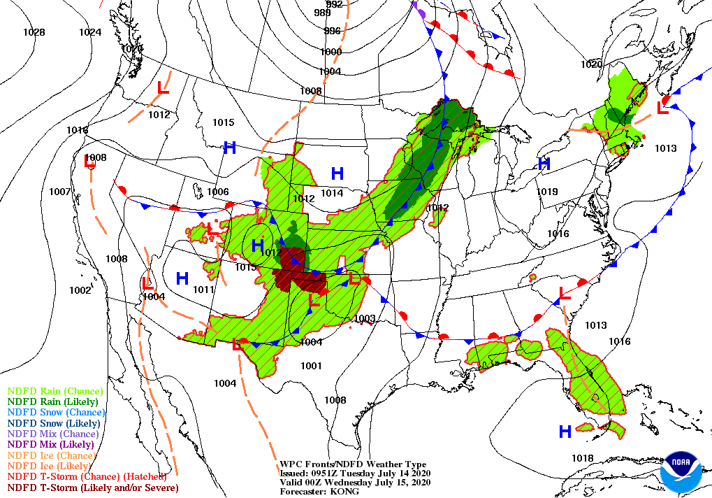
Across the Corn Belt, showers and thunderstorms across the upper Midwest are providing beneficial moisture for reproductive corn and soybeans. On July 12, nearly half (48%) of the U.S. soybeans had begun to bloom, while 29% of the corn was silking. In parts of the eastern Corn Belt, however, pockets of dryness continue to stress some summer crops. On July 12, Michigan led the Midwest with very poor to poor ratings for 17% of its corn and 13% of its soybeans.

On the Plains, widespread showers and thunderstorms accompany an energetic cold front. Early Tuesday, some of the heaviest rain is falling across central and eastern Kansas. Below-normal temperatures trail the front across the northern Plains; in Montana, Tuesday morning’s low temperatures locally fell to 40º or below. In contrast, extreme heat lingers across much of Texas, where Tuesday’s high temperatures are forecast to reach 110º in the Midland and Lubbock areas.
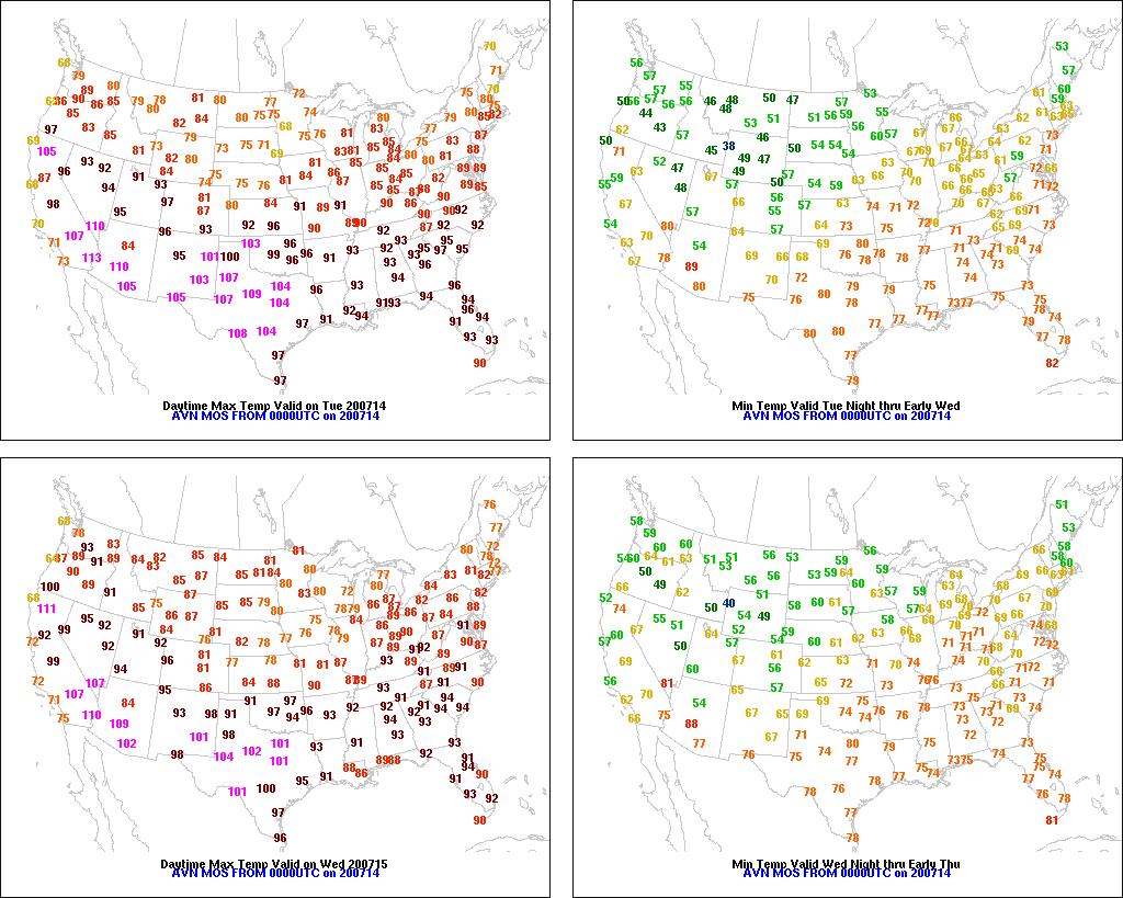
In the South, warm, humid weather is promoting a rapid pace of crop development. However, the western Gulf Coast region is contending with high temperatures approaching 100º and oppressive levels of humidity, leading to an increase in stress on livestock and rain-fed summer crops. Still, most Southern crops remain in good shape, with 74% of the U.S. rice and 73% of the peanuts rated in good to excellent condition on July 12.
In the West, above-normal temperatures dominate the Four Corners region, the southern Great Basin, and the Pacific Northwest. Meanwhile, cooler-than-normal conditions cover the interior Northwest. Despite below-normal Northwestern temperatures, dry weather favors winter wheat harvesting, which on July 12 was 2% complete in Idaho and Washington.
Add Comment