Weather
More storms, heat ahead for much of the Heartland
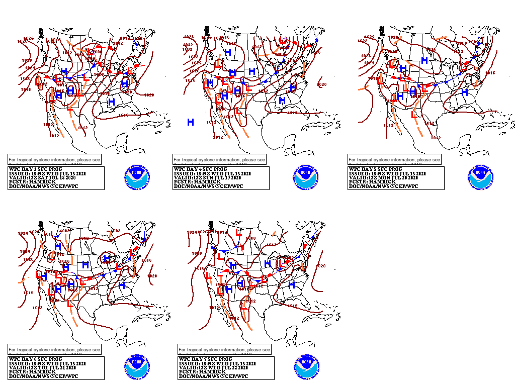
A cold front crossing the Plains and Midwest will drift eastward and gradually weaken, while a second front will arrive across the northern Plains and upper Midwest late in the week. Five-day Midwestern rainfall totals could reach 1 to 2 inches, with locally higher amounts. Meanwhile, the Southwestern monsoon circulation will become more fully established, leading to scattered showers in portions of the Four Corners States.
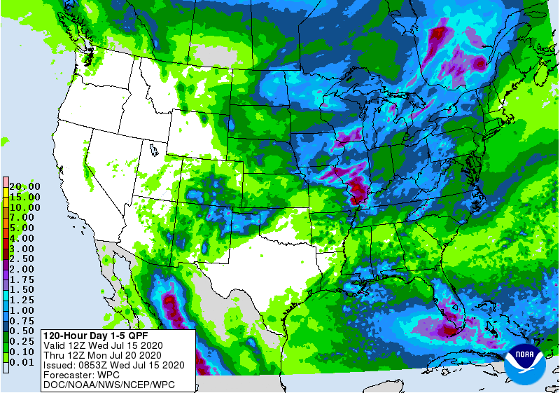
The interaction between the monsoon circulation and the two cold fronts should result in thundershowers on the Plains as far south as Texas’ northern panhandle.
The interaction between the monsoon circulation and the two cold fronts should result in thundershowers on the Plains as far south as Texas’ northern panhandle.
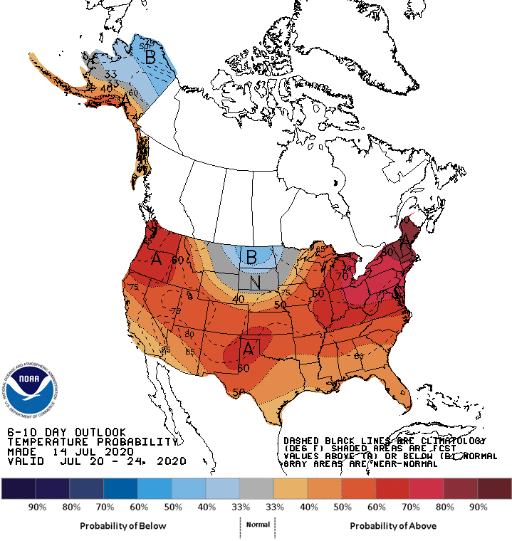
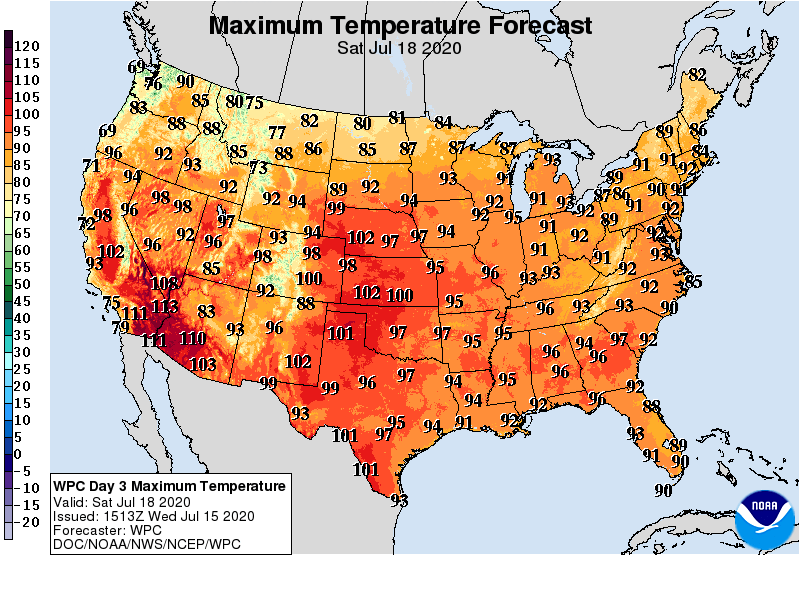
Looking ahead, the 6- to 10-day outlook calls for the likelihood of hotter-than-normal weather nationwide, except for near-or below-normal temperatures across the northern Plains and far upper Midwest.
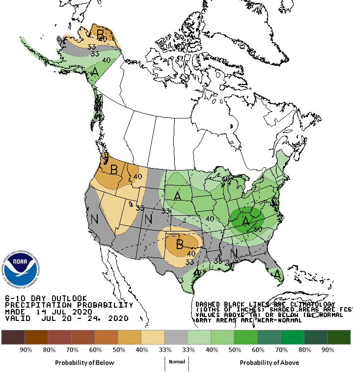
Meanwhile, drier-than-normal conditions in the southern Plains, Great Basin, and Northwest should contrast with near- or above-normal rainfall across the remainder of the country.
Add Comment