Thunderstorms, possibly severe, are expected to push across southern parts of Central Indiana between 5 and 10 pm. Damaging winds and hail will be the primary threats today, but isolated tornadoes cannot be ruled out. Check My Huge Radar for the latest warnings.

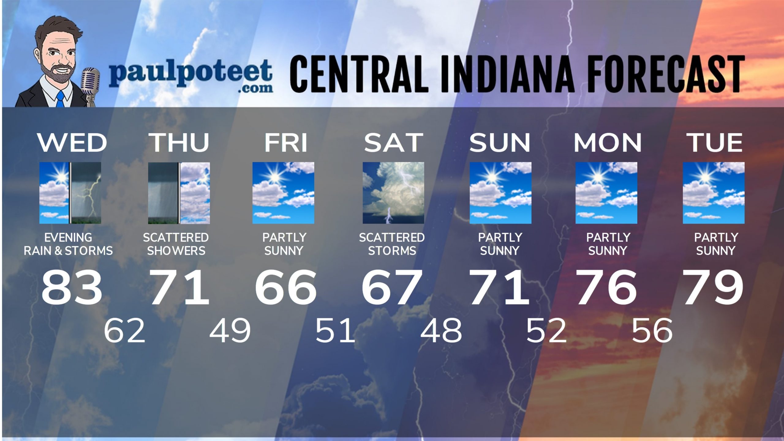
INDY SEVEN DAY FORECAST
Today: Mostly sunny morning. Clouds gradually increase in the afternoon. High 83.
Tonight: Showers and storms in the evening, possibly severe. Storms end by midnight. Low 62.
Thursday: Partly to mostly cloudy. Scattered showers and storms in the morning, with spotty showers in the afternoon. High 71.
Thursday Night: Partly cloudy. Low 49.
Friday: Partly sunny. High 66.
Friday Night: Partly cloudy. Low 51.
Saturday: Mostly cloudy with scattered showers and storms. High 67.
Saturday Night: Partly cloudy. Low 48.
Sunday: Partly sunny. High 71.
Sunday Night: Partly cloudy. Low 52.
Monday: Partly cloudy. High 76.
Monday Night: Partly cloudy. Low 56.
Tuesday: Partly sunny. High 79.


Never miss me! Subscribe for free. My Huge Radar has real-time weather tracking, current temperatures, and severe weather watches and warnings. Get detailed Indiana conditions by clicking here. Click here to see my central Indiana 7-Day Forecast. Follow these links to get my forecasts for Lafayette, Muncie, Hendricks County, and Hamilton County. Need a second opinion? Click here for central Indiana National Weather Service forecasts. (Some charts via WeatherBELL.)


Leave a Reply