Weather
More rain from the southeastern Plains to the central, southern Corn Belt
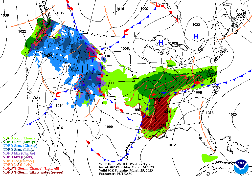
Across the Corn Belt, a significant rainfall event is underway across the Ohio Valley, with some lowland flooding is being reporting across southern sections of Missouri, Illinois, Indiana, and Ohio. The remainder of the Midwest is experiencing dry weather and near- or below-normal temperatures. In snow-covered areas of the far upper Midwest, including the Red River Valley of the North, Friday morning’s minimum temperatures fell below 10°F.
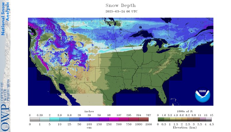
On the Plains, showers and thunderstorms linger early Friday in eastern Oklahoma and northeastern Texas. Cool, dry weather covers the remainder of the nation’s mid-section, including the northern and central Plains. In eastern North Dakota, Grand Forks has reported a continuous snow cover for 134 consecutive days (starting November 11), closing in on the all-time station record of 158 days set in 1978-79.
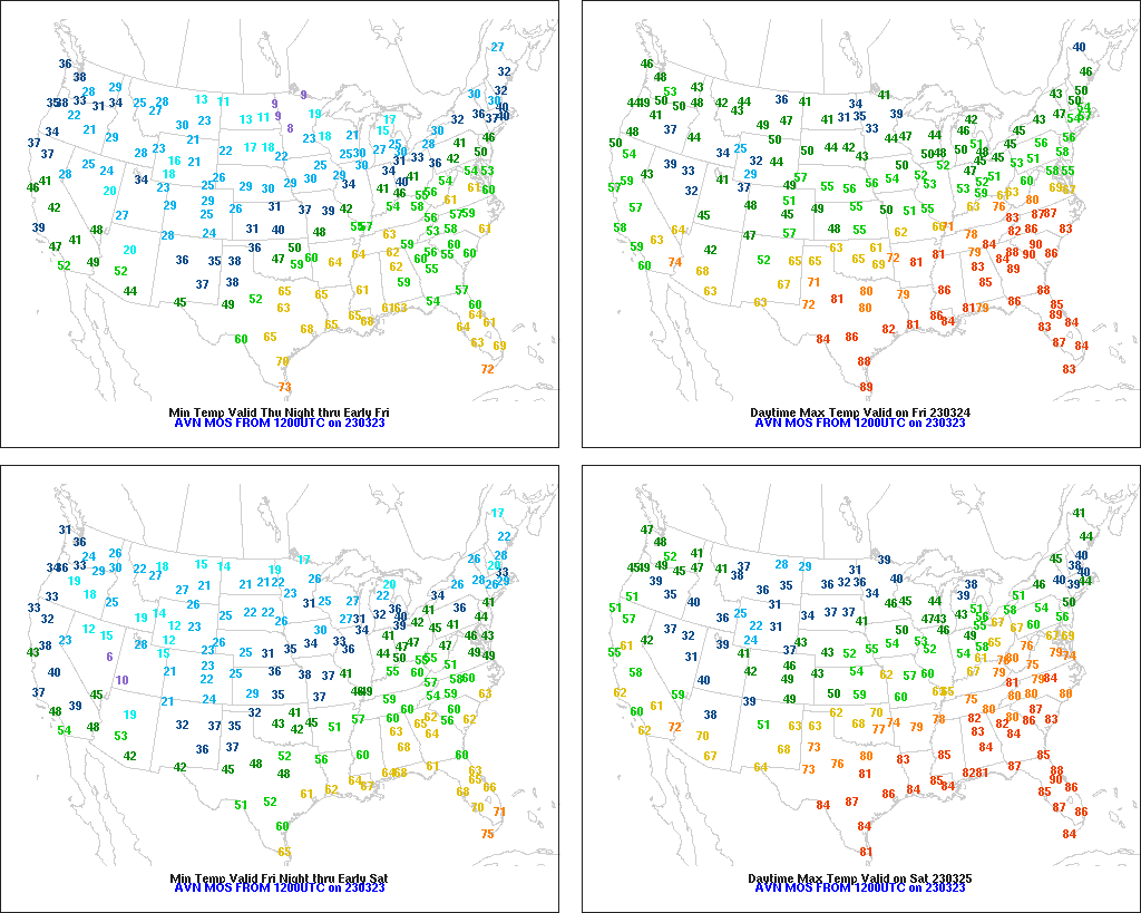
In the South, warm weather prevails. In fact, Friday’s high temperatures will reach 85°F or higher in the Atlantic Coast States, extending as far north as the Carolinas, and will top 90°F in southern Texas. Meanwhile, locally heavy showers and thunderstorms are developing in the mid-South, with flash flooding occurring early Friday in portions of northern and central Arkansas.
In the West, the focus for precipitation has temporarily shifted across the northern half of the region. Early today, rain and snow showers dot the Pacific Northwest, as well as northern sections of the Rockies, Great Basin, and Intermountain West. California is experiencing a reprieve from stormy weather; the most recent major storm system boosted the average water equivalency of the Sierra Nevada snowpack to approximately 58 inches, more than 225% percent of average.
Add Comment