Weather
Brownfield Ag Weather Today
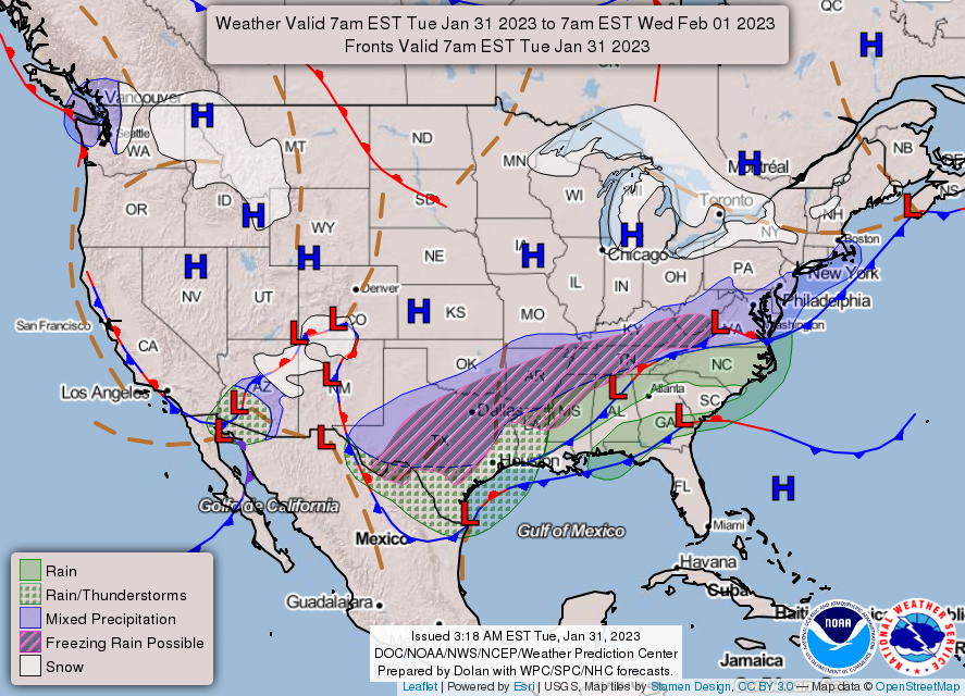
Shallow cold air interacting with overrunning moisture will lead to widespread wintry precipitation during the next couple of days. The greatest threat of travel and electrical disruptions due to frozen and freezing precipitation—snow, sleet, and freezing rain—will stretch from the southern Plains into the mid-South. In the latter region, communities such as Little Rock, Arkansas, and Memphis, Tennessee, could receive as much as one-quarter to one-half inch of freezing rain by Tuesday night or early Wednesday. After the winter-weather threat ends, heavy rain may continue across the Deep South. Meanwhile, bitterly cold conditions across the northern Plains and upper Midwest will slowly ease, although sub-0°F temperatures will linger for much of the week. Toward week’s end, the focus for extreme cold will shift into the Northeast, particularly across New England. Aside from the South and lower Midwest, much of the country will receive little, if any, precipitation for the remainder of the week.
Add Comment