
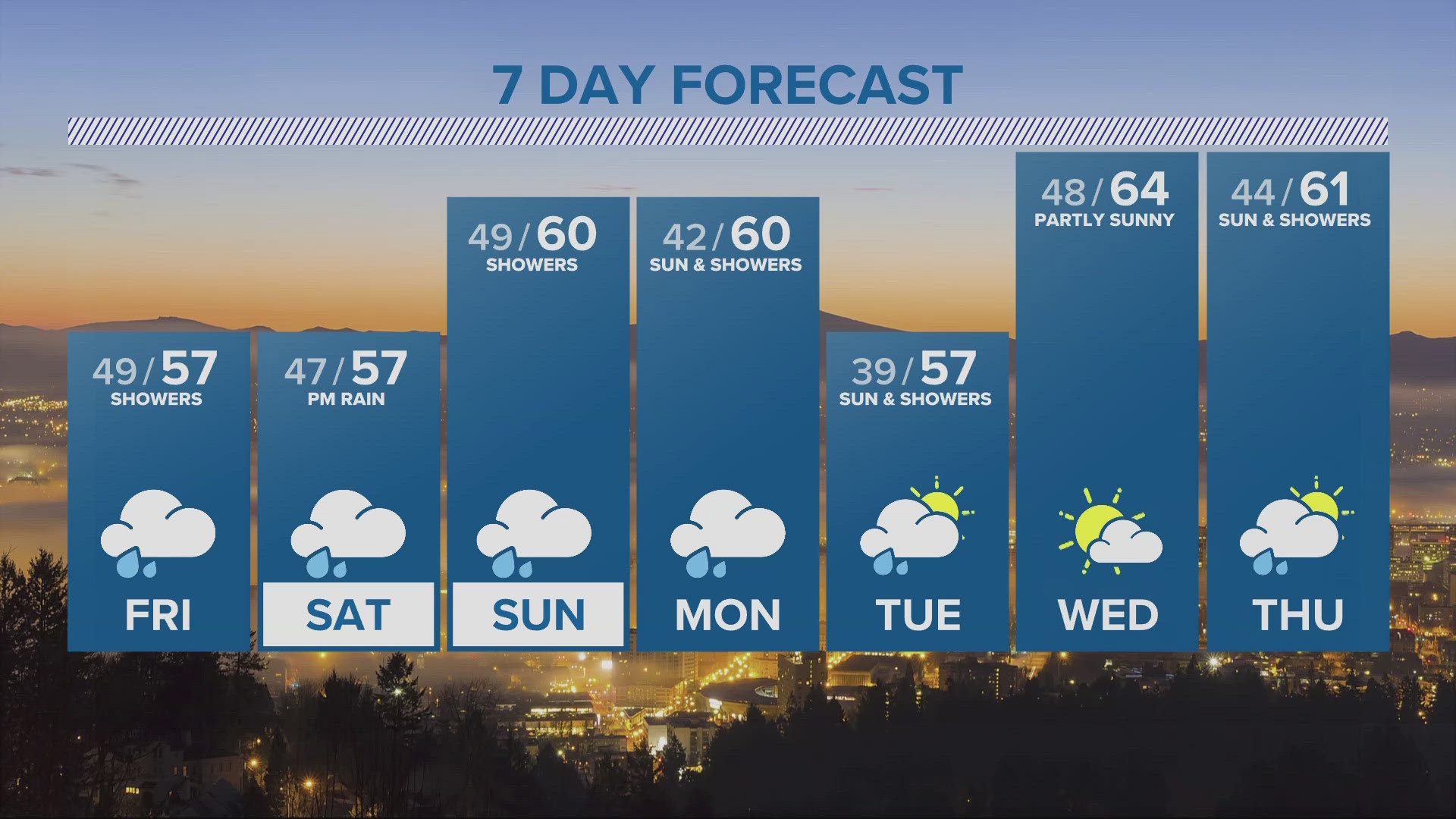
PORTLAND, Oregon — We should have a little dry-time early Friday before showers pick back up Friday afternoon.
Saturday morning offers a better chance for dry weather, ahead of the next weather system that will bring steady rain back Saturday night into Sunday. Showers continue into early next week.
High temperatures will be in the 50s Friday but should make 60-degrees over the weekend.
Our next chance at a totally dry day and some sun comes on Wednesday.
A Winter Weather Advisory is up in the Cascades above 4,500 feet. Over a foot of new snow will fall by Saturday morning above 5,500 feet, with more snow falling this weekend.
Have a great Friday.
Matt Zaffino
KGW Chief Meteorologist
Extended weather reports and more on KGW+: You asked for more access to local news, weather and more at home, and we listened! Now, watching KGW News is easier than ever with the KGW+ app for Roku, Amazon Fire TV and Apple TV. Easily find live newscasts and local programs, access top videos and stream breaking news on your schedule. KGW+ offers 24-7 streaming that includes live local news, newscast replays, extended coverage, expanded weather reports, station specials and investigations. Click or tap here to learn more.