
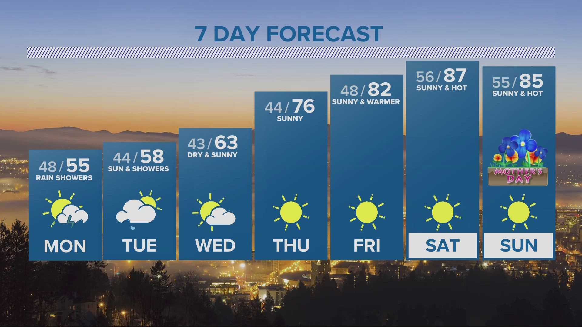
PORTLAND, Oregon — Monday is going to be almost a carbon copy of what we have been seeing the last couple of days with scattered showers and cooler conditions. Daytime highs will be topping out around the low to mid 50s. The one thing that is going to be different, is that there’s a chance we could see thunderstorms develop by the afternoon.
A Winter Weather Advisory in the Cascades continues above 4,000 ft through Monday night. Timberline Lodge could see close to a foot of snow over the next 24 hours.
A Wind Advisory is also in place for parts of the Gorge and Eastern Oregon through 11 pm Sunday. Winds will reach 25-35 MPH with gusts hitting 50 MPH.
Dry and sunny weather will move in by midweek. Wednesday will be mostly dry and sunny with highs in the low 60s. We'll see mid 70s Thursday and 80s and sunny by next weekend.
Happy Sunday and Cinco De Mayo for all who celebrate,
Joe Raineri
KGW Meteorologist
Extended weather reports and more on KGW+: You asked for more access to local news, weather and more at home, and we listened! Now, watching KGW News is easier than ever with the KGW+ app for Roku, Amazon Fire TV and Apple TV. Easily find live newscasts and local programs, access top videos and stream breaking news on your schedule. KGW+ offers 24-7 streaming that includes live local news, newscast replays, extended coverage, expanded weather reports, station specials and investigations. Click or tap here to learn more.