Weather
Significant rains developing on the Plains; cool across the Corn Belt

Across the Corn Belt, widespread frost was reported Monday morning in the upper Great Lakes region, particularly in northern sections of Michigan and Wisconsin. The cool weather trails last week’s multi-day Midwestern severe weather outbreak, which included a fatal tornado on May 20 in Gaylord, Michigan. The chilly conditions, with Monday’s high temperatures remaining below 70°F, are also slowing a return to fieldwork in areas that recently received heavy rain.
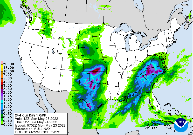
On the Plains, a significant rain event is just getting underway. Showers are especially beneficial across drought-affected sections of the central and southern High Plains, although rain is too late for some winter grains. Cool weather accompanies the rain, especially across the central Plains, where Monday’s high temperatures will remain mostly below 60°F. The rain follows a winter-like storm system, which produced 2.3 inches of snow in Denver, Colorado, on May 20-21.
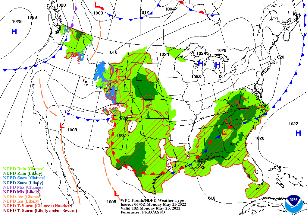
In the South, showers and thunderstorms are occurring east of the Mississippi River. The rain is slowing fieldwork but greatly benefiting pastures and summer crops. Meanwhile, warm, dry weather in the western Gulf Coast region favors a rapid development pace for crops such as cotton and rice.
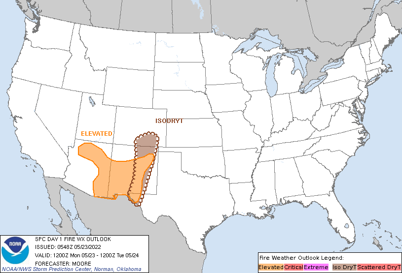
In the West, an elevated wildfire threat continues across parts of Arizona and New Mexico. In New Mexico, the Black Fire has charred more than 130,000 acres of vegetation, while the largest wildfire in modern state history—the Calf Canyon / Hermits Peak Fire—has scorched 310,000 acres. Heat is again building in parts of California and the Desert Southwest, while chilly conditions linger in the Great Basin and Intermountain West.
Add Comment