Weather
Hot weather, storms ahead for the eastern Corn Belt
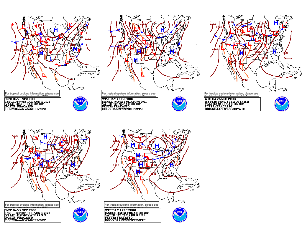
Many areas of the country, including the Plains, Midwest, and Far West, will remain mostly dry during the next 5 days. Rainfall associated with the Southwestern monsoon circulation will also subside, although showers will linger through mid-week in the Rockies and environs.
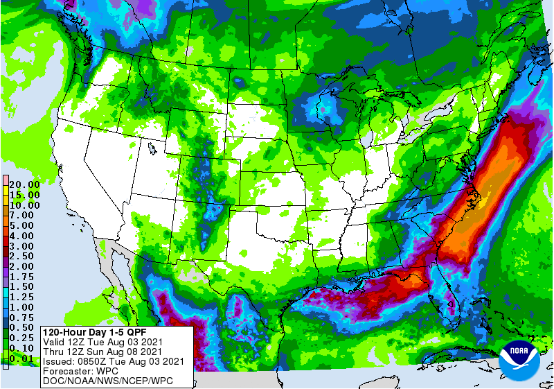
Farther east, however, a multi-day rain event will affect the southern Atlantic region and areas along the Gulf Coast. Five-day rainfall totals could reach 4 inches or more in the coastal Carolinas. During the mid to late-week period, occasional rain may spread as far north as coastal New England and could dampen the upper Great Lakes region.
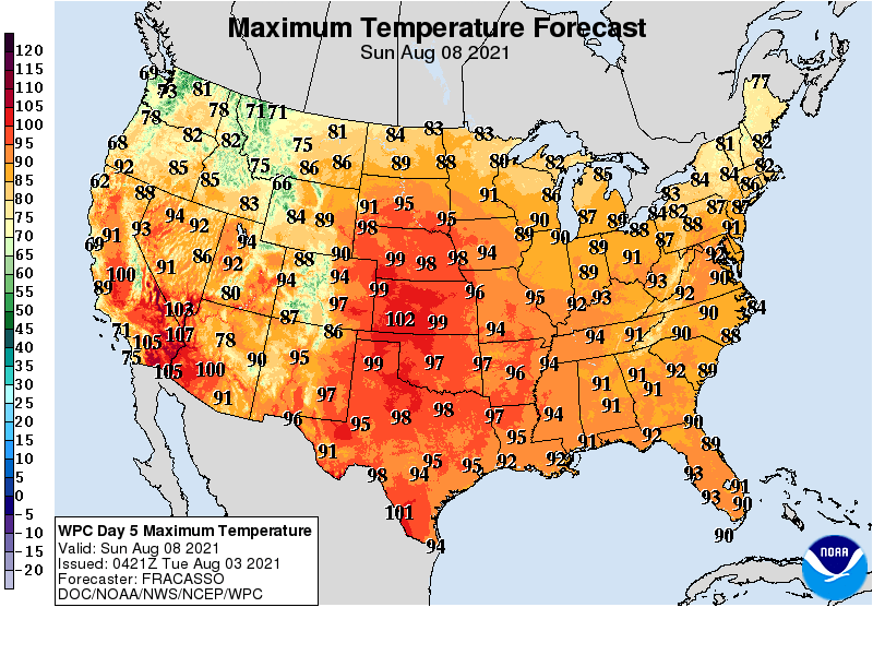
During the next few days, hot weather will be focused across the nation’s mid-section, especially on the central and southern Plains.
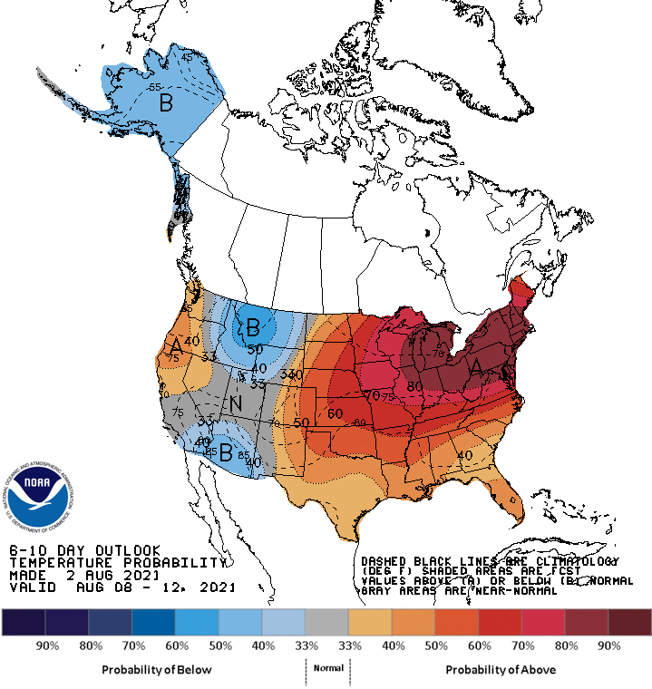
Looking ahead, the 6- to 10-day outlook calls for the likelihood of near- or above-normal temperatures and precipitation across much of the country.
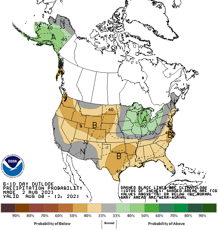
Cooler-than-normal conditions will be confined to parts of the West, while wetter-than-normal weather should be largely limited to the Great Lakes region.
Add Comment