Weather
Heat, limited rains to expand across the Heartland
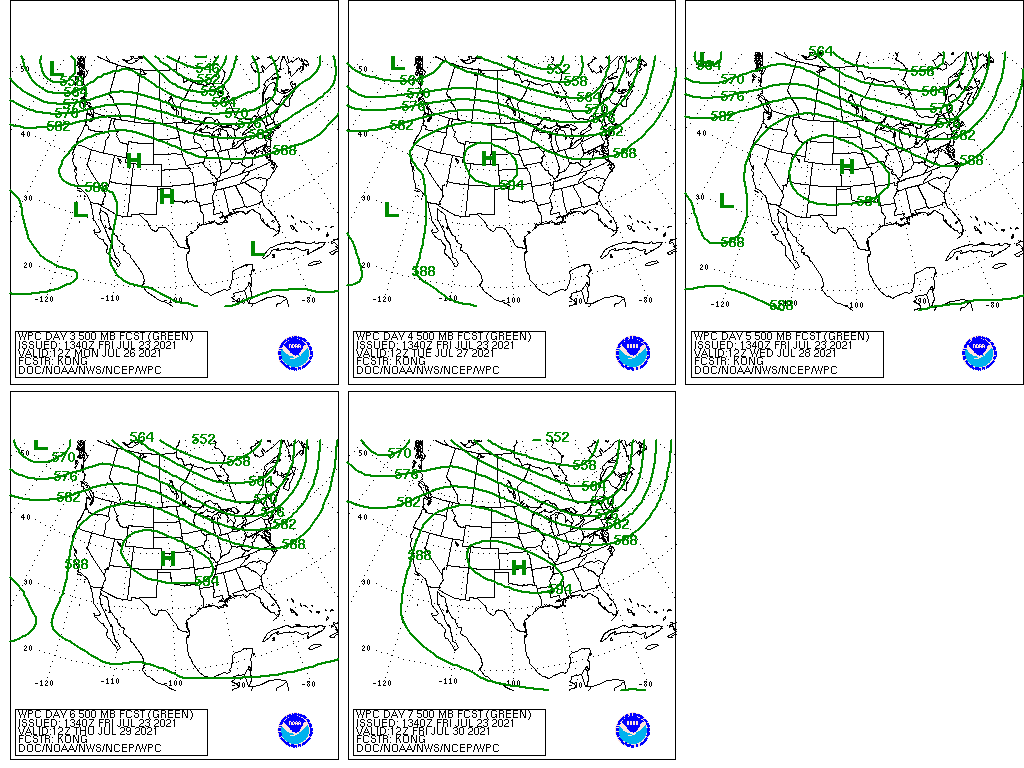
An active Southwestern monsoon circulation will continue to generate locally heavy, drought-easing showers in the Four Corners States. Lighter showers may reach into southeastern California and the southern Great Basin. However, the remainder of California, along with the northern Plains and Northwest, will continue to endure hot, dry weather and rampant wildfire activity.
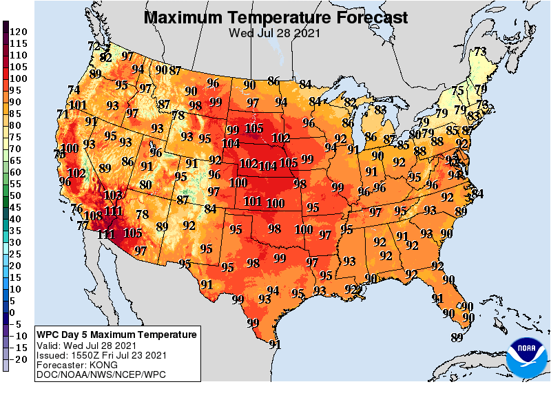
Farther east, only widely scattered showers will occur during the next 5 days across the central and southern Plains, accompanied by building heat that may signal the onset of “flash drought” conditions.
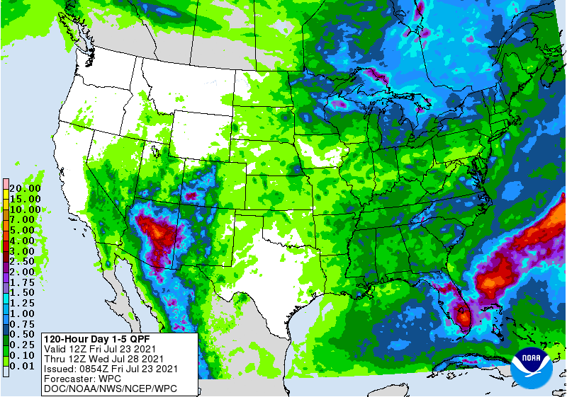
Elsewhere, significant Midwestern rainfall will be mostly limited to the Great Lakes region, while scattered showers will return across the Southeast.
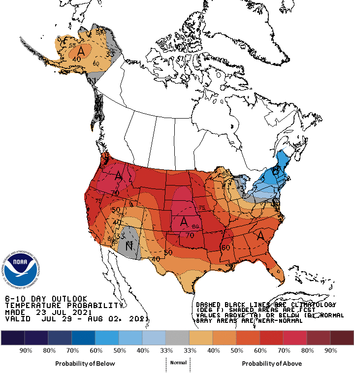
Looking ahead, the 6- to 10-day outlook calls for the likelihood of near- or above-normal temperatures nationwide, except for cooler-than-normal conditions in New York and New England.
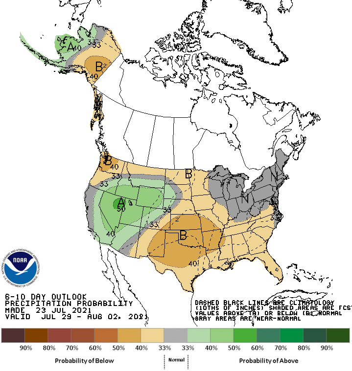
Meanwhile, near- or below-normal rainfall across most of the country should contrast with wetter-than-normal weather in the Great Basin, Intermountain West, and portions of the Great Lakes region.
Add Comment