When I drove two-and-a-half hours west from home to Monticello, Utah, last Friday for the inaugural 50-mile Bears Ears Ultra, my mind was picturing the dramatic red-rock landscape around Canyonlands National Park and Bears Ears National Monument. The relatively small Abajo Mountain range, where the ultra course loops around, sits in between those special areas in eastern Utah. I thought we’d be racing through high-desert countryside, and I braced for high heat because temperatures had reached the 90s a week earlier.
I was totally surprised, therefore, when I saw the Abajo Mountains rising as a verdant green mass behind the westside of Monticello. The mountains are almost entirely grass-covered and forested with healthy pine and aspen, not at all the desert I’d pictured. I guess I should’ve paid more attention to the race guide, which mentioned that the course goes through aspen groves at high elevation. Still, I couldn’t believe it. And, on Friday afternoon, a light rain fell and made everything cleaner and greener. We would be treated to Goldilocks weather with the midday temperatures topping out in the 70s.
This pleasant surprise of a forested mountain run, not a Moab-like desert run, made me more eager and confident to run the route, which turned out to be one of my new favorite 50-milers for its beauty, variety and difficulty.
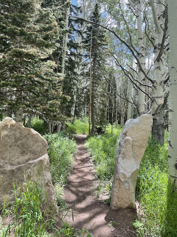
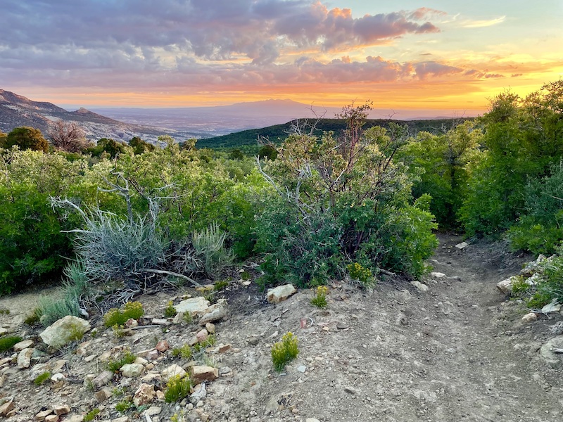
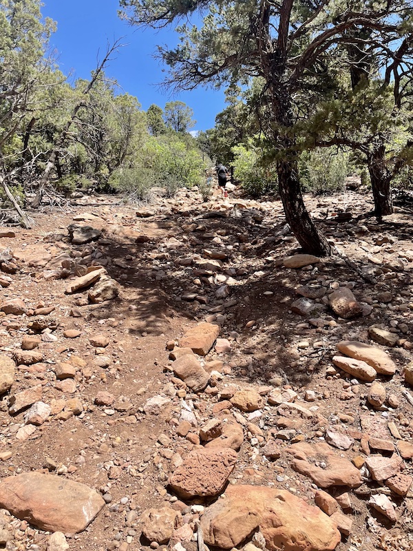
My intro to the Bears Ears Ultra course the day before the race, when I scouted out the final miles. This is around mile 45 on the course.
I signed up for the June 26 Bears Ears 50 as a final peak training run before the July 30 High Lonesome 100 in five weeks. By “training run” I mean I did not taper for it or prepare specifically to race it; rather, I approached it as a tough, long supported run, my goals being to finish strong and uninjured for a boost in confidence. I wasn’t feeling competitive, just grateful to getaway to somewhere new for the weekend.
Mad Moose Events introduced the 50K and 30K versions of Bears Ears Ultra last year, and the 50-miler was new for this year. This September, they are introducing the “Golden Bears Ears” autumn version of the event, but only the 50K and 30K, so you have to wait until next June for this 50-miler.
The sparse course description and map did not include an elevation profile, but it advertised approximately 12,000 feet of climbing, which turned out to be an exaggeration. The total elevation gain, according to my watch, was around 10,000. The course dipped down to a low of about 7,400 feet elevation and rose to high points around 10,600, with lots of ups and downs in between. One section in the middle had so many ankle-rolling, slide-like rocky descents and ascents that I decided it was an ultrarunning game of Chutes and Ladders. But I’m getting ahead of myself.
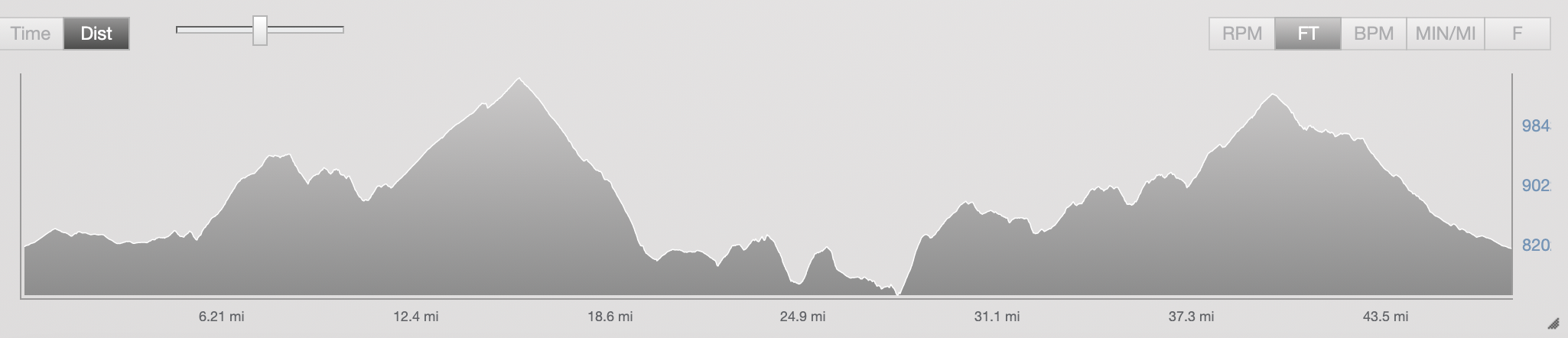
Bears Ears 50 (actually 48 miles) elevation profile from my watch.
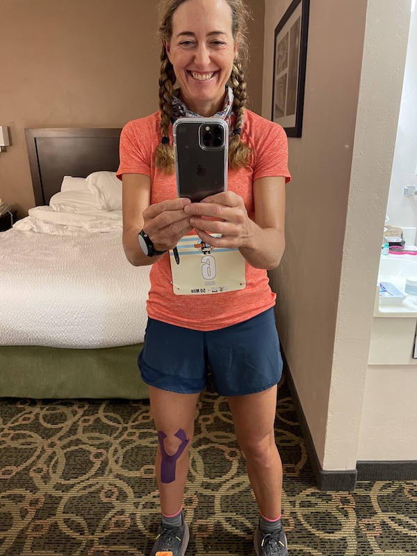
Race morning selfie
I drove about 8 miles outside of town at 4 a.m. Saturday to get to the race starting line in time for the 5 a.m. start. Only around 50 people signed up for the 50-miler (38 would finish), so the vibe felt low-key and friendly. On that same morning, the Western States 100 was taking place, and I flashed back to five years ago when I was in Olympic Village with hordes of others getting ready for the country’s premier 100-miler. I felt nostalgic about and inspired by Western States, but also, glad to be far from that hoopla, just out for a day-long run with no performance pressure. My friend Christina Dennison, also there running the 50-mile, and I joked that our main goal on this day was to finish our 50 miles faster than repeat champ Jim Walmsley would finish his Western States 100, which meant we had to go sub-14 hours and change.
Ahead of me in the starting line, I spotted a woman older than I who I could tell from one glance was ultra-fit and experienced. I knew I recognized her but couldn’t recall her. “So much for being the fastest ‘old lady,’” I told myself, realizing just by looking at her sinewy legs and sculpted arms that this older woman would smoke me, but it’d be fun following her. Later, it hit me—it was Anita Ortiz, 57, the 2009 Western States 100 female champ and winner of numerous mountain ultras and trail championships. John Trent profiled her in the May issue of Ultrarunning magazine, detailing her past year of adversity in which she suffered traumatic injuries and was in a leg brace. And here she was, fit and fast again. She would go on to finish 3rd female, two hours ahead of me. Now I feel inspired to try to run more like her five years from now, when I’m her age, and to stop viewing myself as the “old lady” in the field.
A full moon illuminated the start, but still, it was dark, and several runners had chosen not to bother with a headlamp because the first miles follow a gravel road. I was glad I had my headlamp, however, because the gravel road had enough tripping hazards that I wouldn’t want to run in the dark.
Our small field took off before sunrise (the 50K and 30K started an hour later). The first five miles of this route are totally runnable and relatively fast, making for a gentle warmup. We ran a boring gravel road that led away from the start/finish area, then transitioned to a couple of miles on a paved road that circles the mountains. Shortly after Aid Station 1 at mile 4.5, we hopped on singletrack for an 1100-foot ascent up switchbacks for three miles to an area called Robertson Pasture, then Red Ledges.
Looking east to see the sunrise above Monticello.
I leapfrogged with Christina in this section, and we kept remarking on the beauty as the sun rose and enhanced the colors in the aspen groves. Bunches of red, purple, pink and yellow wildflowers, including clumps of columbine, lined the dewy trail. I had never seen so much columbine at such a low elevation (about 8900 feet).
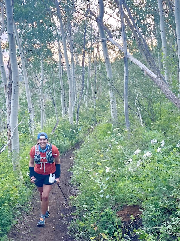
Christina around mile 7 or 8. The flowers to her side are columbine.
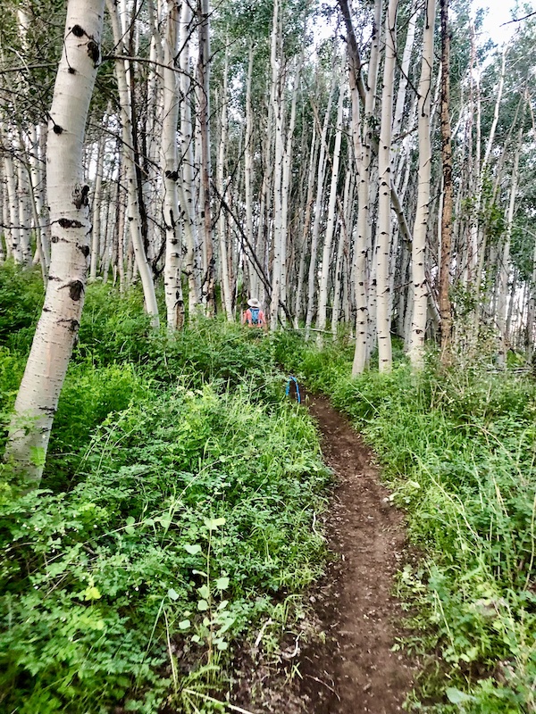
Christina’s photo of me in the distance being swallowed by the aspens.
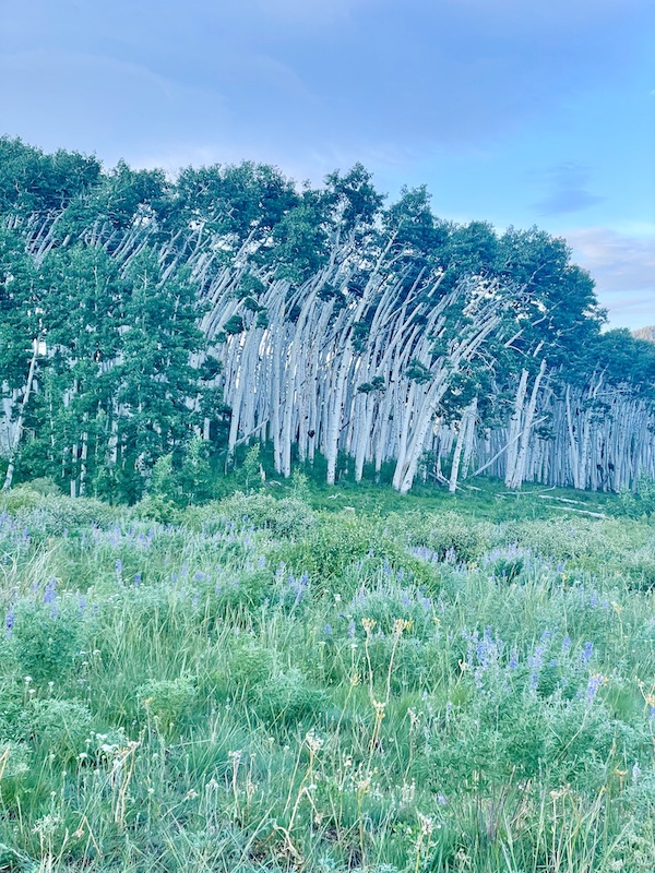
Gorgeous meadows and some bendy trees.
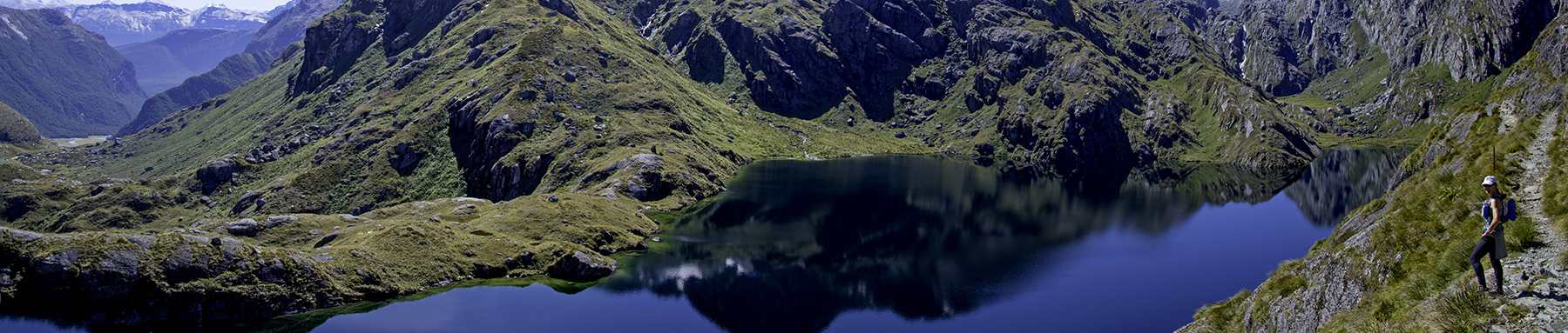
After Aid Station 2 at mile 11.5, we ascended 1200 more feet over four miles, up to an elevation of about 10,600, on a stunningly beautiful mountainside traverse called the Skyline Trail. Emerging from the forest to wide-open views, we could see the double buttes that make the Bears Ears to the southwest, and the canyons of Canyonlands to the north.
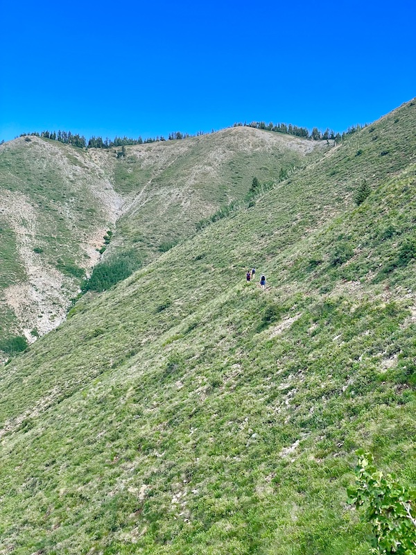
Runners ahead of me on the Skyline Trail, high up in the Abajo Mountains.
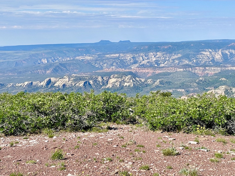
The Bears Ears buttes and Bears Ears National Monument in the distance.
I didn’t mind the trail’s climb, and I was able to run flatter portions in between hiking. But once we transitioned to running downhill some 2500 feet over the next four miles, I struggled. I got passed by faster downhill runners, and I suffered the first of two ankle turns on my left ankle that made me yelp with pain. I walked off the soreness and started running again, but my left ankle felt unreliable all day. Thankfully, my wonky left knee, which I had taped for support, and my achy lower back behaved fairly well on the steep, loose-rock downhill.
Miles 20 through 22 featured an out-and-back on an unremarkable gravel road called the Causeway to add distance. But the race map showed us going out and back a total of four miles on this road, so I was confused by the shorter distance. Later, I learned the race director had shortened the course by two miles here, to get runners into and through the next section—the hottest, toughest part of the course—sooner. Hence, the route would end up being only 48 miles, not 50. I didn’t really hanker to run two more miles on that exposed gravel Causeway road; but, I felt kind of shortchanged by the shortening of the course, and I hope the course is a full 50 as advertised in future years.
Leaving the aid station at mile 22, the race director warned everyone to carry 40 ounces of water for the next section. I obliged, even though the temperatures were not nearly as hot as had been feared. But I ended up drinking all my water over the slow, treacherous seven miles to the next aid station.
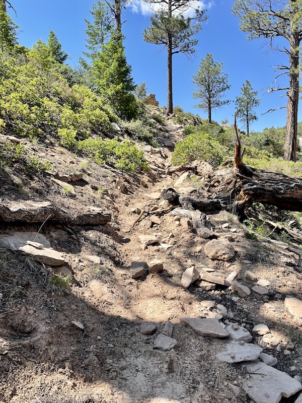
Steep rocky trail around mile 25
This section of the course, on the Tuerto Trail, doesn’t seem that difficult on the elevation profile. But its ups and downs add up to about 2000 feet of gain, and canyon walls in the lower elevation (between about 7400 and 8800 feet) trap heat. Plus, this little-used section is quite overgrown, with full-body encounters with pokey branches through bushes, and tall grass completely obscuring the faint trail. Thankfully, Mad Moose Events marks its course with abundant ribbons, so it wasn’t too hard to follow the course markings.
In spite of the trail’s difficulty, this became my favorite section of the route because I passed six people along the way. I was able to grind up the rocky slopes faster than the others who looked wobbly and depleted, and who paused repeatedly to catch their breath, some resting on a rock or log for several minutes. A rock-strewn climb at the halfway point of mile 25 felt as steep as climbing a multi-story ladder, and the loose-dirt descent that followed felt as frightening as surfing a landslide, hence my feeling of being a pawn in an evil game of Chutes and Ladders.
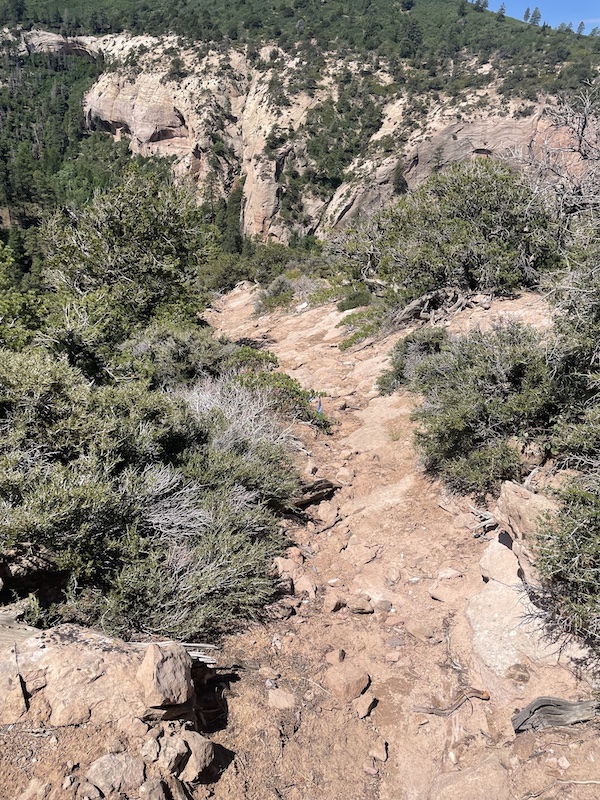
Looking back down at a segment I went up. It’s much steeper than this photo makes it look.
Another steep rocky uphill, a runner ahead of me in the center.
I reached the 50K (31.5M) mark at just over 8 hours. By comparison, a more typical trail 50K at sea level takes me 5 to 6.5 hours.
After the Tuerto Trail section, we transitioned to the smoother, friendlier Aspen Flats Trail and reconnected with the course that the 50K runners follow. I ran these six miles well enough and steadily, feeling positive overall, only getting frustrated when I rolled my left ankle a second time and a couple of guys passed me as I walked off the pain.
At the penultimate aid station, around mile 36, we faced a final big climb of about 1500 feet over four miles to get back up to around 10,300 feet elevation. (The course description described it as a 2500-foot climb, but my altimeter shows otherwise.) I had braced myself for the miles in the high-30s to be the toughest mentally and most fatiguing physically in a 50-miler, but this climb wasn’t so bad. Or maybe my early-summer training in the San Juan Mountains is paying off. It just went up up up, switchbacking but giving some runnable straightaways, through more lush forest with birdsong.
The final eight miles of this route are almost all downhill-to-flat. Knowing that the High Lonesome 100 course ends with relatively runnable miles, I pushed myself to run as efficiently as possible on the singletrack through more aspen grove and not take any more hiking breaks. About four miles from the finish, the singletrack pops out onto a forest road with expansive views to the east, past Monticello to western Colorado. The late-day slanted light gave everything a golden hue. I booked it down the forest road a little over a mile to where the dirt road meets the paved road for a short stretch, then the route rejoins the gravel road leading to the start/finish.
I passed a guy limping with IT band problems, and a couple of women hiking the final miles of their 50K race. I resolved not to walk, and I ran strong with the exception of one short bump of an uphill. I felt so relieved that I could run relatively well at around mile 47. Unlike the self-supported 54-miler I did in May, when my legs gave out and refused to run more than 30 seconds at a stretch after mile 40, I felt much stronger today and more confident about the prospect of a 100-miler in five weeks.
I reached the finish line in 12:33, seventh female and 20th overall. The men’s winner from Ophir (near Telluride), Dave Chew, finished three hours earlier in a blazing 9:37, with two guys close behind him, so I imagine they hammered those final miles on the gravel road. The top woman, Caroline Weiler, was right behind those three guys in 9:51. (Full results.)
I liked this course so much, I might return to experience the 50K autumn version at the Golden Bears Ears Ultra on September 18. But for now, I’m only focused on getting ready for High Lonesome 100. Who knows what I’ll feel like doing after that.
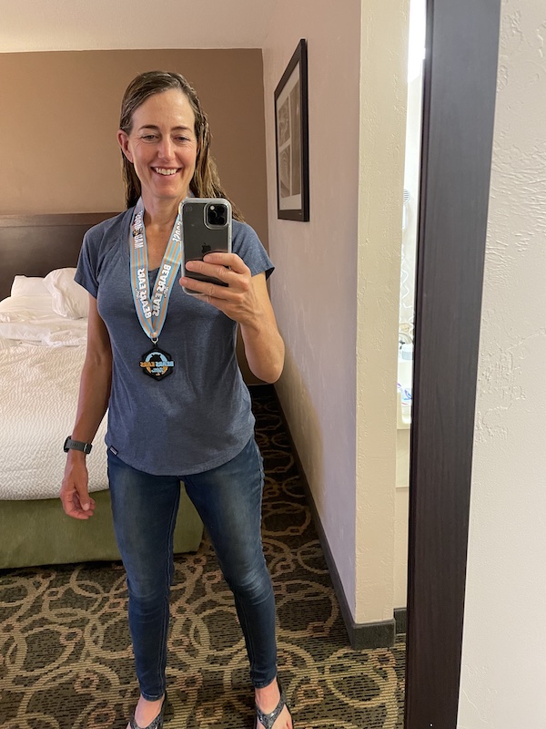
Post-race, post-shower selfie with my finisher’s medal.
If you want to learn about the real Bears Ears National Monument, check out my earlier post about it.
Love your blogs your are so amazing. I love 50 k and 50 milers too. I am a slower runner mid pack. Your adventures are awesome. Thank you so much.
Great report, Sarah! Really enjoyed reading this (and liked how your altimeter readings corrected the course description–way to keep them honest!) This seems like a wonderful landscape sandwiched between two areas I’m more familiar with (especially Canyonlands). Congrats on a fine finish for a ‘training’ run!
Nice race report! Good luck on your 100 in 5 weeks!