Weather
Chilly temperatures cover much of the Heartland
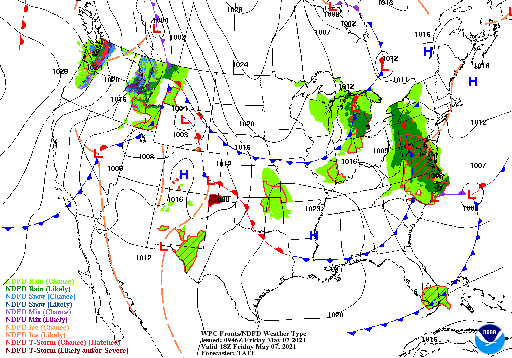
Across the Corn Belt, unusually cool conditions continue to slow winter wheat development and the emergence of recently planted corn and soybeans. Advisories for frost and near-freezing temperatures were in effect early Friday across parts of the northern Corn Belt, from South Dakota to Michigan. Dry weather covers much of the Midwest, although a few rain and snow showers are occurring in the Great Lakes region.
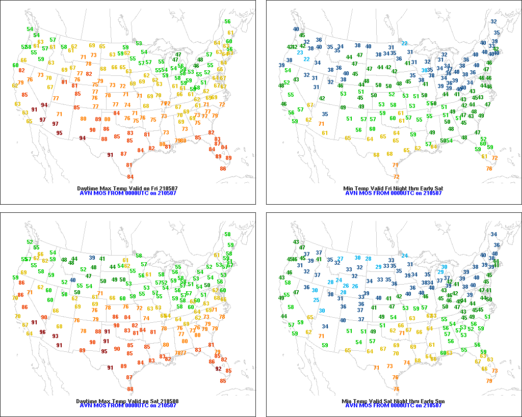
On the Plains, widespread freezes occurred early Friday in the Dakotas. In North Dakota, Friday morning’s low temperatures included 20° in Devils Lake and 23° in Grand Forks. In contrast, warmth has returned across the southern half of the High Plains, where Friday’s high temperatures should generally range from 85 to 90°. Dry weather throughout the nation’s mid-section favors planting activities for variety of crops.
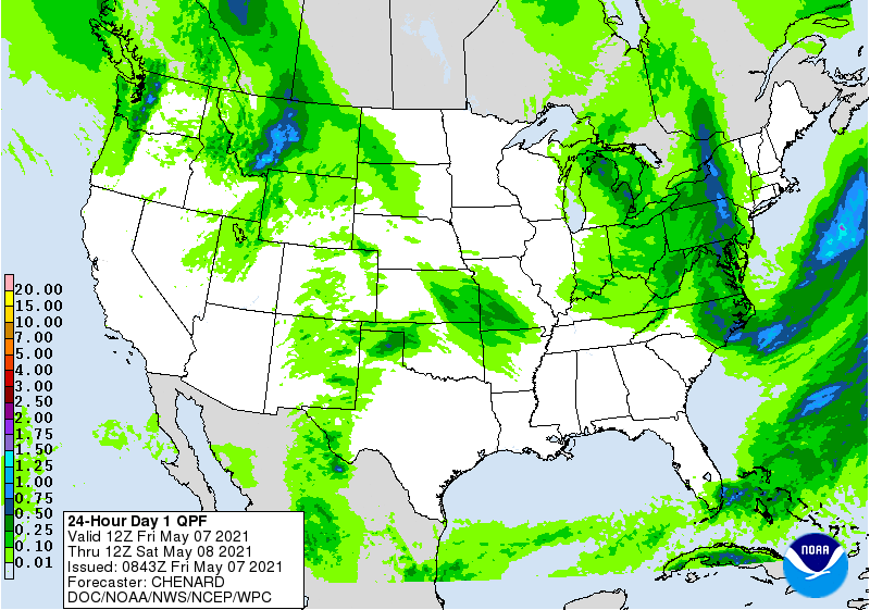
In the South, rain showers are confined to the middle Atlantic States, including portions of Virginia and North Carolina. Elsewhere, dry weather continues to promote fieldwork, including spring planting activities. Cooler-than-normal weather blankets much of the South, although warmth prevails across southern Florida and the western Gulf Coast region.
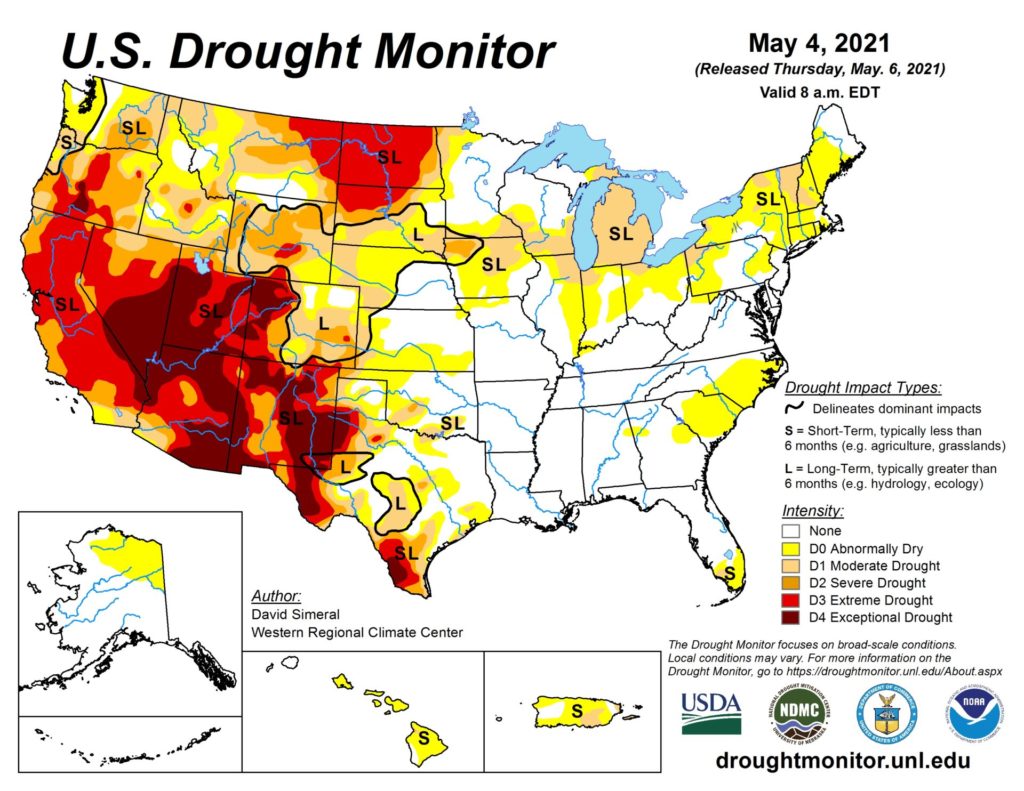
In the West, a storm system is producing scattered showers from the Pacific Northwest to the northern Rockies. Nevertheless, short-term dryness remains a concern for many rain-fed crops across the interior Northwest. On May 2, topsoil moisture was rated 70% very short to short in Oregon, along with 64% in Washington. More than one-third (35%) of Oregon’s winter wheat was rated in very poor to poor condition on May 2, up from 13% the previous week.
Add Comment