Weather
A wet, mild to warm pattern ahead for the Heartland
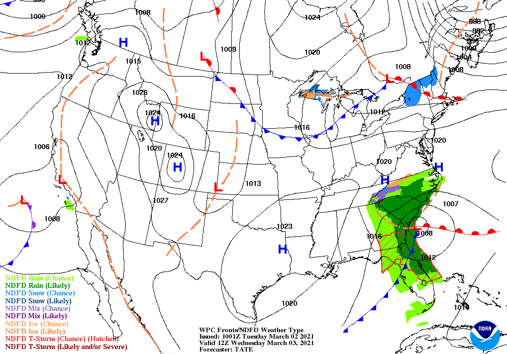
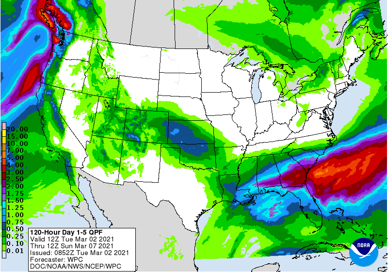
Southern rain will end on Wednesday, following additional amounts of 1 to 3 inches from the central Gulf Coast into parts of Georgia, South Carolina, and northern Florida.
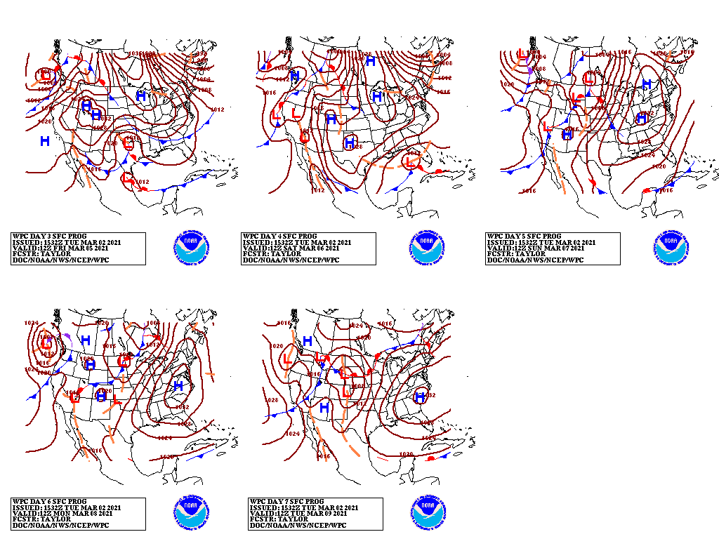
Farther west, a storm system crossing the southwestern and south-central U.S. will generate widespread but generally light precipitation, mainly from March 3-5.
Late in the week, some additional rain will fall in the Southeast, mainly south of the areas currently experiencing significant flooding.
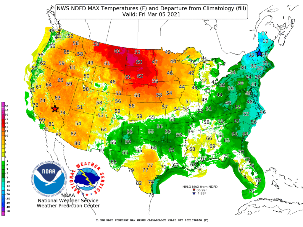
During the next 5 days, cold air will be largely absent from the Lower 48 States, aside from chilly conditions in the Great Lakes and Northeastern States.
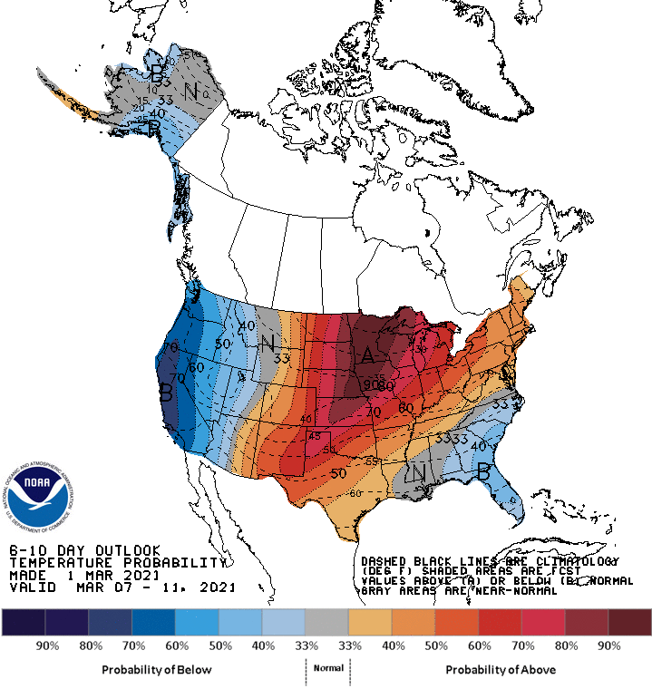
Looking ahead, the 6- to 10-day outlook calls for the likelihood of near- or above-normal temperatures nationwide, except for cooler-than-normal conditions in the Far West and the southern Atlantic States.
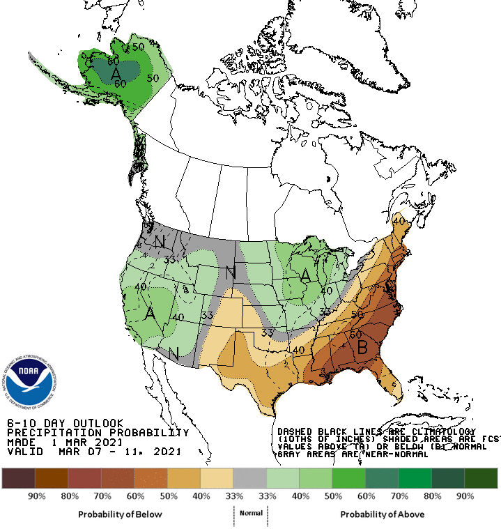
Meanwhile, below-normal precipitation in the southern and eastern U.S. should contrast with wetter-than-normal weather in much of the West and Midwest.
Add Comment