Weather
More beneficial moisture for the West, Heartland
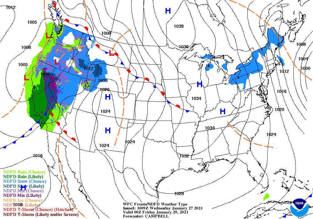
An active weather pattern will continue, with multiple storms following a similar path from the Pacific Coast into the Southwest.
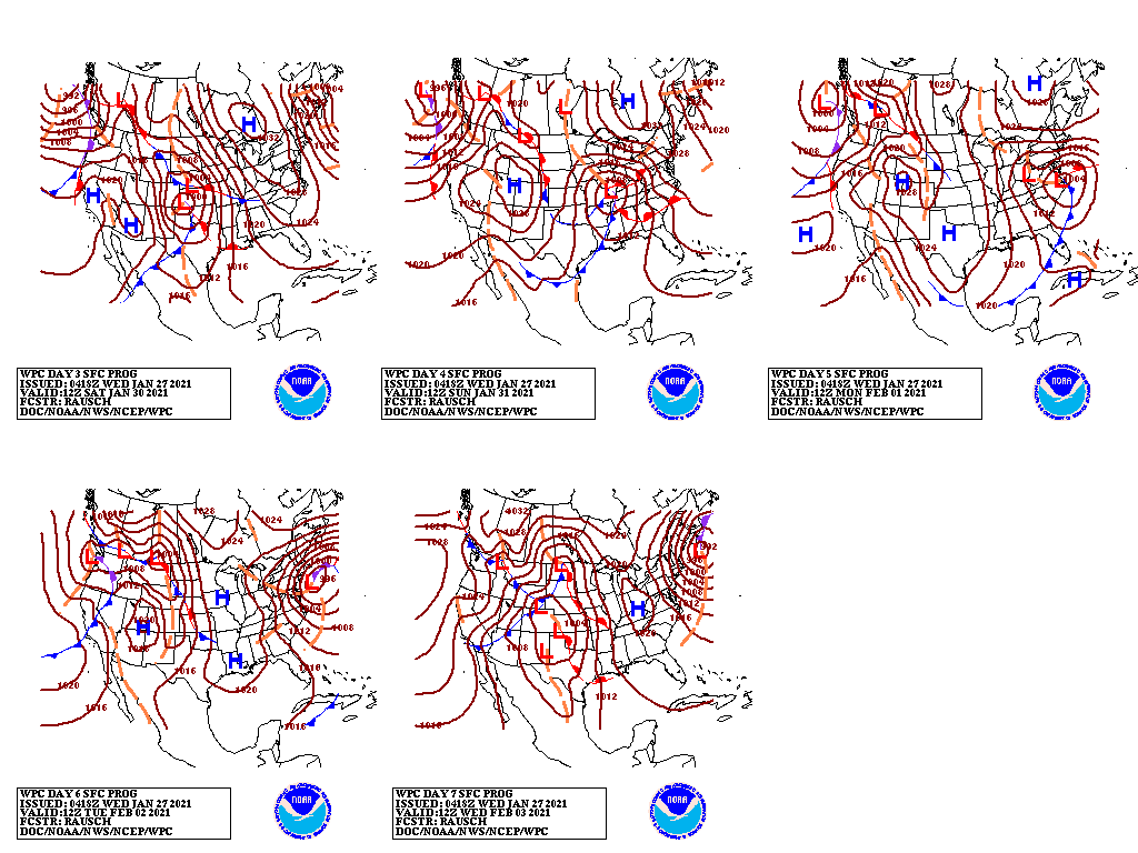
Each storm will accelerate northeastward from the Four Corners region across the central and eastern U.S.
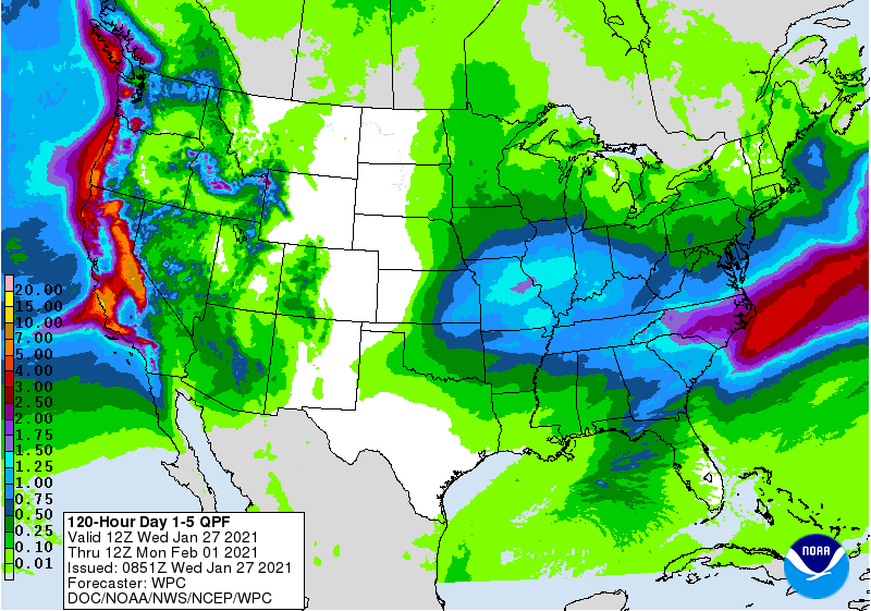
Five-day precipitation totals could reach 4 to 8 inches or more in portions of coastal California, while similar amounts will result in impressive snowfall in the Sierra Nevada.
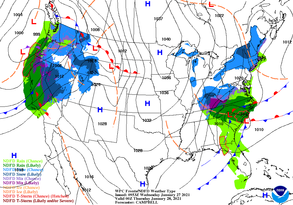
Farther east, precipitation associated with a departing storm will end by mid-week across the East, followed by another round of rain and snow across the eastern half of the country during the weekend.
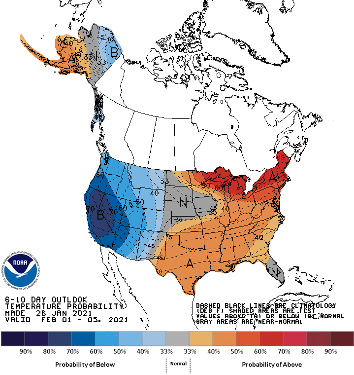
Looking ahead, the 6- to 10-day outlook calls for the likelihood of near- or above-normal temperatures from the Plains to the East Coast, while colder-than-normal conditions will prevail west of the Rockies.
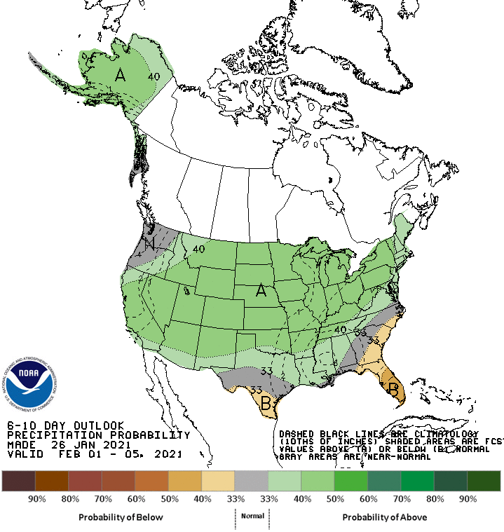
Meanwhile, near- or below-normal precipitation across the nation’s southern tier should contrast with wetter-than-normal weather across the remainder of the country.
Add Comment