(Via @NWSIndianapolis.)
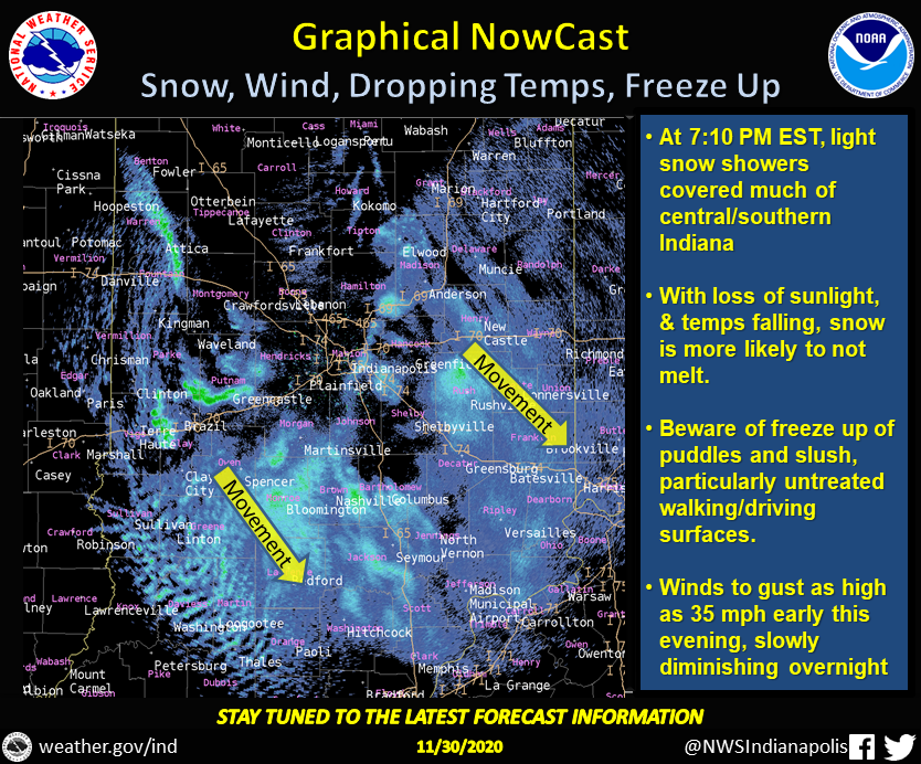
At 7:10 PM EST radar showed snow showers covering much of central/southern IN. Chance of snow accumulation & freeze up of slush/puddles more likely now that temps falling & sunlight absent. Winds gusting to 35 mph. Snow and winds to slowly diminish overnight. #INwx #nwsind https://t.co/DlsflKEC9E
My Huge Radar has real-time weather tracking, current temperatures, and severe weather watches and warnings. Get detailed Indiana conditions by clicking here. Follow these links to get my forecasts for Lafayette, Muncie, Hendricks County, and Hamilton County. Need a second opinion? Click here for central Indiana National Weather Service forecasts.
Never miss me! Subscribe for free. My Huge Radar has real-time weather tracking, current temperatures, and severe weather watches and warnings. Get detailed Indiana conditions by clicking here. Click here to see my central Indiana 7-Day Forecast. Follow these links to get my forecasts for Lafayette, Muncie, Hendricks County, and Hamilton County. Need a second opinion? Click here for central Indiana National Weather Service forecasts. (Some charts via WeatherBELL.)


