Weather
A wide-range of weather across the Heartland
Across the Corn Belt, cold, mostly dry weather prevails. However, corn and soybean harvest activities remain limited in many areas by wet fields or—in the upper Midwest—a substantial snow cover.
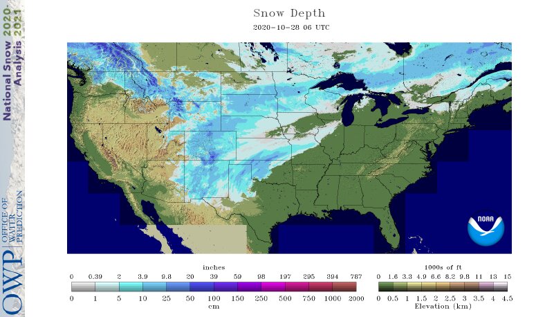
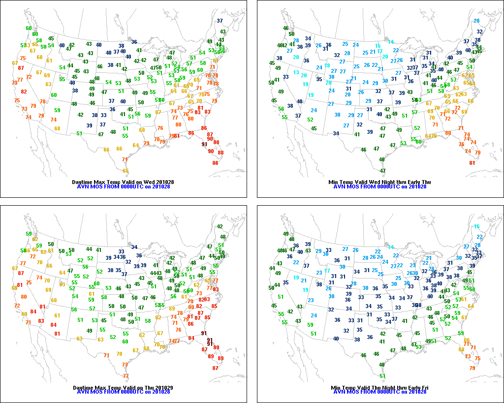
On the Plains, early-season snow is blanketing Texas’ northern panhandle and environs, while an ice storm is glazing portions of western Oklahoma. The winter storm, while highly beneficial for winter wheat, is causing travel disruptions and increasing livestock stress. Farther north, temperatures have begun to rebound from historically low levels—but remain below normal. On Tuesday, lows of 0° in Goodland, Kansas, and Burlington, Colorado, set October records for those locations. However, an extensive snow cover is helping to insulate the Plains’ emerging winter wheat crop.
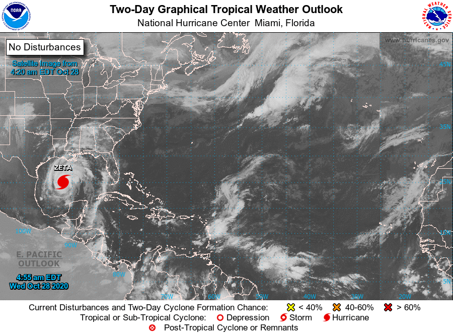
In the South, rain showers are spreading northward in advance of Hurricane Zeta, halting pre-storm efforts to harvest crops such as cotton, soybeans, and sugarcane. At 7 am CDT Wednesday morning, Zeta was centered 295 miles south-southwest of New Orleans, Louisiana, moving toward the north at 17 mph. Sustained winds are near 90 mph. Meanwhile, sharply colder air is overspreading the western fringe of the region, from Texas into Arkansas.
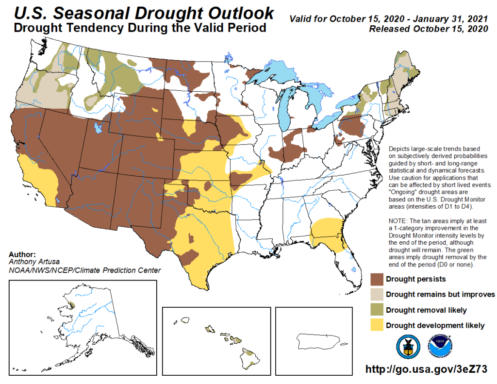
In the West, the wildfire threat in southern California is slowly diminishing as winds subside, but several fires remain active. Southern California’s Silverado and Blue Ridge Fires—both of which started on October 26—have collectively burned nearly 28,000 acres of vegetation. Elsewhere, beneficial snow is gradually ending in the drought-affected southern Rockies, while warmth is returning across northern California and the Pacific Northwest.
Add Comment