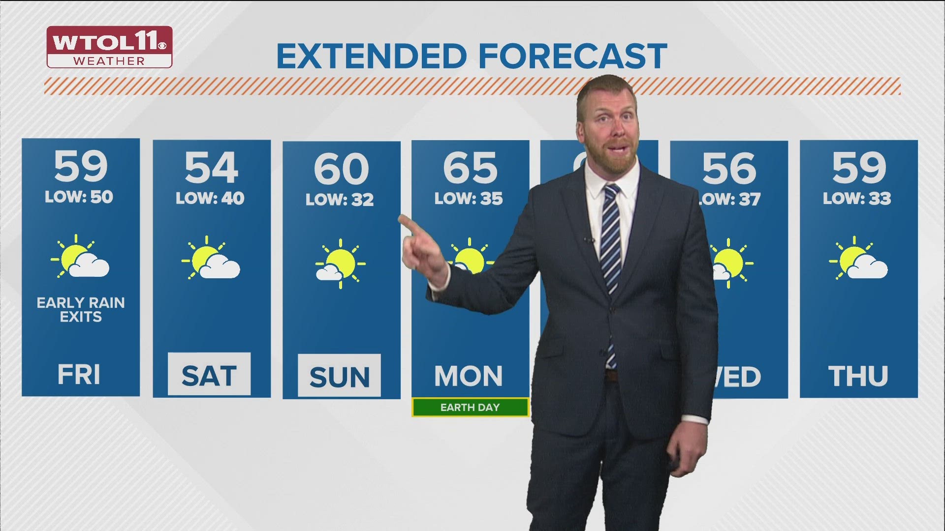
TOLEDO, Ohio — A damp start on Friday with lingering wet clouds before they dry out, turning partly sunny in the early afternoon. A west wind will drop highs back into the upper 50s.
Decreasing clouds will make for partly sunny skies into the afternoon. Winds may gust up to 30 mph through the afternoon.
The cooler feeling will continue into the weekend with highs only in the mid-50s expected on Saturday.
Frosty conditions are possible Sunday morning with a chilly start, eventually warming up to near 60 degrees under brighter skies.
The dry warming trend extends into early next week with highs reaching the mid-60s on Monday and Tuesday.
Scattered rain showers return next Tuesday, giving the area only a few days to dry out during what has been a very wet April so far. Additional rain would be lighter with totals again 0.25" to 0.50" or less.
Cooler air returns the middle of next week following the rain with highs dropping back to the 50s once again.
There are signs milder air will return by next week as the April sun angle continues to increase, making it easier for warmer air to build.
Download the free WTOL 11 Weather app
WTOL 11 meteorologist John Burchfield breaks down how the free WTOL 11 Weather app works for you:
MORE COVERAGE: More rainy and warm spring weather in northwest Ohio, southeast Michigan | Climate Friday
What's the weather like where you are?
Share your photos by tapping "Near Me" on the WTOL 11 News app navigation bar at the bottom of your screen! Be sure to give us your name and you may just see your photos on air.