TOLEDO, Ohio — Clouds increase Thursday evening with the chance of rain showers and a few isolated thunderstorms arriving near and after midnight.
A few storms may have some gusty winds, but widespread severe weather is not anticipated. The heaviest of the rain will be shortly after midnight with downpours possible. Overall rain will be near 0.25'' with a few isolated spots up to 0.50".

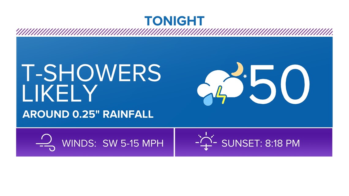
Dry weather will be expected by daybreak Friday with lingering early morning clouds.
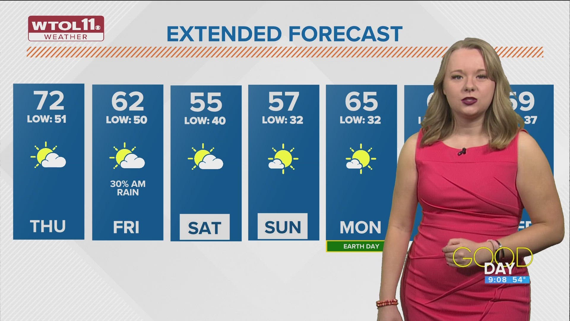
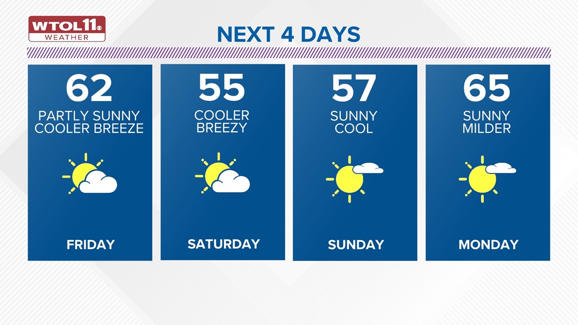
Decreasing clouds will make for brighter skies and sunshine into the afternoon Friday. It will be breezy and a bit cooler with highs in the low 60s. Winds may gust up to 30 mph through the afternoon.

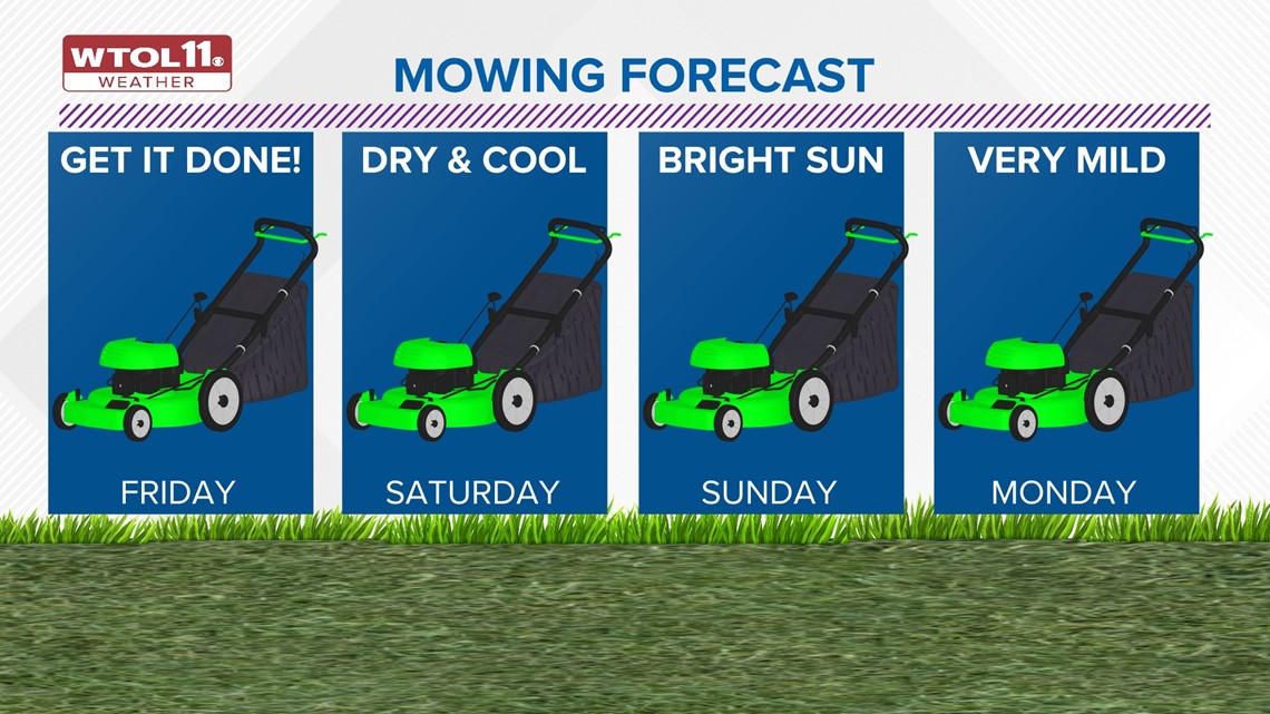
It will stay cooler into the weekend with highs in the 50s on Saturday and Sunday. Dry weather early next week on Monday with temperatures back into the 60s.
The next rain chance will arrive on Tuesday with afternoon rain showers. Additional rain would be lighter with totals again 0.25" to 0.50" or less.
Highs toward the middle of next week will dip back into the 50s.

Download the free WTOL 11 Weather app
WTOL 11 meteorologist John Burchfield breaks down how the free WTOL 11 Weather app works for you:
MORE COVERAGE: More rainy and warm spring weather in northwest Ohio, southeast Michigan | Climate Friday
What's the weather like where you are?
Share your photos by tapping "Near Me" on the WTOL 11 News app navigation bar at the bottom of your screen! Be sure to give us your name and you may just see your photos on air.