Weather
Typical early-Spring Pattern across the Heartland
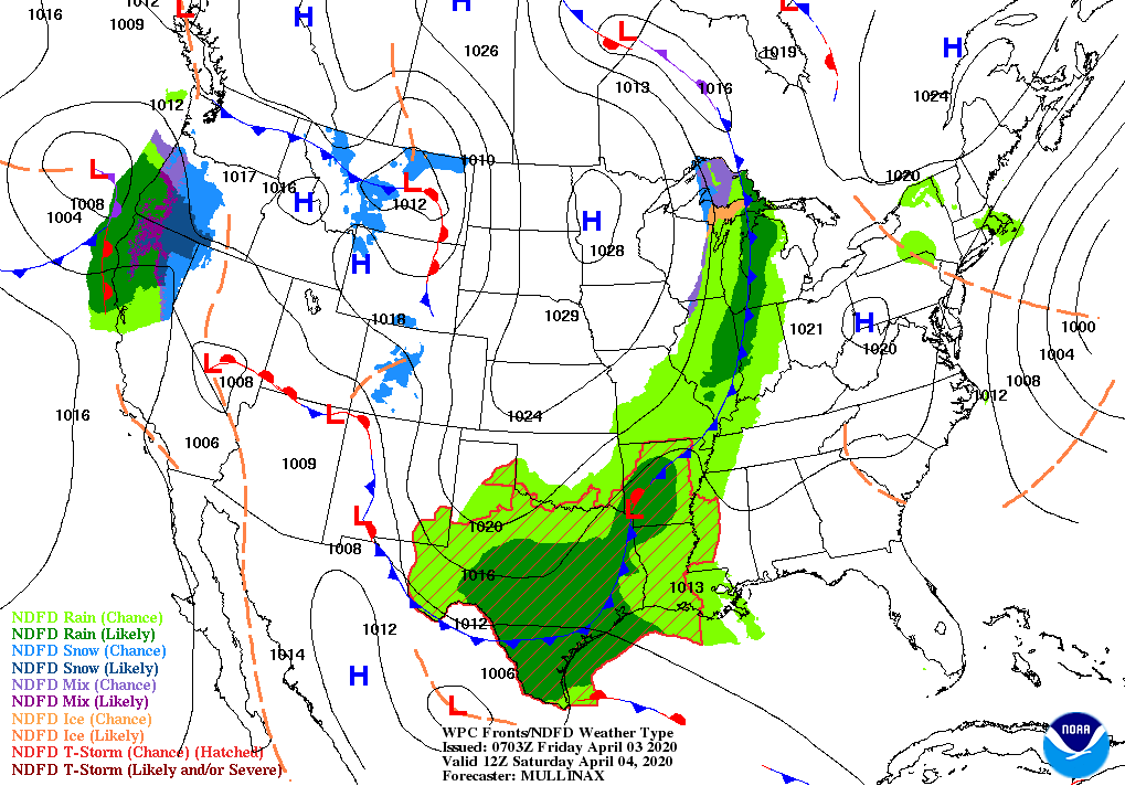
A cold front currently stretching from Minnesota to Texas will slowly advance eastward and weaken.
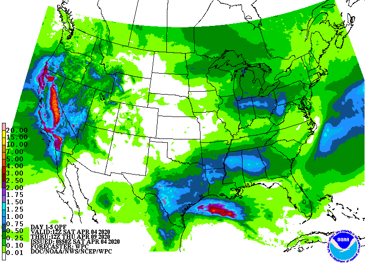
Prior to weakening, however, the front could spark heavy showers (1 to 4 inches) and locally severe thunderstorms in the western Gulf Coast region. Later, the focus for storminess will shift to California, where weekend precipitation should become heavy. In contrast, little or no precipitation will fall during the next 5 days in the Southwest or the southern Atlantic States.
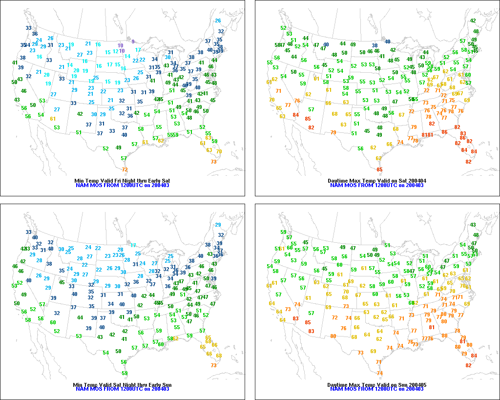
Elsewhere, a blast of cold air will briefly result in weekend freezes as far south as the northern panhandle of Texas.
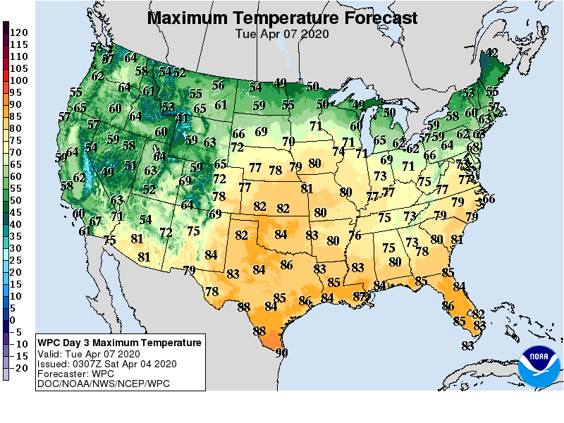
By early next week, however, above-normal temperatures will return across much of the central and eastern U.S.
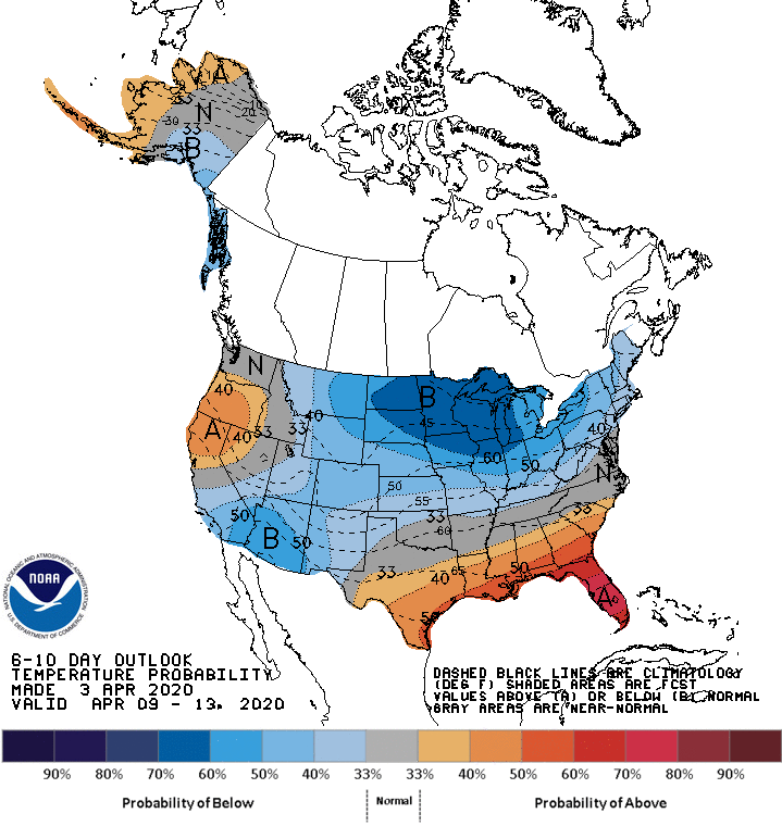
Looking ahead, the 6- to 10-day outlook calls for the likelihood of near- or below-normal temperatures across the northern and western U.S., while warmer-than-normal weather will prevail from the southern Plains into the Southeast.
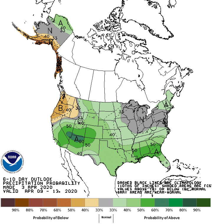
Meanwhile, near- or below-normal precipitation from the Pacific Northwest to the northern Plains should contrast with wetter-than-normal conditions across the remainder of the country.
Add Comment