Weather
Briefly milder; a more active pattern for the Heartland
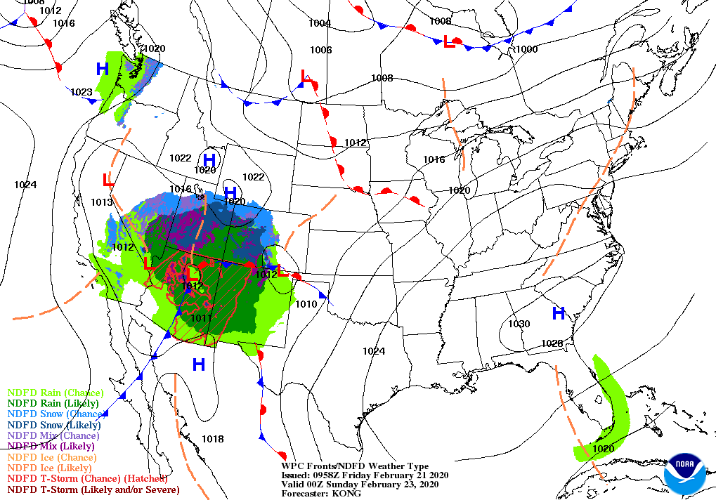
A short period of tranquil weather will end during the weekend, starting in southern California and the Four Corners States. The Pacific storm system responsible for the upcoming showery in the Southwest will cross the middle Mississippi Valley on Monday.
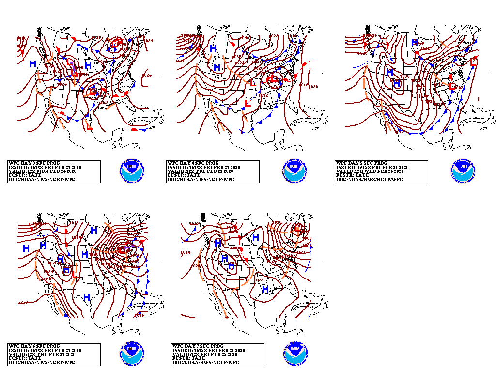
Subsequently, a complex storm system will intensify by the middle of next week across parts of the Midwest and Northeast.
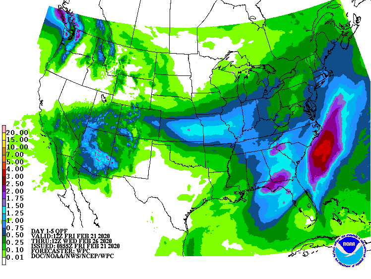
Five-day precipitation totals could reach 1 to 2 inches in a broad area from southern California to the lower Great Lakes region. Similar amounts may fall in a separate area across the Southeast. Some of the precipitation will fall as snow, especially across the mountains of the Southwest and—eventually—in parts of the Midwest. In contrast, mostly dry weather will prevail during the next 5 days in northern California and much of Texas.
Elsewhere, a significant warming trend will commence late in the weekend and early next week east of the Mississippi River, while a new surge of cold air will engulf the Rockies and Plains.
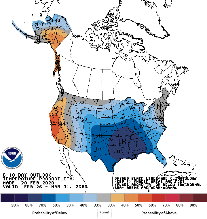
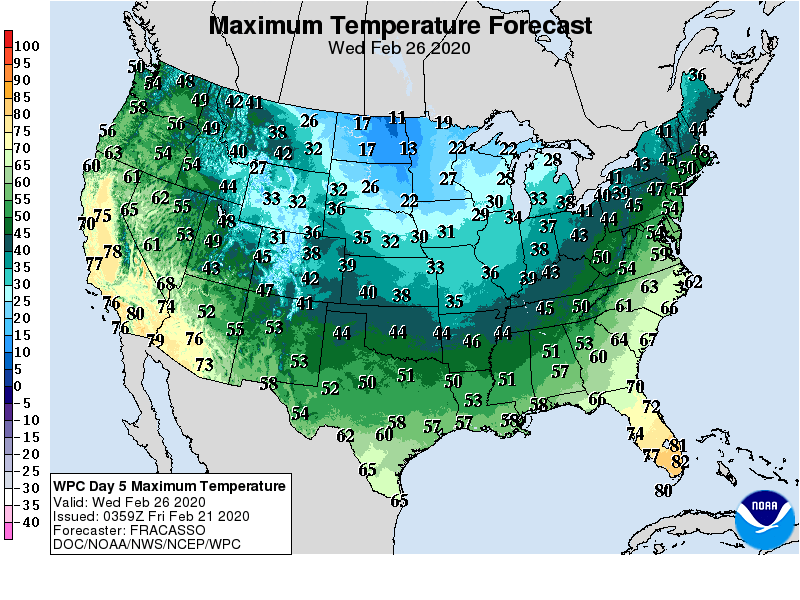
Looking ahead, the 6- to 10-day outlook calls for the likelihood of near- or below-normal temperatures nationwide, except for warmer-than-normal weather in California and environs.
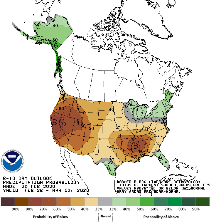
Meanwhile, below-normal precipitation across most of the country should contrast with wetter-than-normal conditions in the lower Rio Grande Valley, peninsular Florida, and an area stretching from the Great Lakes region into the Northeast.
Add Comment