Weather
Milder, trending more unsettled for the Heartland
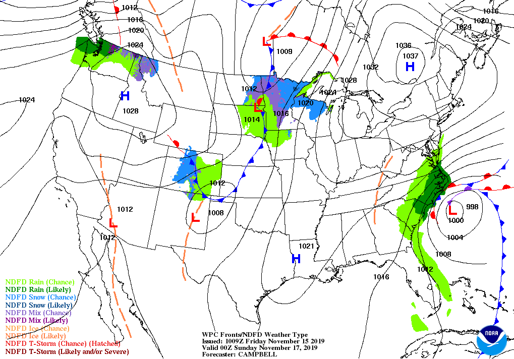
A storm system will drift northward just east of the Atlantic Seaboard, reaching the Canadian Maritimes by next Tuesday. Although the storm will graze the Atlantic Coast States with heavy rain, greater concerns will include coastal winds of 60 mph or greater and beach erosion.
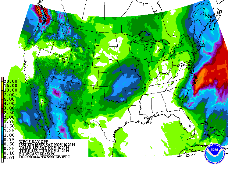
Some of the most significant storm impacts should occur during the weekend in the coastal Carolinas, where storm-total rainfall could reach 2 to 4 inches or more. Early next week, snow may fall in parts of interior New England. Meanwhile, mostly dry weather will prevail during the next 5 days in California, the Great Basin, the central and southern Plains, and the lower Mississippi Valley. Periods of generally light precipitation will affect the North, although rain (and high-elevation snow) could become heavy at times in the northern Rockies and Pacific Northwest. Early next week, tropical moisture may begin to overspread the Desert Southwest.
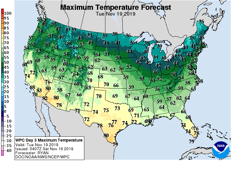
Above-normal temperatures should prevail in most areas west of the Mississippi River, while chilly conditions will prevail across the East.
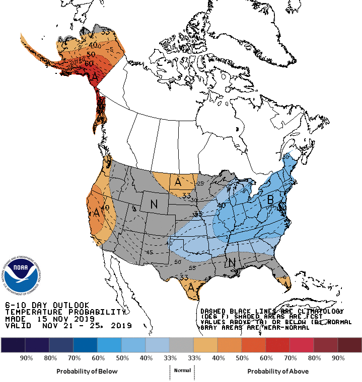
Looking ahead, the 6- to 10-day outlook calls for the likelihood of near- or above-normal temperatures in the western and central U.S., while colder-than-normal conditions will linger in much of the East.
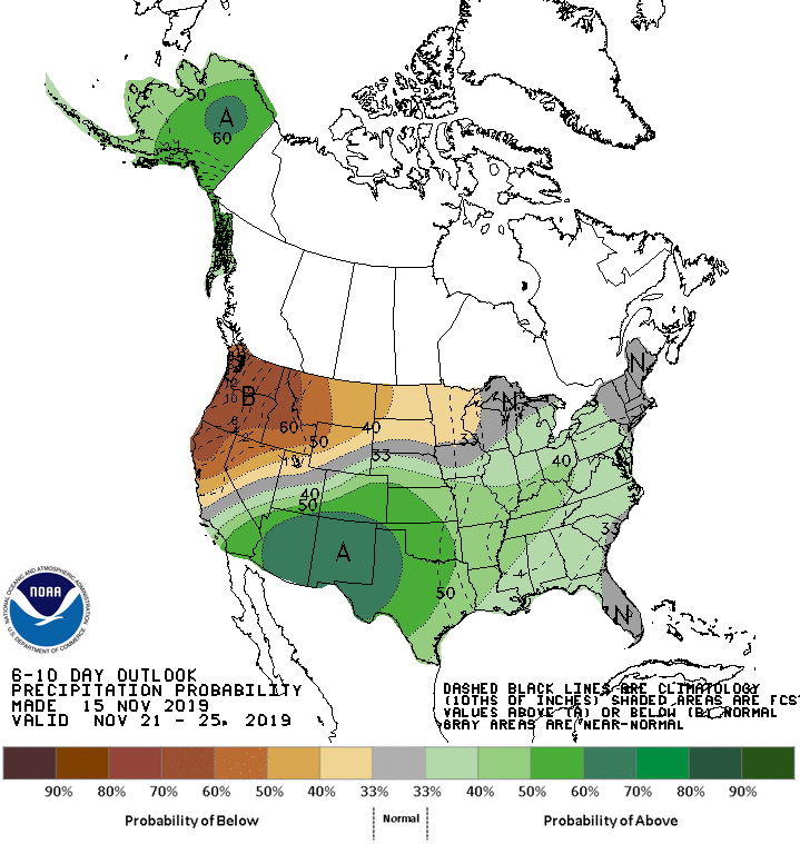
Meanwhile, below-normal precipitation in northern California, much of Florida, and the Northwest should contrast with wetter-than-normal weather across the remainder of the country, including the Plains, Midwest, Southwest, and Northeast.
Add Comment