Weather
Historic cold across the eastern-half of the Nation
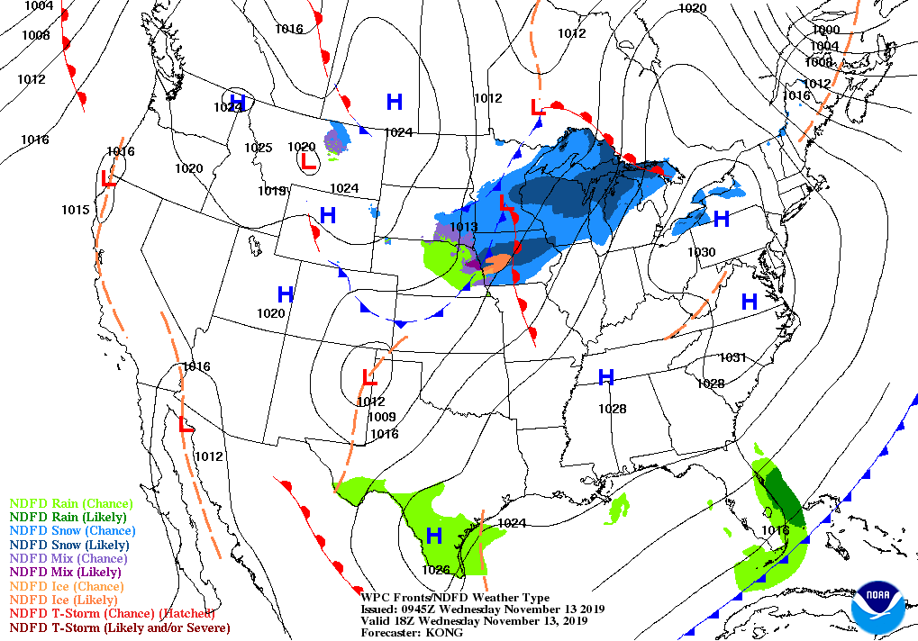
Across the Corn Belt, patches of light precipitation stretch from Nebraska and South Dakota into the Great Lakes region. As upper Midwestern fields freeze, producers are selectively harvesting crops. Corn, which in many cases needs additional time to dry down in the field, was 66% harvested nationally on November 10. This represents the slowest U.S. corn harvest pace since 2009, when the crop was 42% harvested on that date.

On the Plains, temperatures have rebounded from Tuesday’s frigid levels. Some light precipitation—mainly rain—is falling early Wednesday in portions of Nebraska and South Dakota. Some winter wheat fields are struggling to emerge and become established due to cold conditions. In Montana, only 68% of the wheat had emerged by November 10, compared to the 5-year average of 92%. Farther south, dryness is causing some wheat establishment issues on the High Plains. On November 10, topsoil moisture was rated at least 40% very short to short in Colorado, Kansas, and Oklahoma.

In the South, Freeze Warnings were in effect early Wednesday from coastal Texas to Georgia. In Louisiana, producers will need to monitor freeze-affected sugarcane that remains in the field; on November 10, the crop was 47% harvested, statewide. Farther west, a new storm system is producing a chilly rain is parts of the lower Rio Grande Valley.
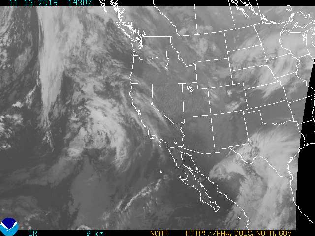
In the West, mild, dry weather favors autumn fieldwork, including cotton harvesting in Arizona and California. However, issues with air stagnation persist in parts of Idaho, Oregon, and Washington.
Add Comment