Weather
Moderating temperatures ahead for the Heartland
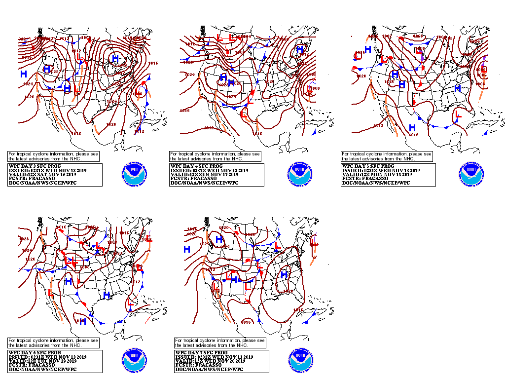
A high-pressure system currently centered over the Ohio Valley will reach the northern and middle Atlantic Coast by Thursday morning. Subsequently, another strong high-pressure system will settle across the Great Lakes and Northeastern States late in the week. Meanwhile, several weak disturbances will produce periods of light snow across the North.
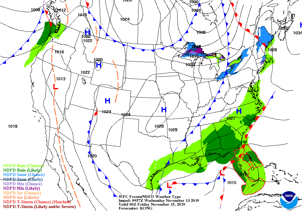
Farther south, a developing storm system will result in rainy, breezy conditions across the Deep South and later—during the weekend—along the Atlantic Seaboard.
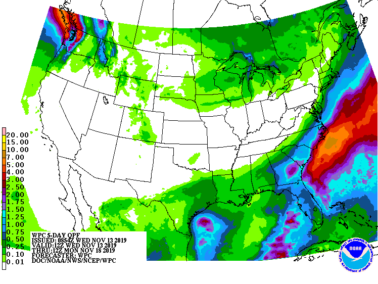
Storm-total rainfall could reach 1 to 2 inches or more in the southern Atlantic coastal plain. In contrast, mostly dry weather will prevail during the next 5 days from California to the Plains, as well as the mid-South and the Ohio Valley.
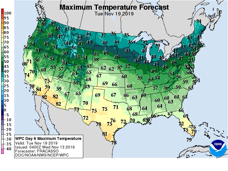
Elsewhere, cold air will maintain its grip on the South, East, and lower Midwest, but mild weather will prevail in the West and gradually expand eastward to reach the nation’s mid-section.
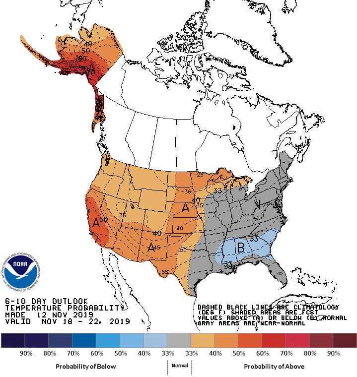
Looking ahead, the 6- to 10-day outlook calls for near- or below-normal temperatures across the eastern one-third of the U.S., while warmer-than-normal weather will prevail from the Pacific Coast to the Plains.
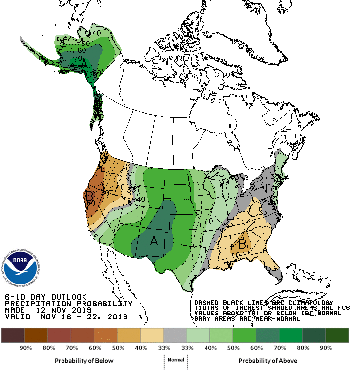
Meanwhile, below-normal precipitation in the Southeast and Far West should contrast with wetter-than-normal conditions across the remainder of the country. The greatest likelihood of wet weather can be expected across central and southern sections of the Rockies and High Plains.
Add Comment