Weather
A wide range of temps, moisture for the Heartland
For the remainder of Wednesday and into Thursday, significant rain and increasingly windy conditions will affect the Northeast. Meanwhile, rain will end later Wednesday across the South, but a disturbance over the southwestern Gulf of Mexico is forecast to drift northeastward and could provide additional Southeastern drought relief by week’s end.
Farther west, widespread precipitation—including high-elevation snow—will precede and accompany a surge of cold air into the Northwest.
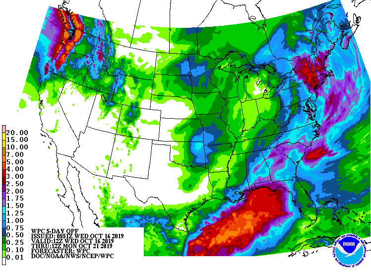
Five-day precipitation totals could reach 4 to 10 inches or more in parts of the Pacific Northwest. In contrast, mostly dry weather will prevail during the next 5 days from central and southern California to the central and southern High Plains.
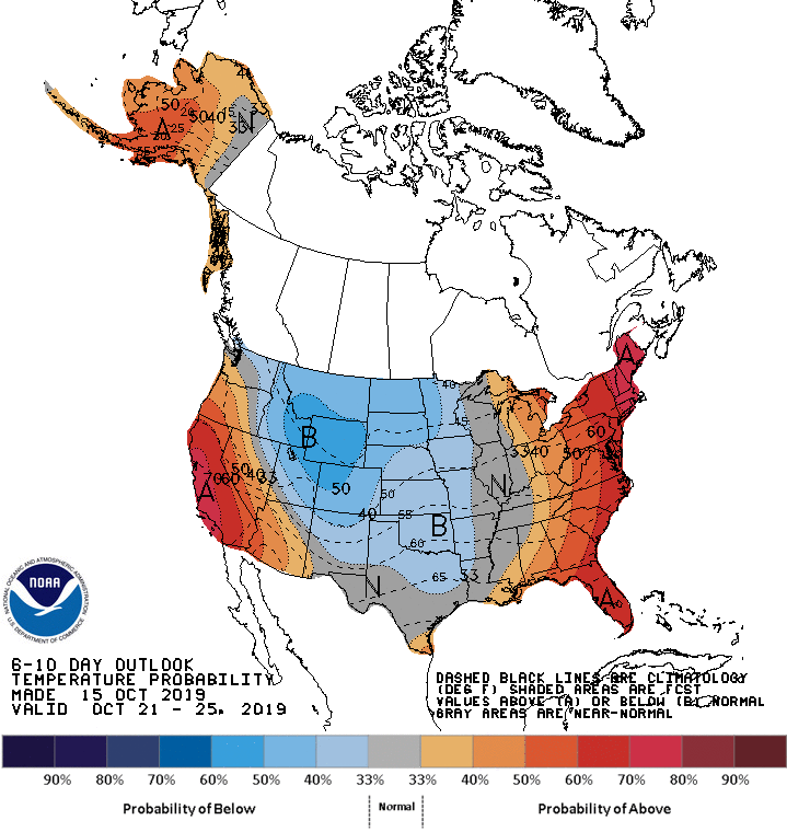
Looking ahead, the 6- to 10-day outlook calls for below-normal temperatures from Rockies to the Plains and western Corn Belt, while warmer-than-normal weather will prevail in the East and Far West.
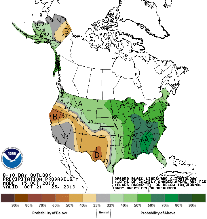
Meanwhile, near- or below-normal precipitation from Oregon and California to the southern High Plains should contrast with wetter-than-normal conditions across northern sections of the Rockies and Plains, as well as the eastern one-half of the U.S.
Add Comment