Weather
More summer-like warmth ahead for the Corn Belt

During the next several days, much of the country will continue to experience above-normal temperatures. However, a cooler pattern will become established across the North. Late in the week, cool air will further expand to include much of the West, while late-season heat will persist across the South.
Meanwhile, 5-day rainfall totals could reach 1 to 3 inches across the upper Midwest and environs, mainly due to late-week showers. Similar totals (locally 1 to 2 inches) can be expected in the northernmost Rockies, Pacific Northwest, Southwest, and northern New England, but mostly dry weather will prevail in California and the Southeast.
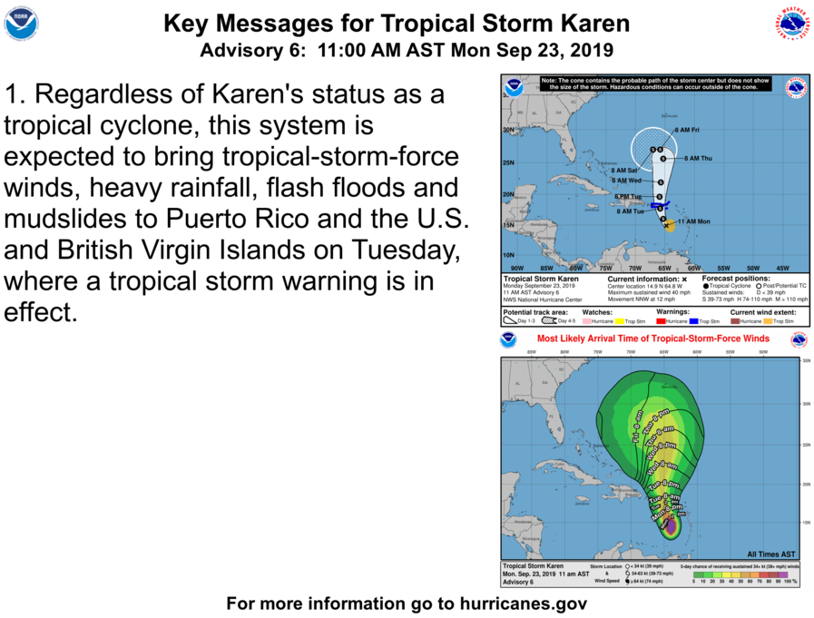
In the Caribbean, Tropical Storm Karin could deliver heavy rain and gusty winds to Puerto Rico and the U.S. Virgin Islands, starting on Tuesday.
Looking ahead, the 6- to 10-day outlook calls for the likelihood of above-normal temperatures along and east of a line from New Mexico to Minnesota, while cooler-than-normal conditions will cover the northern High Plains and the West.
Meanwhile, above-normal precipitation across the West, as well as the Rio Grande Valley, northern Plains, and upper Midwest, will contrast with drier-than-normal weather in the mid-South, Ohio Valley, and the East.
Add Comment