Weather
Favorable warmth to yield to rains across the Heartland
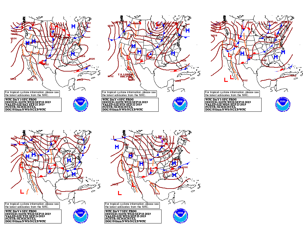
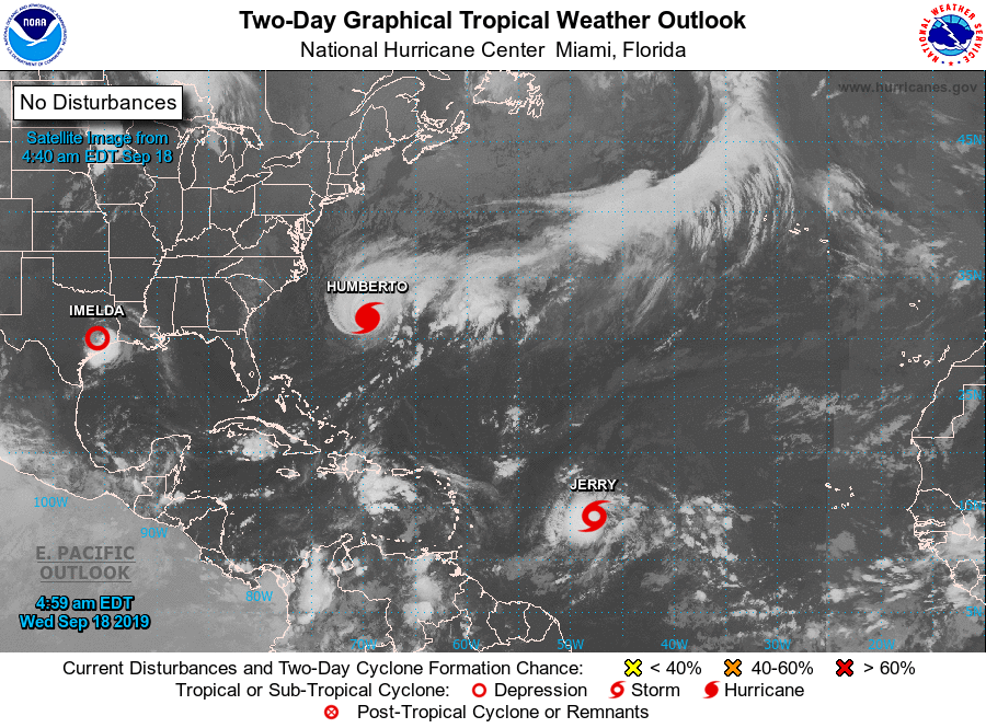
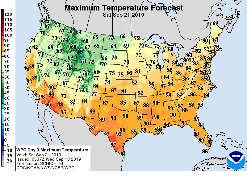
High pressure building southward from eastern Canada will maintain mostly sunny skies across the eastern third of the nation while deflecting Hurricane Humberto out to sea. The high will bring below-normal temperatures to the East Coast States, whereas southerly flow on the backside of the high maintains very warm weather (temperatures averaging 10° or more above normal) from the Plains into the Corn Belt.
Meanwhile, a weak tropical disturbance over the northwestern Gulf of Mexico will move ashore, producing locally heavy downpours in southeastern Texas, where 5-day rainfall totals could top 6 inches.
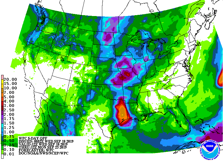
Farther west, a cold front currently producing pockets of rain across the Rockies will move slowly east and dissipate, while a reinforcing cold front will generate increasingly heavy showers during the latter half of the week in eastern portions of the Great Plains and environs; the heaviest rain (2 inches or more) is most likely in the Dakotas and western Corn Belt.
Behind the front, cooler-than-normal conditions will prevail from the Rockies to the Pacific Coast, with more showers expected in the Northwest.
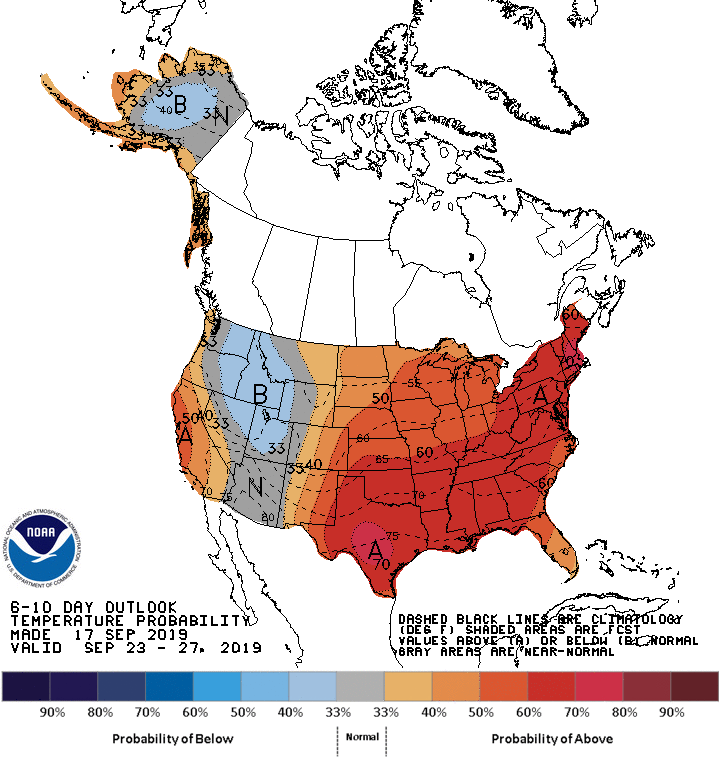
Looking ahead, the 6- to 10-day outlook calls for above-normal temperatures nationwide, save for a pocket of near-normal temperatures in the Northwest. Above-normal rainfall is expected in the Pacific Northwest and from the southern Plains into the Great Lakes Region.
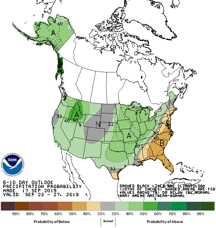
Conversely, drier-than-normal conditions are expected in Deep South Texas, central and northern portions of the Rockies and High Plains, and from the central Atlantic Coast into the Southeast.
Add Comment