Weather
Drier for water-logged portions of the Heartland
Across the Corn Belt, a low-pressure system is crossing the upper Great Lakes region, where showers linger. Showers and thunderstorms extend southward into the middle Mississippi Valley along a trailing cold front. In advance of the front, favorably warm weather across the eastern Corn Belt is promoting the development of late-planted corn and soybeans.
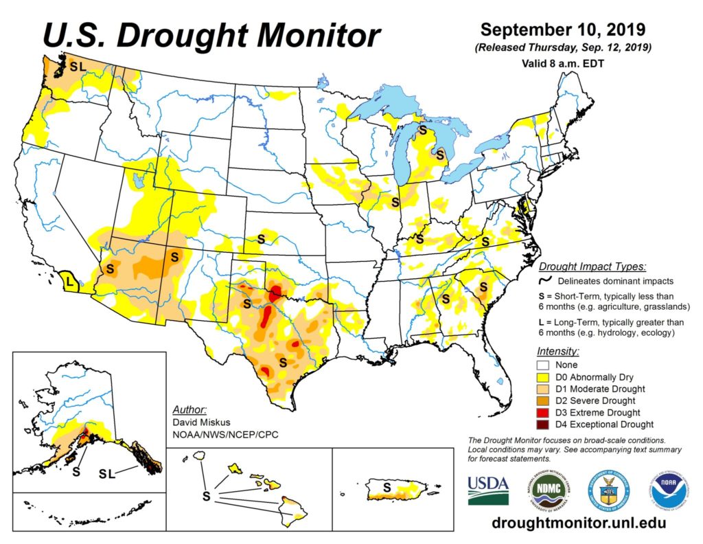
On the Plains, dry weather has returned across Montana and the Dakotas, following repeated rounds of heavy rain during the early- to mid-week period that slowed or halted small grain harvesting. Meanwhile, showers and thunderstorms across the southern Plains are providing limited relief from a fast-developing drought.
In the South, cooler air is overspreading the southern Mid-Atlantic region, accompanied by some rain and drizzle. However, hot weather across the remainder of the region continues to promote crop maturation and fieldwork, including corn and rice harvesting. A potential tropical cyclone over the Bahamas is contributing to a showery pattern that extends across Florida’s peninsula.
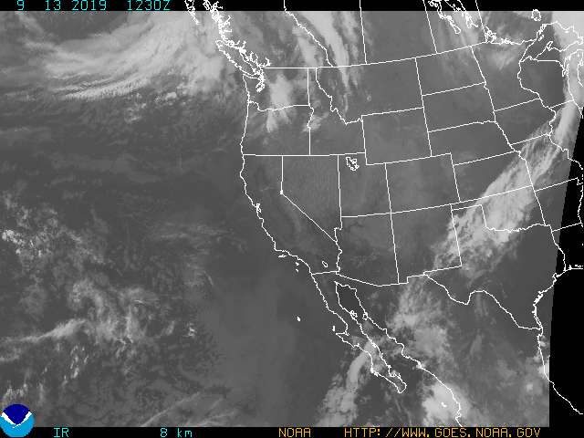
In the West, mostly dry weather accompanies a general warming trend, favoring most fieldwork operations. Any shower activity is limited to the southernmost Rockies and the Pacific Northwest.
Add Comment