Weather
Much cooler, drier air ahead for the Heartland
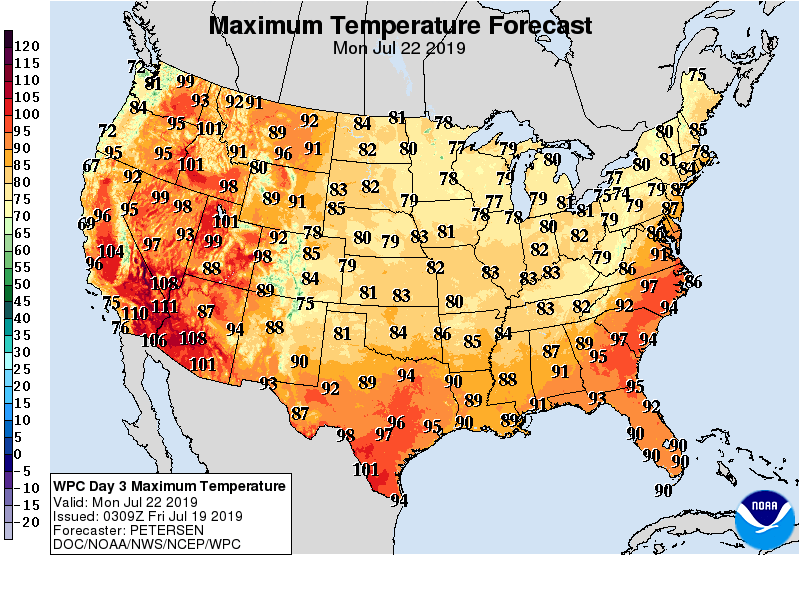
A short-lived heat wave will end during the weekend across the Plains and upper Midwest, and early next week in most other areas east of the Rockies.
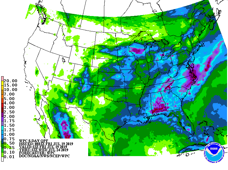
Widespread showers and thunderstorms will precede and accompany the surge of cool, dry air, with some of the heaviest rain (locally 2 to 4 inches or more) falling in parts of the Southeastern and Mid-Atlantic States. Elsewhere, monsoon-related showers will develop across the central and southern Rockies and the Desert Southwest, while mostly dry weather will prevail from the Pacific Coast to the northern Plains.
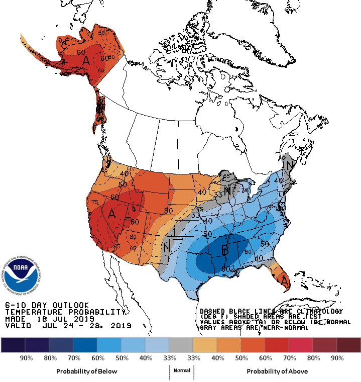
Looking ahead, the 6- to 10-day outlook calls for hotter-than-normal weather in southern Florida and west of a line from New Mexico to Lake Superior, while below-normal temperatures will prevail across much of the South, East, and lower Midwest.
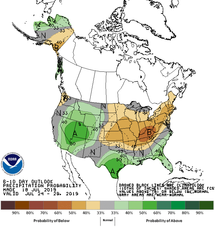
Meanwhile, near- or above-normal rainfall across the West and Deep South should contrast with drier-than-normal conditions in the Midwest, Northeast, and Tennessee Valley
Add Comment