Weather
Brief, but intense heat wave ahead across the Heartland
Heat and high humidity levels will dominate the central and eastern U.S. through week’s end, except on the northern Plains. By early next week, however, markedly cooler, drier air will arrive across the Plains and Midwest, easing stress on livestock and summer crops.
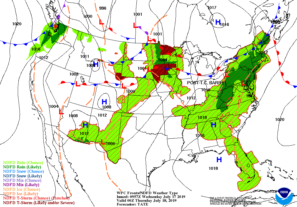
Meanwhile, the remnants of Barry will spark showers in the East through Thursday, while scattered showers and thunderstorms will affect parts of the nation’s northern tier.
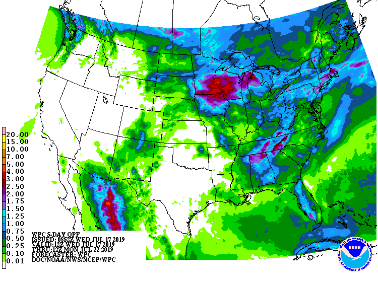
Midwest and locally 1 to 3 inches east of the Mississippi River. In contrast, dry weather will prevail in the south-central U.S. and from California to the Intermountain West.
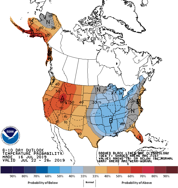
Looking ahead, the 6- to 10-day outlook calls for near- or below-normal temperatures across the eastern half of the U.S., except along the Atlantic Seaboard, while hotter-than-normal conditions will dominate areas from the Pacific Coast to the High Plains.
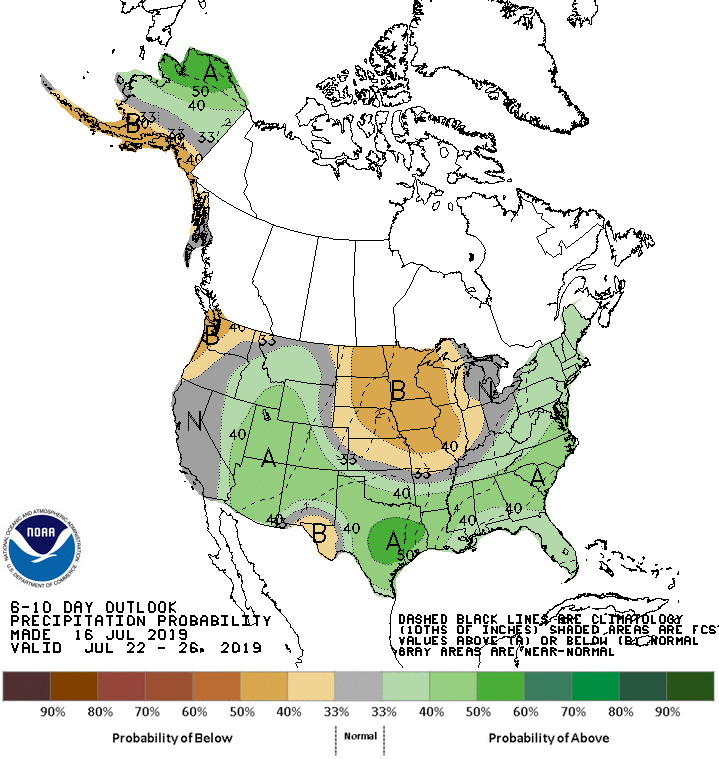
Meanwhile, below-normal rainfall in the Midwest and Pacific Northwest will contrast with wetter-than-normal weather in most other areas, including the South, East, and Intermountain West.
Add Comment