Weather
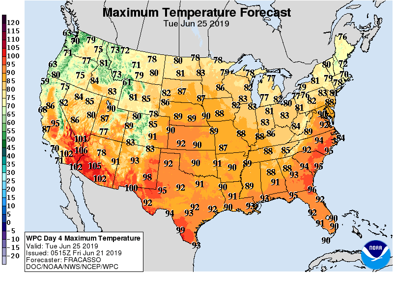
Less rain, more heat ahead for parts of the Heartland
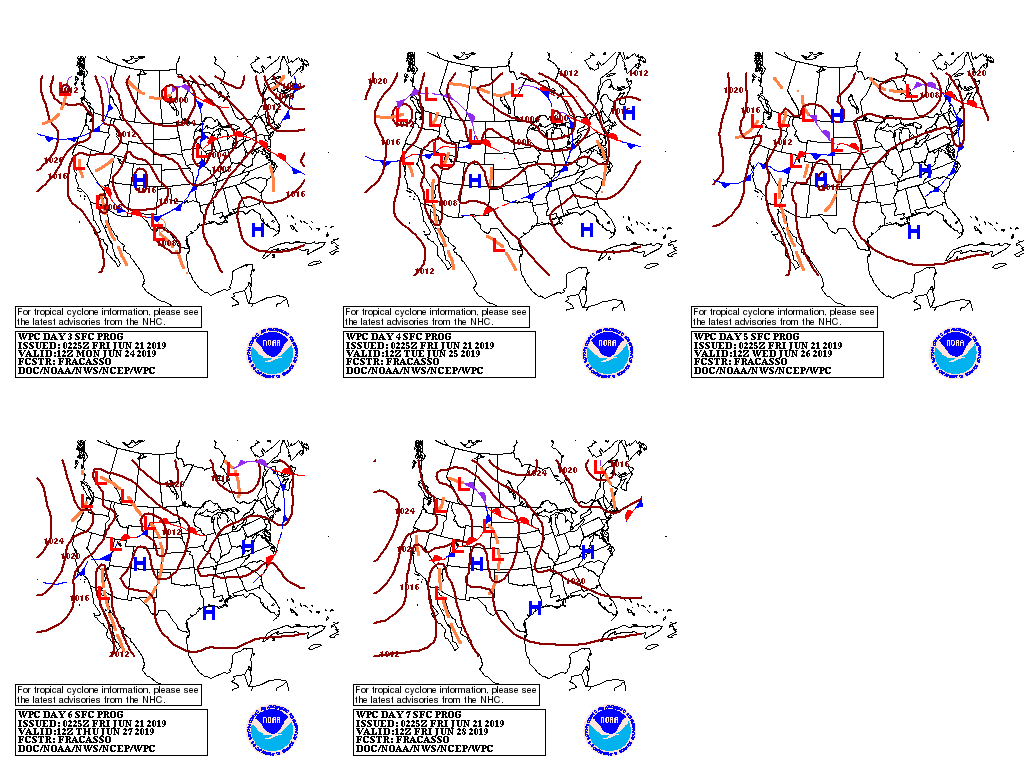
A slow-moving cold front will drift eastward across the Plains and Midwest during the next several days, generating locally heavy showers and thunderstorms.
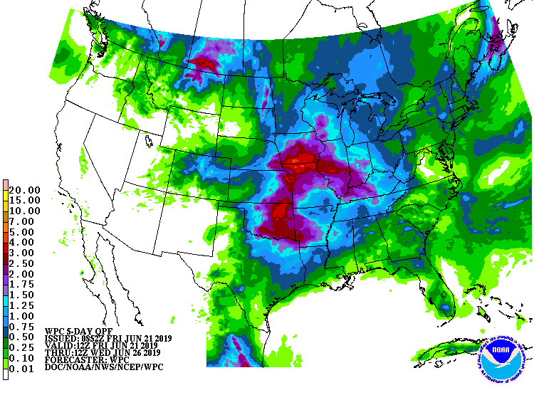
Five-day rainfall totals could reach 1 to 3 inches or more across the Midwest, mid-South, and eastern Plains. In contrast, only scattered showers will occur along and near the Atlantic and Gulf Coasts, while dry weather will prevail in the Far West.
Meanwhile, cool air will expand to cover much of the country, except the South and East, during the weekend.
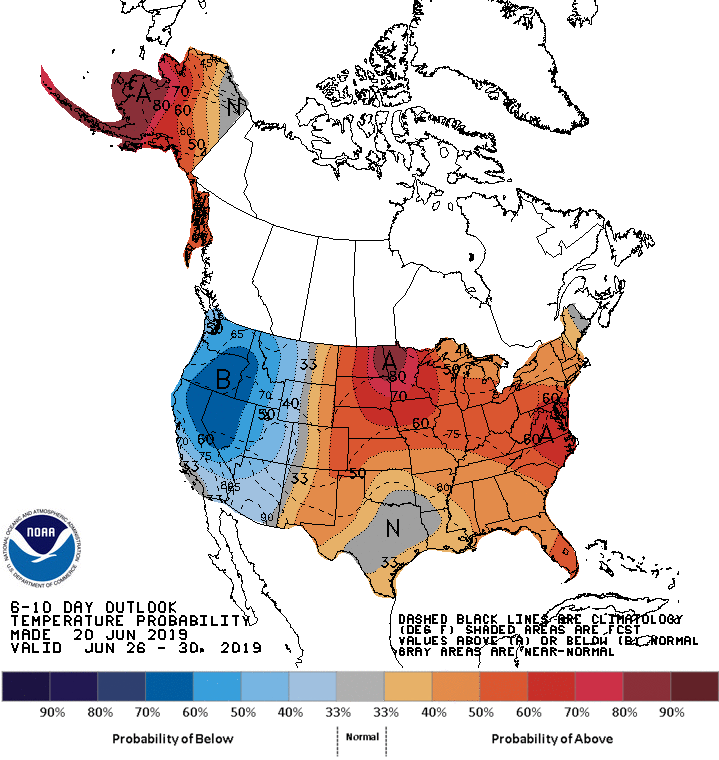
Looking ahead, the 6- to 10-day outlook calls for cooler-than-normal conditions in the West, while near- or above-normal temperatures will prevail from the Plains to the East Coast.
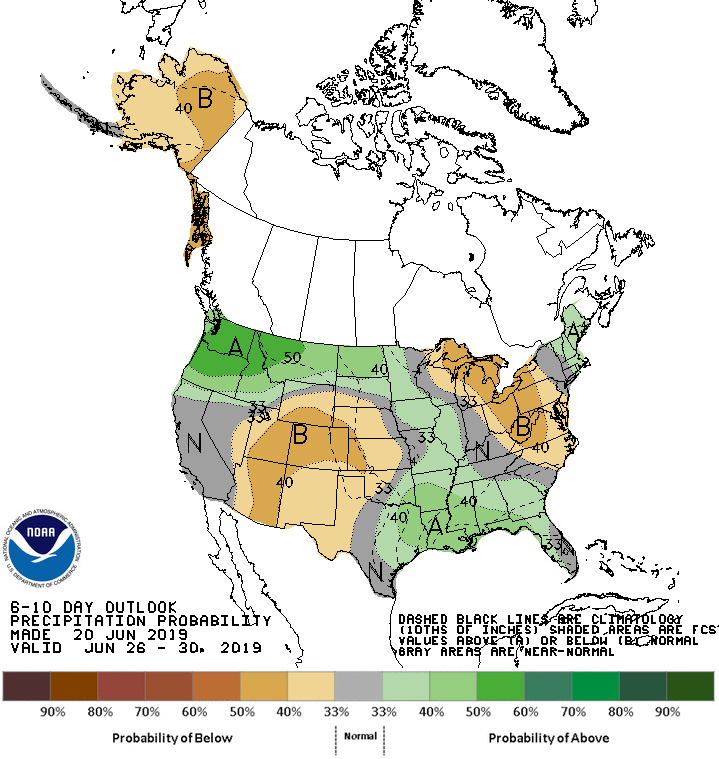
Meanwhile, wetter-than-normal weather in the Southeast, Northwest, and New England will contrast with below-normal rainfall from the Great Lakes region into the Mid-Atlantic States and from the Four Corners region to the central and southern High Plains.
Add Comment