Weather
Warmer; pattern to remain active across the Heartland

During the next few days, disturbances moving eastward along a nearly stationary frontal boundary will maintain showery weather across much of the central and eastern U.S.
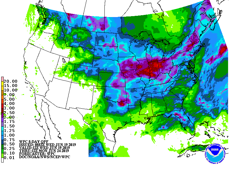
Five-day rainfall totals could reach 1 to 3 inches or more across much of the Plains, Midwest, and Northeast.
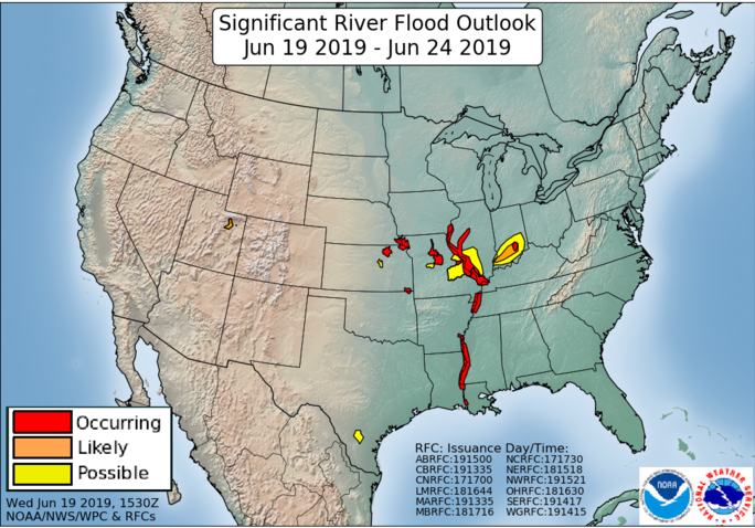
Some of the heaviest rain could fall in already soggy sections of the southern and eastern Corn Belt.
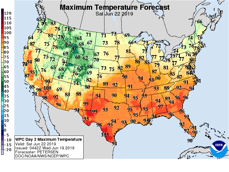
Meanwhile, hot, humid conditions will cover the South. A surge of cool air will engulf the Northwest by Thursday and later overspread the Plains and much of the West.
Elsewhere, mostly dry weather will prevail during the next 5 days in the Far West.
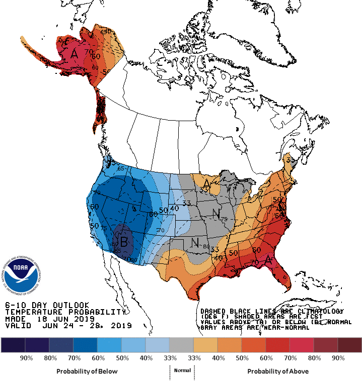
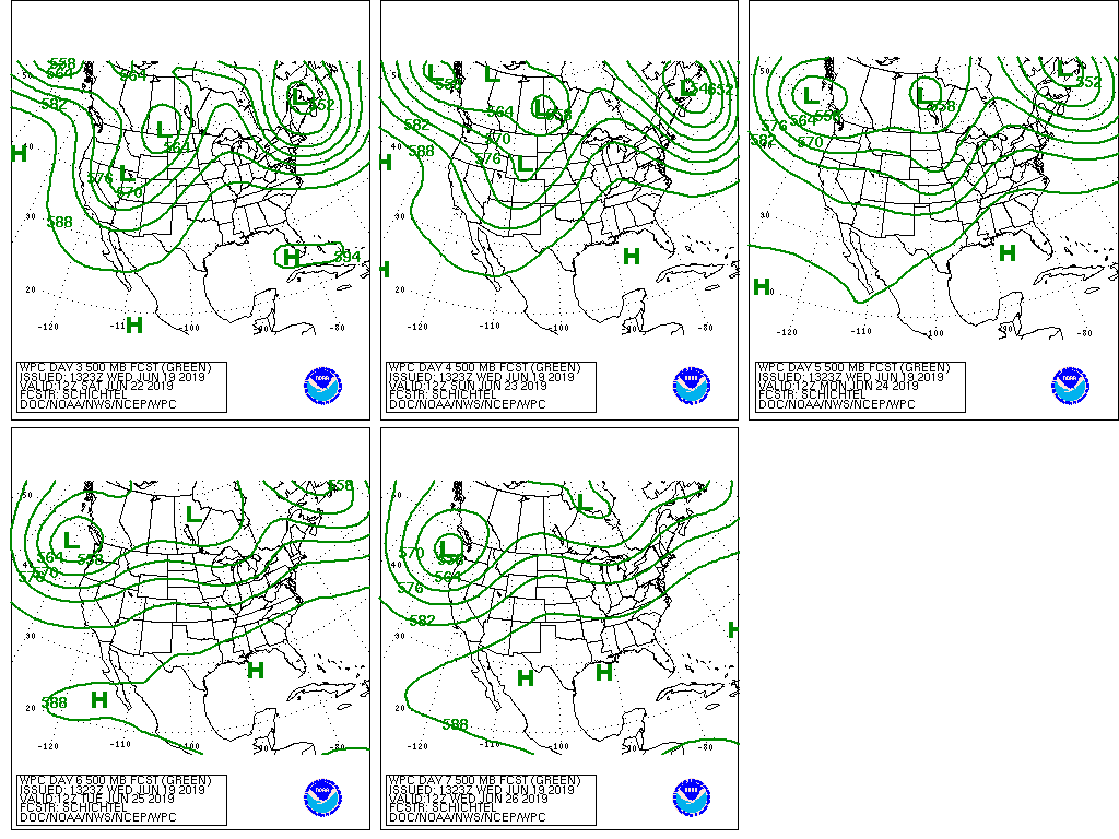
Looking ahead, the 6- to 10-day outlook calls for near- or above-normal temperatures across the eastern half of the U.S., while cooler-than-normal conditions will prevail in the West.
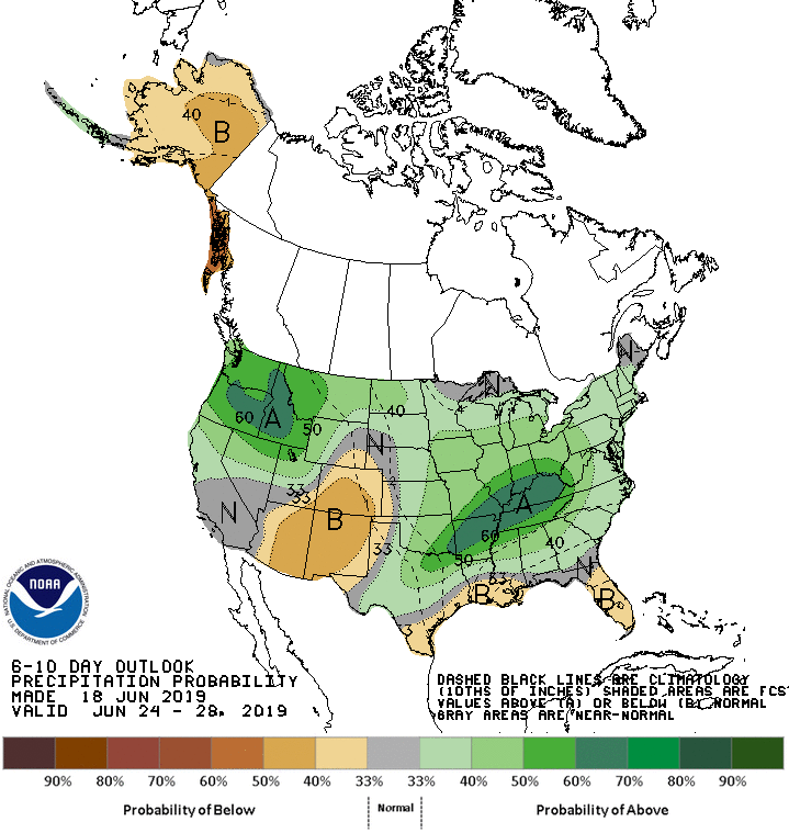
Meanwhile, near- or above-normal rainfall across most of the country will contrast with drier-than-normal weather in the central and southern Rockies and along the Gulf Coast.
Add Comment