Post
Little change; excessively wet pattern continues
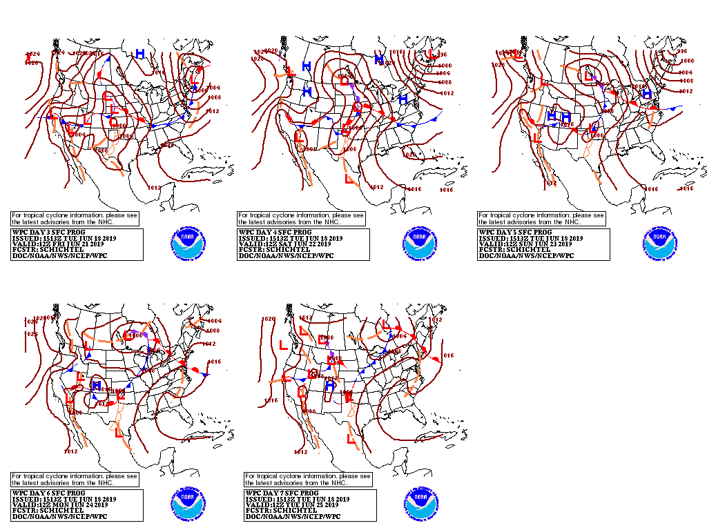
A procession of storms will maintain showery conditions during the next several days from the Plains to the middle and northern Atlantic States.
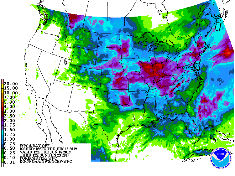
Five-day rainfall totals could reach 1 to 3 inches or more across this entire area, with some of the highest totals expected across the eastern Corn Belt. Only a few areas, including the upper Great Lakes region, the western Gulf Coast region, and portions of the southern Atlantic States, will escape the heavy rain.
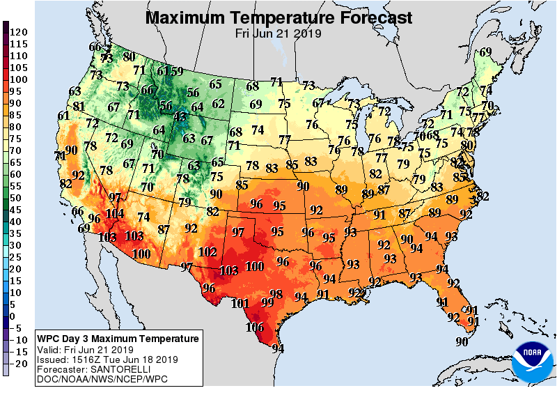
As the week progresses, heat and humidity will further build across the South, while cooler-than-normal conditions will cover much of the North. After mid-week, a fairly strong surge of cool air will engulf the Northwest and later spread across the Plains and Southwest.
Elsewhere, mostly dry weather will prevail during the next 5 days in the Far West.
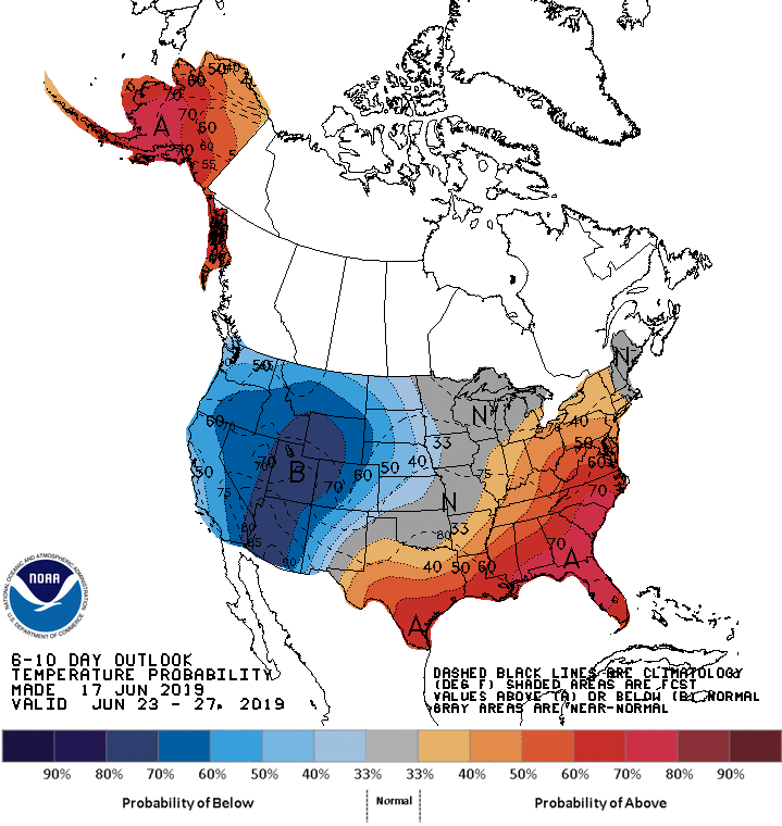
Looking ahead, the 6- to 10-day outlook for calls for the likelihood of below-normal temperatures across the northern and central Plains and the West, while hotter-than-normal conditions will prevail in the South and East.
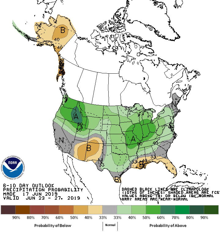
Meanwhile, near- or above-normal rainfall across most of the country will contrast with drier-than-normal weather in the Southwest and much of the Gulf Coast region.
Add Comment