Weather
Wet, stormy pattern to prevail across the Heartland
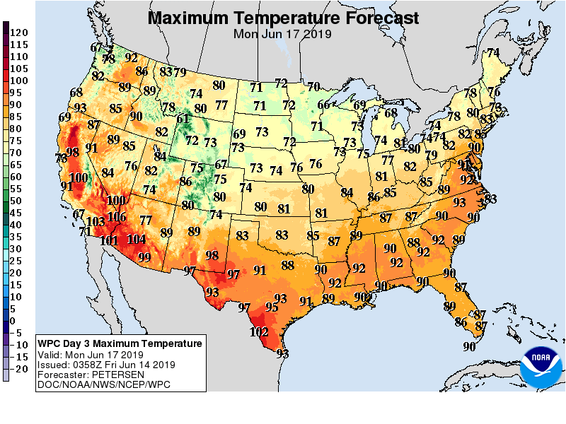
Cool weather east of the Rockies will persist for the next several days across the Plains and Midwest, but near- or above-normal temperatures will return by week’s end across much of the South and East. Meanwhile, lingering heat in the West will be mostly confined to interior portions of the region, including the northern Great Basin.
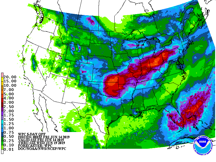
During the next 5 days, an axis of heavy rain—with widespread totals of 2 to 4 inches or more—will stretch from Kansas and Oklahoma into the northern Mid-Atlantic States and southern New England. Significant rain will also fall across Florida’s peninsula, but much of the remainder of the South, as well as the northern half of the Plains and the upper Midwest, will receive only light rain. Mostly dry weather will prevail west of the Rockies.
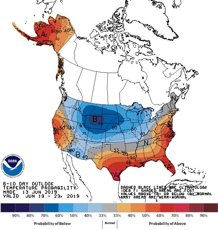
Looking ahead, the 6- to 10-day outlook calls for below-normal temperatures in the Midwest, as well as northern and central parts of the Rockies and Plains. Hotter-than-normal conditions will prevail, however, in California, the Gulf Coast region, and the middle and southern Atlantic States.
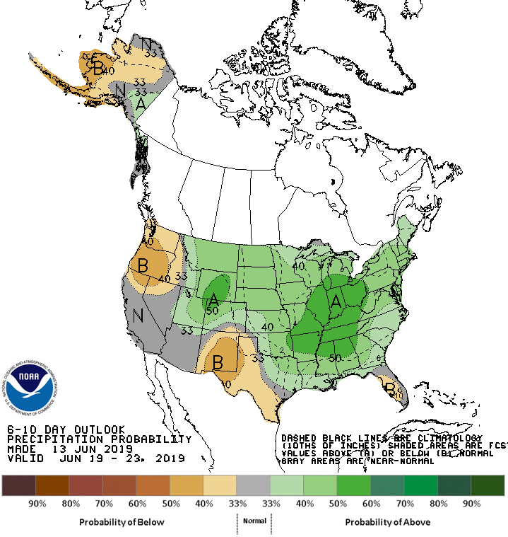
Meanwhile, wetter-than-normal weather across most of the country will contrast with below-normal rainfall in the Pacific Northwest, parts of Florida’s peninsula, and southern sections of the Rockies and High Plains.
Add Comment