Weather
Pattern to remain wet, active over much of the Heartland
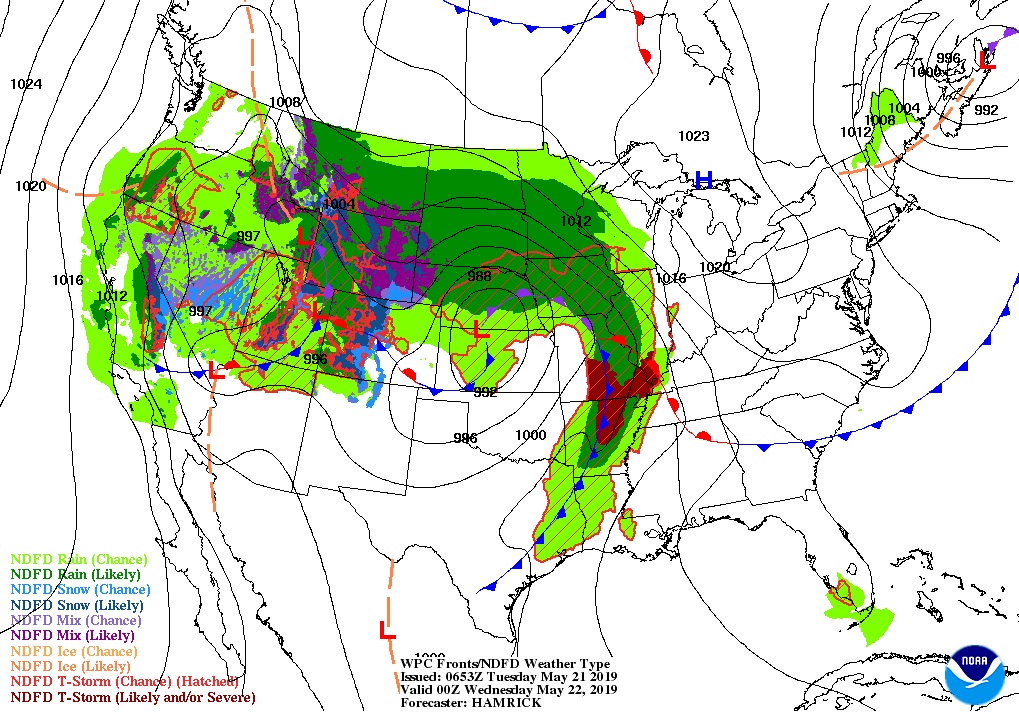
A powerful storm over the central and southern Plains will drift northeastward and slowly weaken, reaching the upper Great Lakes region by Thursday. Subsequently, additional storms will cross the western and central U.S., maintaining showery conditions.
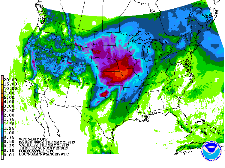
Five-day rainfall totals should reach 2 to 5 inches or more across large sections of the Plains and western Corn Belt, leading to flood concerns and further planting delays.
Lighter rain (locally an inch or more) will fall from the eastern Corn Belt into the Northeast, while warm, mostly dry weather will prevail in the Southeast. Elsewhere, cool, showery conditions will persist in much of the western U.S.
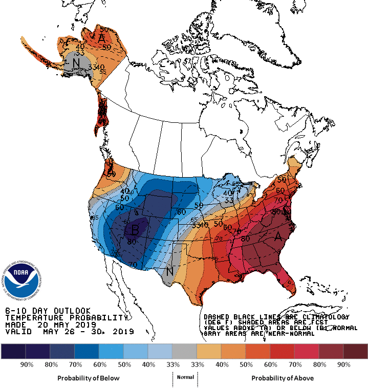
Looking ahead, the 6- to 10-day outlook calls for above-normal temperatures in the Pacific Northwest and from the southern Plains to the Atlantic Coast. Cooler-than-normal conditions will prevail in most areas along and west of a line from New Mexico to Upper Michigan.
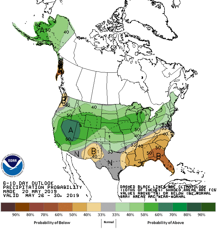
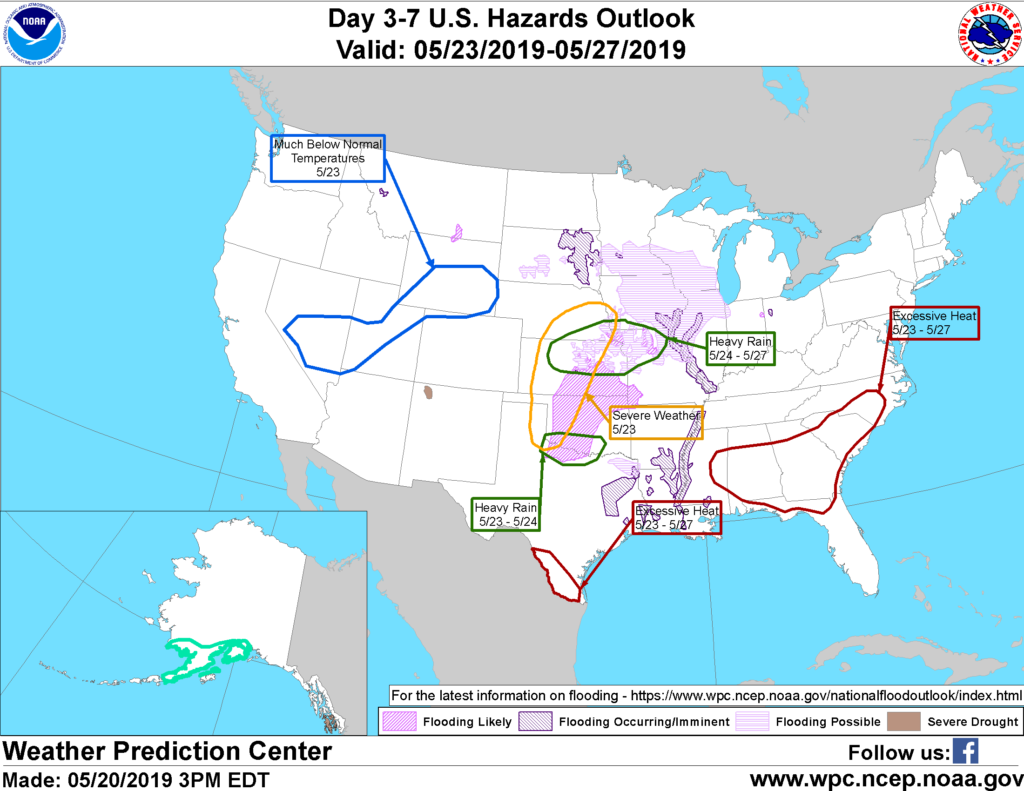
Meanwhile, wetter-than-normal weather across a broad area of the country will contrast with below-normal rainfall in the southern Rockies and the Southeast.
Add Comment