Weather
Storms across much of the Heartland; heat Southeast
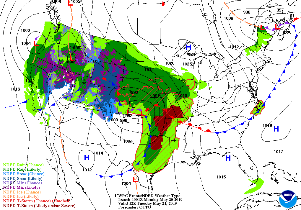
A storm system currently emerging from the Rockies will rapidly intensify later Monday and on Tuesday while crossing the central and southern Plains.
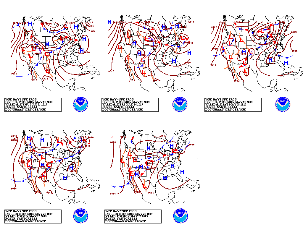
By mid-week, the storm will weaken while crossing the upper Midwest, while a new system will develop across the Intermountain West. Toward week’s end, the latter storm will also traverse the Plains, while the initial low-pressure system will turn eastward and affect the Northeast.
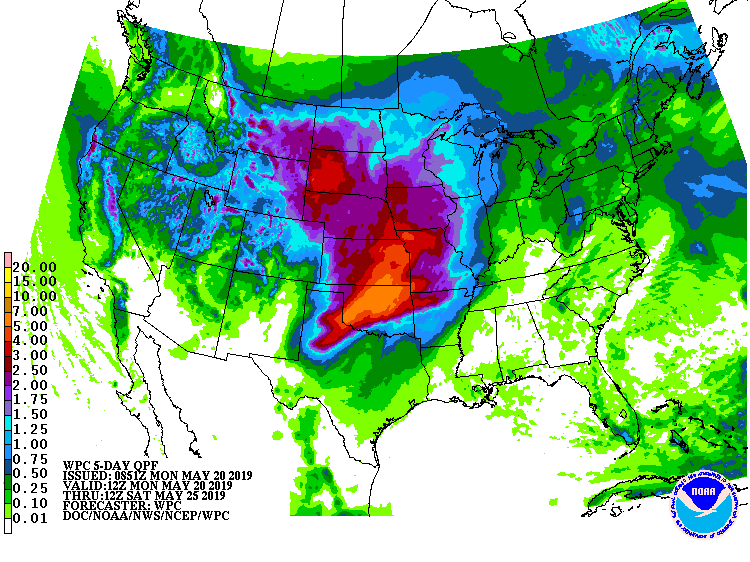
Five-day rainfall totals should reach 2 to 5 inches or more across large portions of the Plains and western Corn Belt, leading to the likelihood of renewed or expanded flooding.
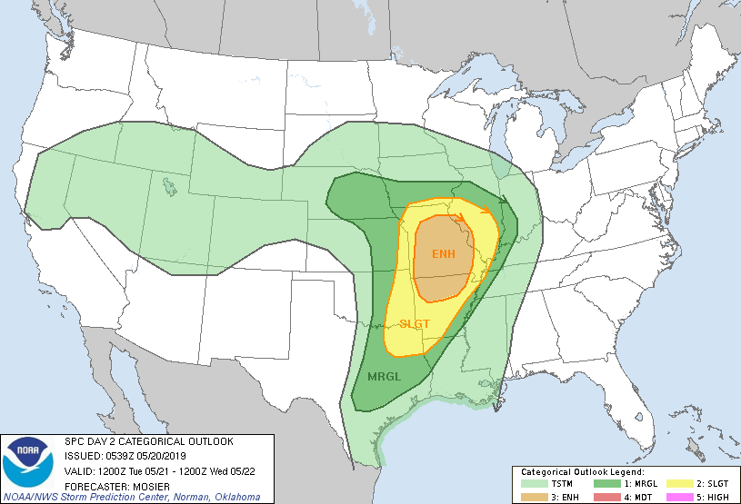
In addition, locally severe thunderstorms will sweep eastward from the southern Plains, starting Monday..
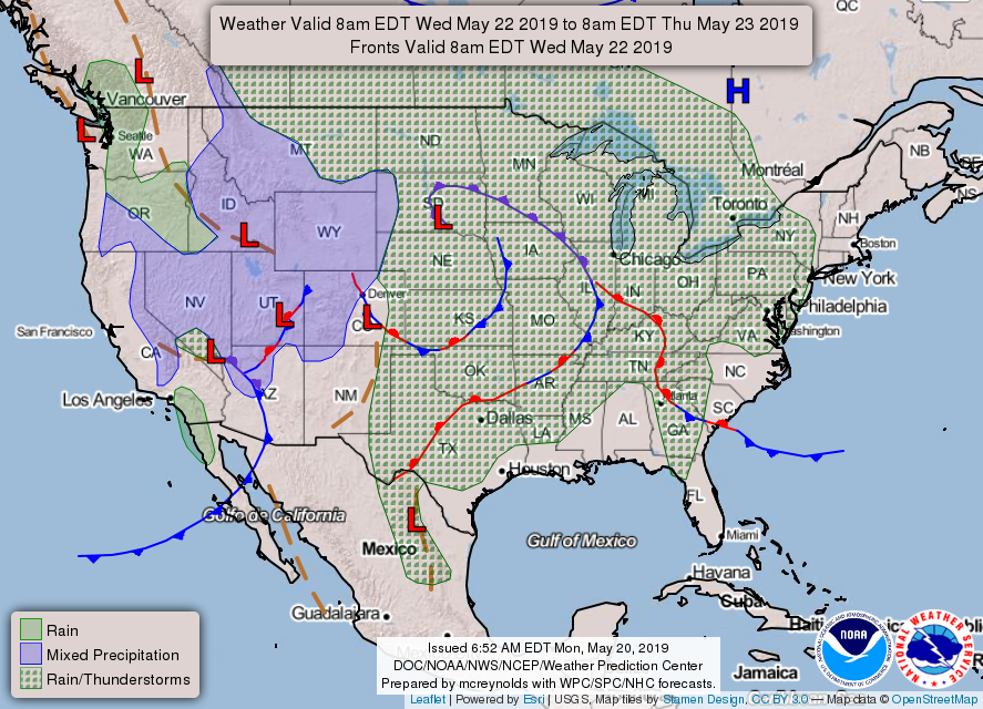
Finally, late-season snow will blanket the Rockies and environs during the next several days.
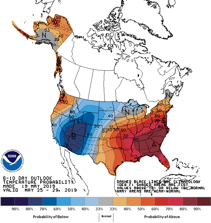
Looking ahead, the 6- to 10-day outlook calls for the likelihood of above-normal temperatures in the Pacific Northwest and from the central and southern Plains to the East Coast. Cooler-than-normal conditions will cover most areas along and west of a line from New Mexico to Minnesota.
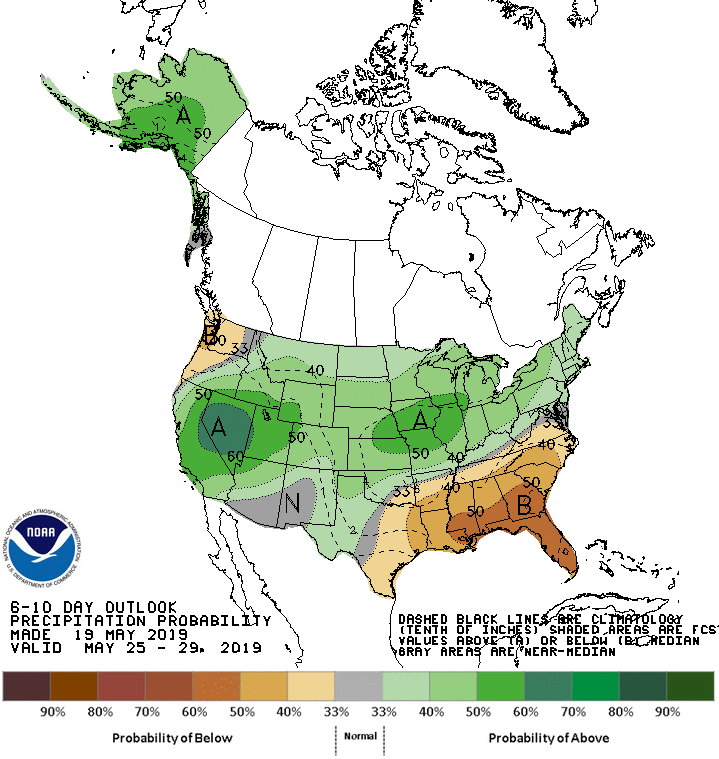
Meanwhile, below-normal precipitation in the South and Pacific Northwest will contrast will wetter-than-normal weather across the remainder of the country, including a broad area stretching from California to the Plains and Midwest.
Add Comment