Weather
A pattern change ahead for parts of the Heartland
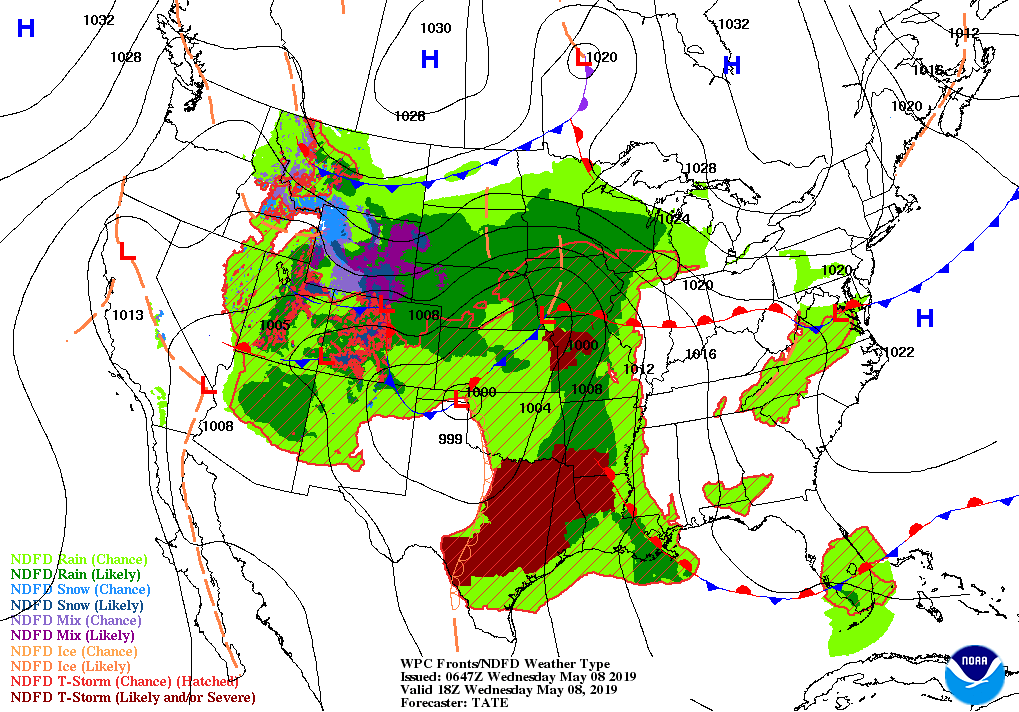
A storm system currently centered over the southern half of the Plains will drift northeastward, reaching the Great Lakes region by late Thursday and eastern Canada by week’s end. Snow in the central Rockies will gradually diminish, while mid- to late-week rain will fall in most areas east of the Rockies.
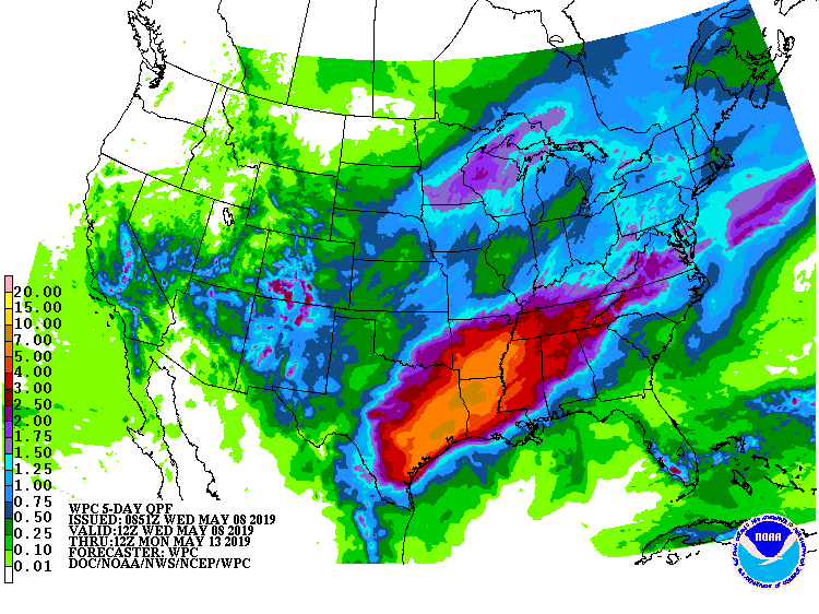
Storm-total rainfall could reach 4 to 8 inches or more and trigger widespread flooding from eastern Texas to the lower Mississippi Valley.
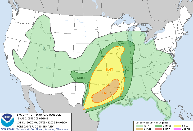
In addition, the storm’s trailing cold front will help to spark a multi-day severe weather outbreak through Thursday across the South and lower Midwest.
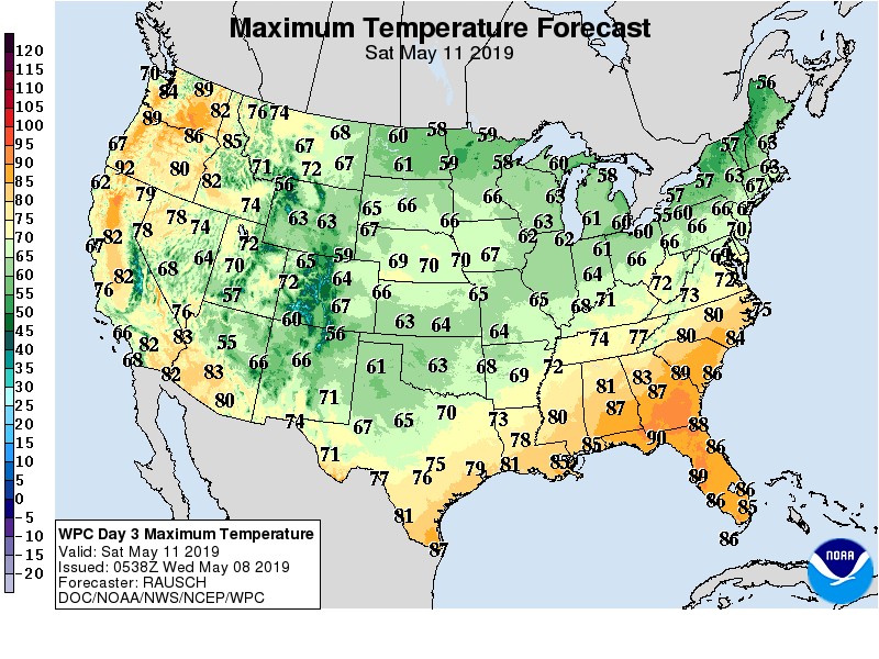
Although much of the country will experience near- or below-normal temperatures during the next several days, an early-season warm spell from the Pacific Northwest to the northern High Plains will melt high-elevation snowpack.
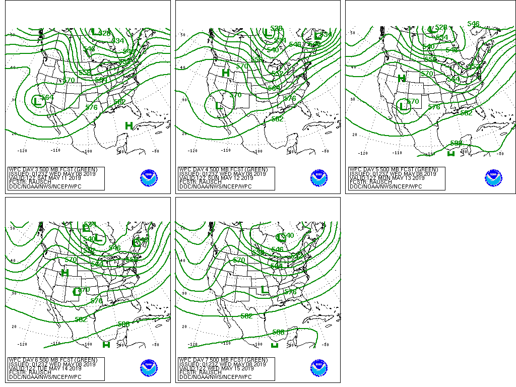
Elsewhere, a late-week disturbance will result in some out-of-season precipitation in central and southern California and the Desert Southwest.
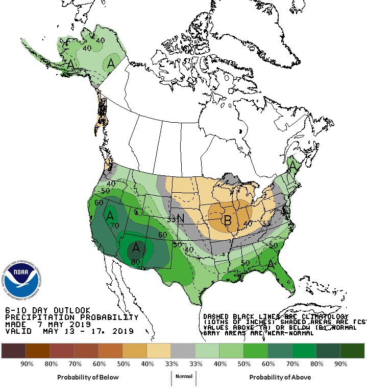
Looking ahead, the 6- to 10-day outlook calls for the likelihood of below-normal rainfall in the Midwest, while wetter-than-normal weather across much of the West, South, and New England.
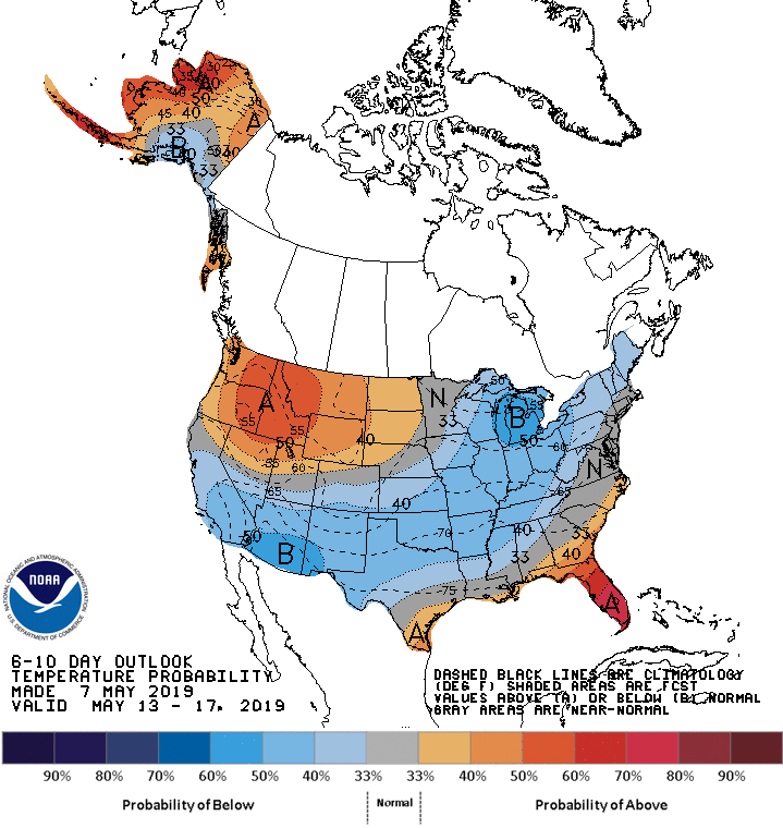
Meanwhile, above-normal temperatures across the lower Southeast and from the Pacific Northwest to the northern High Plains will contrast with cooler-than-normal conditions in southern California, the Southwest, the central and southern Plains, the Midwest, and the mid-South.
Add Comment