Weather
Warmer; wet pattern centered on the Plains
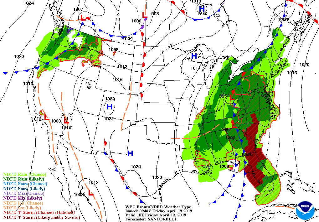
A storm over the Tennessee Valley will drift northeastward and stall, while an accompanying cold front taps into tropical moisture as it sweeps across the East Coast States.
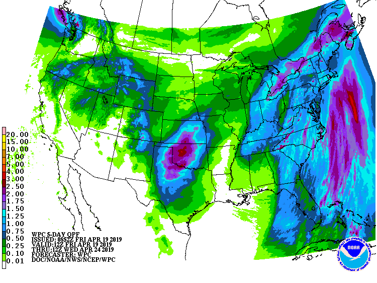
The net result will be a wide swath of 1 to 2 inches of rain (locally more) across the eastern third of the nation over the next three days, with the primary low taking the better part of the upcoming weekend to exit the Atlantic Coast
Meanwhile, dry, increasingly warm weather will prevail from the Midwest to the southern Plains. Conversely, a frontal system will move slowly south across the nation’s northwestern quadrant, producing rain and mountain snow from the Northwest into northern and central portions of the Rockies and High Plains.
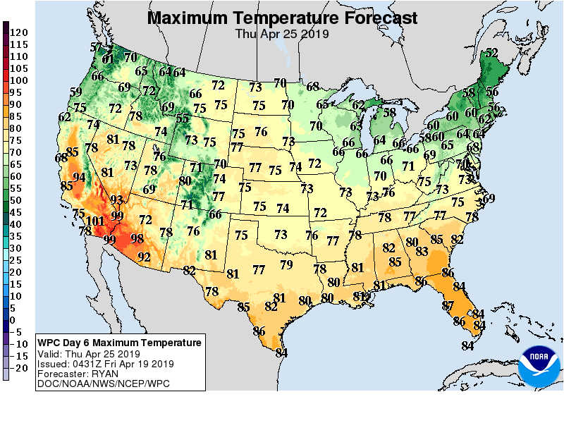
For the remainder of the western U.S., a cool start to the weekend will be followed by building heat early next week.
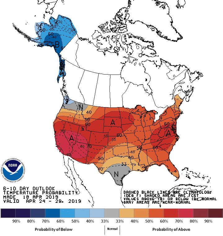
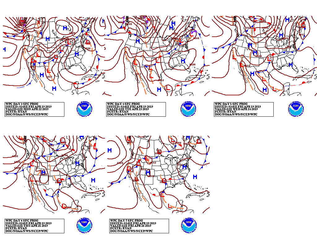
Looking ahead, the 6- to 10-day outlook calls for warmer- and wetter-than-normal weather across most of the country,
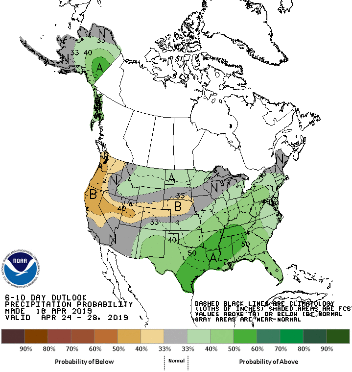
Drier-than-normal conditions will be confined to the Pacific Coast States and from the Great Basin to the central Plains.
Add Comment