Weather
Pattern to remain quite active across the Heartland

For the remainder of Friday, stormy, windy weather will linger across the Northeast, with snow accumulating in some inland areas. Meanwhile, rain showers will gradually overspread the central and southern Plains, including some of the flood-affected areas in Nebraska and adjacent states.
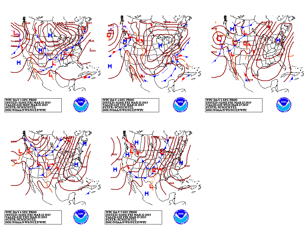
During the weekend, rain will continue to spread eastward, reaching the Atlantic Coast early next week.
Cold air will trail the precipitation across the Midwest and East, as a strong high-pressure system settles across the regions.

Northwestern storminess will increase early next week, as Pacific weather systems begin to push inland.

Looking ahead, the 6- to 10-day outlook calls for the likelihood of near- or above-normal temperatures and precipitation across most of the country. Colder-than-normal conditions should be limited to the middle and southern Atlantic States and an area stretching from northern California to the northern Plains.
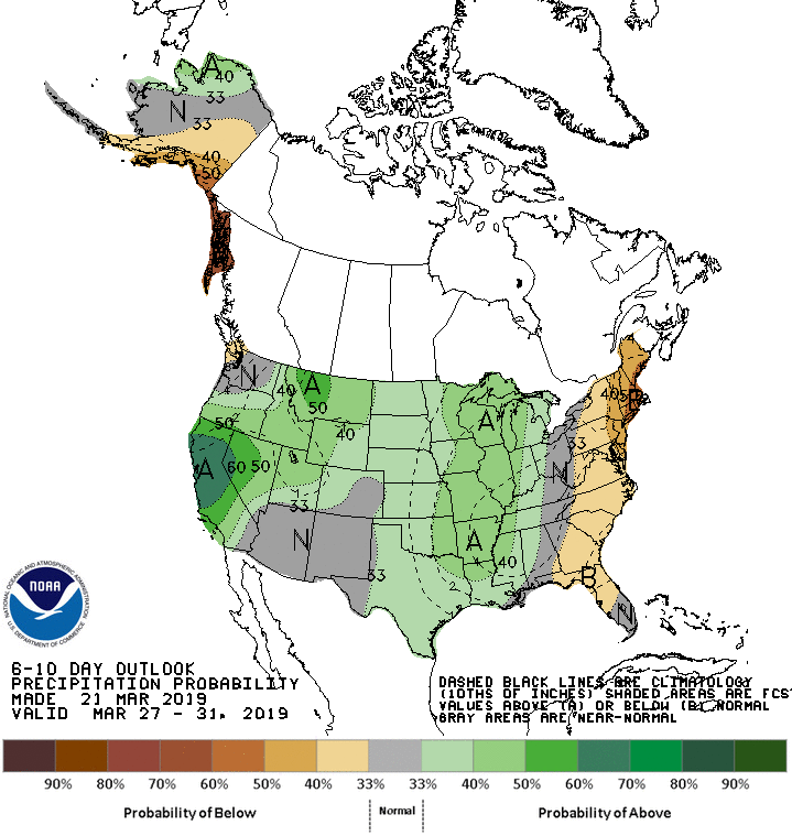
Meanwhile, drier-than-normal conditions will be confined to the East Coast.
Add Comment