Weather
Wet pattern on the Plains, across the Corn Belt
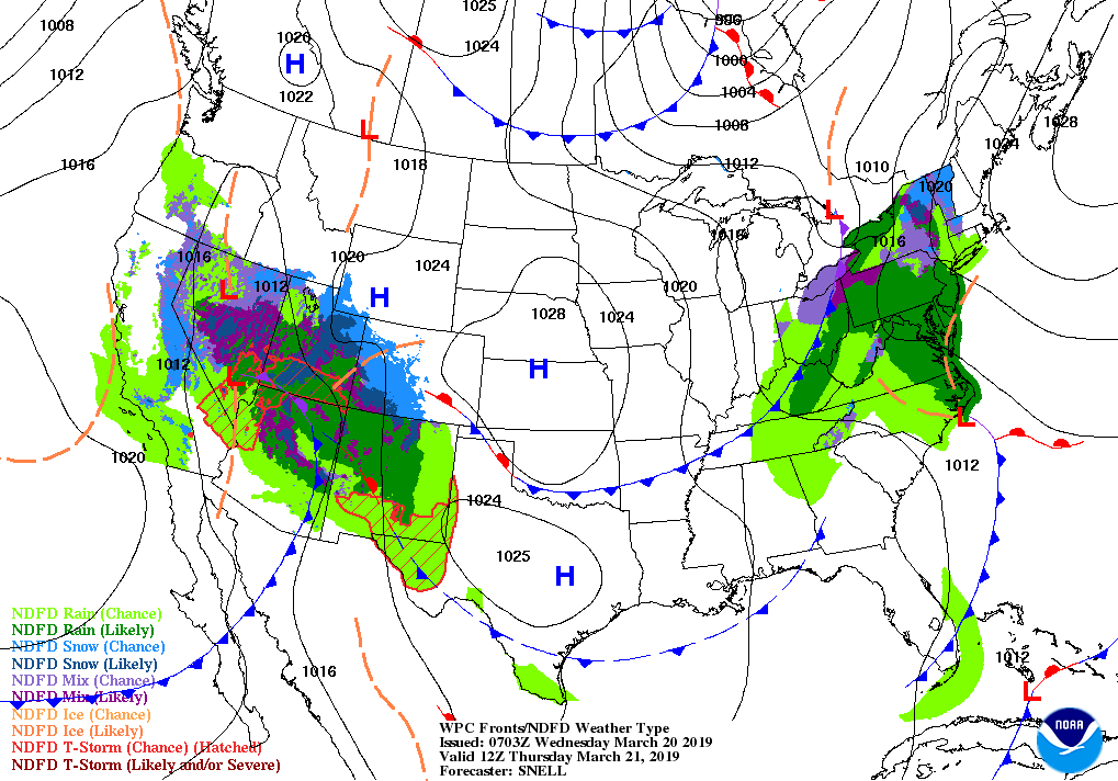
A developing storm system along the Atlantic Seaboard will result in heavy precipitation and high winds, starting on Thursday, in the middle and northern Atlantic States. Snow will accumulate across the northern Appalachians.
Meanwhile, a weather system currently arriving in California will drift eastward, reaching the Plains by week’s end.
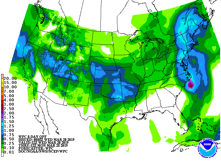
Five-day precipitation totals could locally exceed an inch along the storm’s path, primarily from northern and central California to the central and southern Plains.
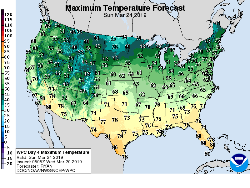
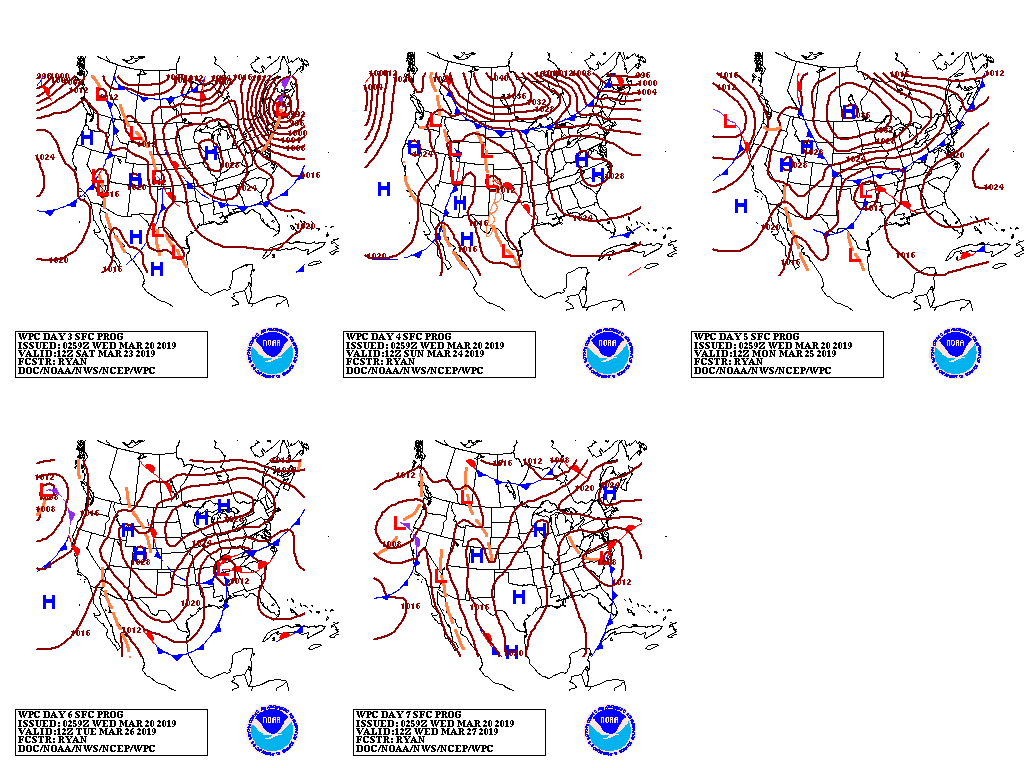
By early next week, a brief warm spell across the North will end amid a surge of colder air.
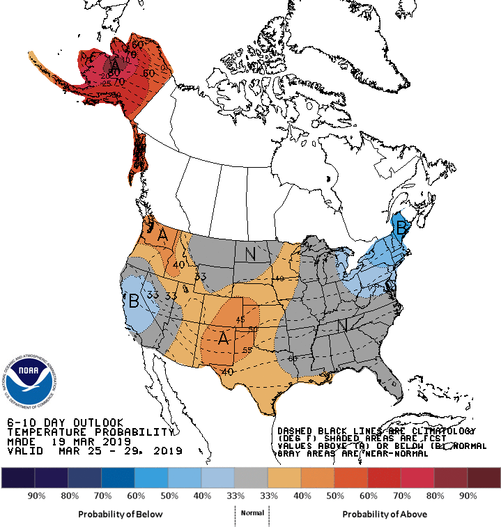
Looking ahead, the 6- to 10-day outlook calls for near- or above-normal temperatures and precipitation across most of the country. Colder-than-normal conditions should be limited to northern and central California, the western Great Basin, and from the lower Great Lakes region into the Northeast.
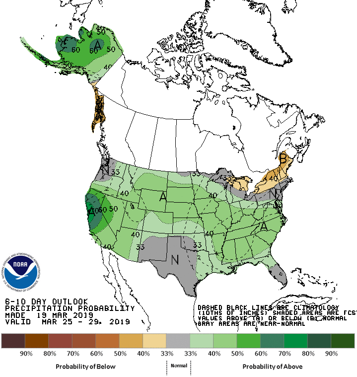
Meanwhile, while drier-than-normal weather will be confined to the nation’s northern tier from Lake Huron to northern New England.
Add Comment