Weather
A milder, but wetter pattern for the Heartland
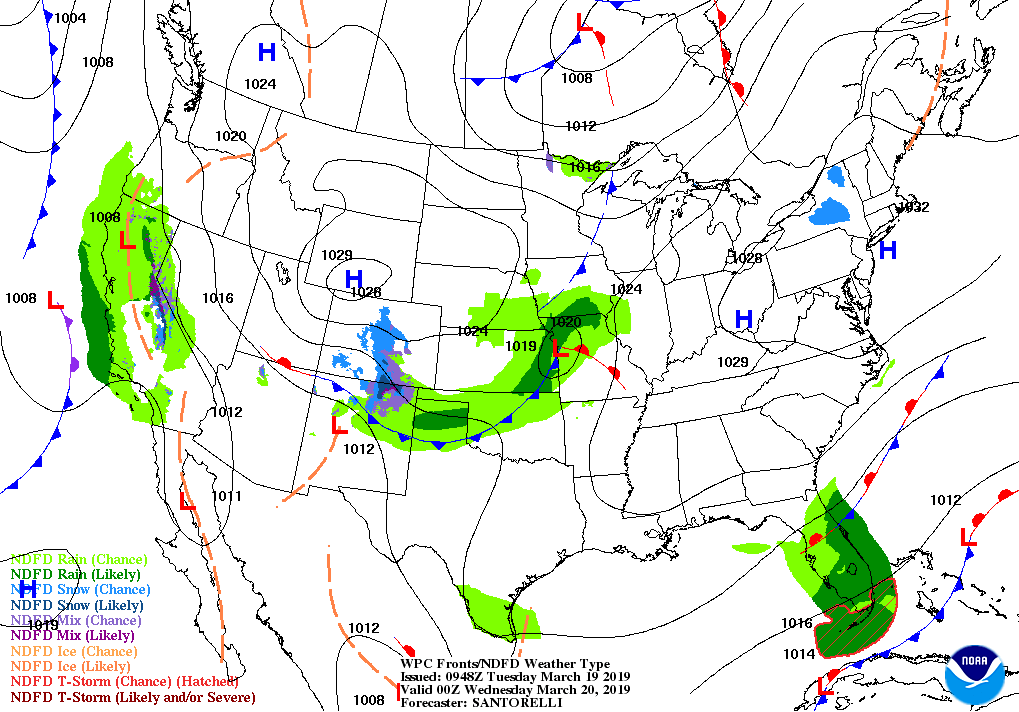
Aside from rain across Florida’s peninsula and light precipitation in the nation’s mid-section, a quiet weather pattern will prevail during the next couple of days.
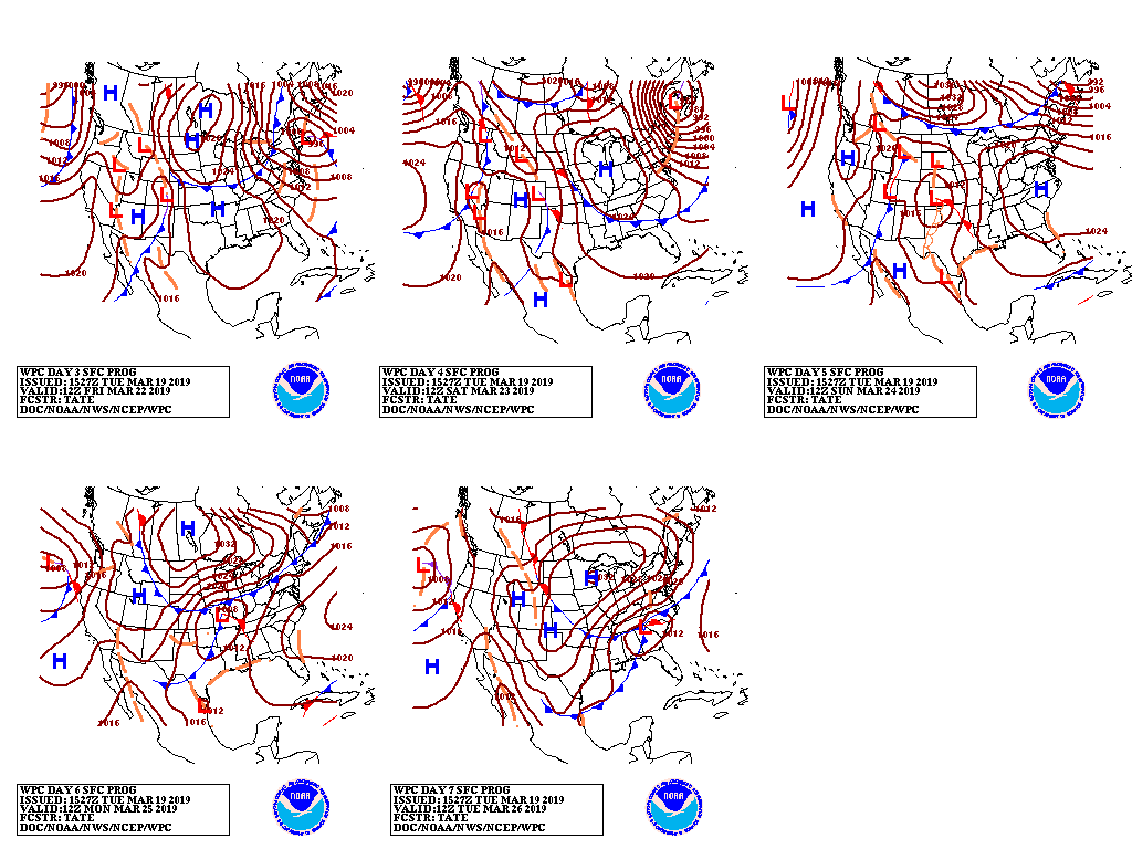
Late in the week, however, storms will develop on opposite sides of the country. Along the northern Atlantic Seaboard, a coastal storm will produce rain and wind, with some snow possible across the interior Northeast.

Meanwhile, precipitation (locally in excess of an inch) will spread from California to the southern High Plains, with snow expected from the Sierra Nevada to the southern half of the Rockies.
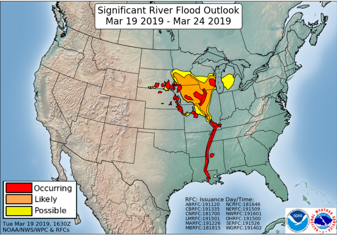
Mostly dry weather will prevail across the northern Plains and the upper Midwest, although lowland flooding will develop as an extensive snow cover begins to melt.

Looking ahead, the 6- to 10-day outlook calls for near- or above-normal temperatures and precipitation nearly nationwide.

Warm weather will be most likely in the Southeast, while drier-than-normal conditions should be limited to the Pacific Northwest.
Add Comment