Weather
A drier, tranquil weather pattern in the days to come
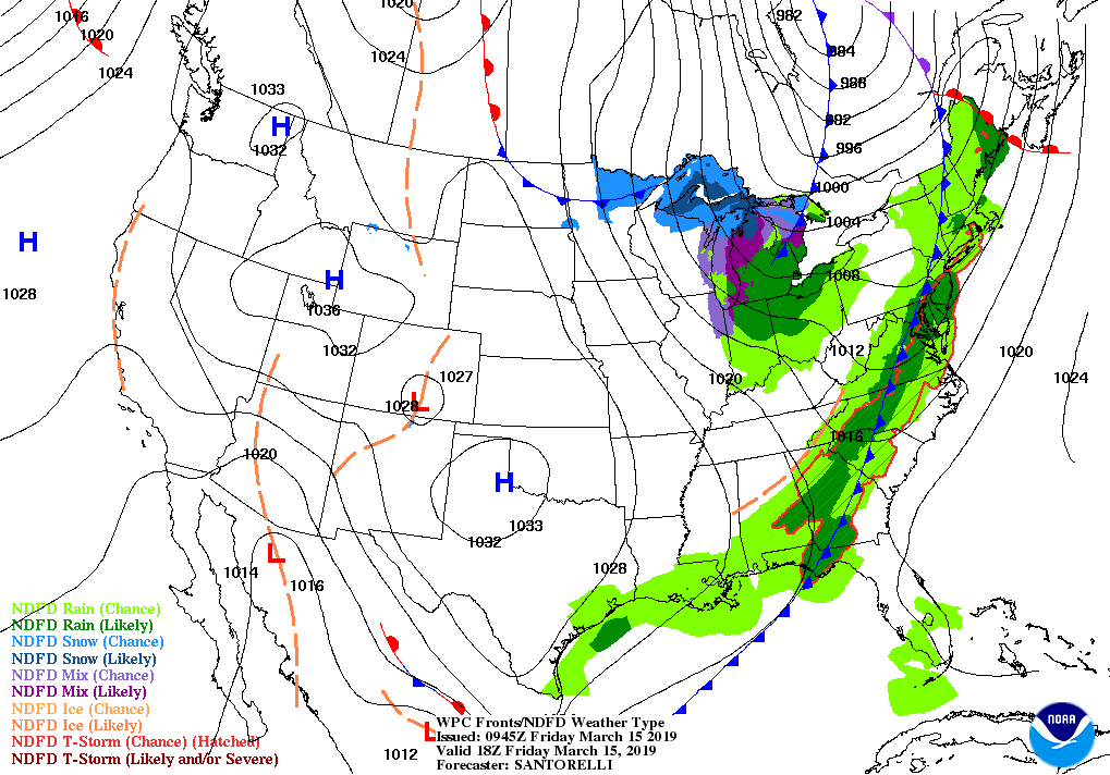
The recent powerful storm’s trailing cold front will cross the Atlantic Seaboard later Friday, leaving cool, dry air in place across much of the country.
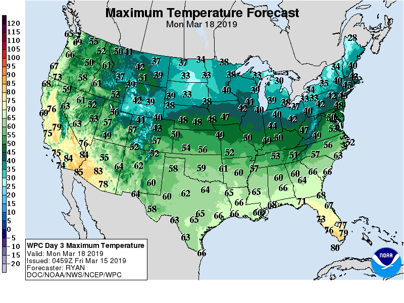
However, a Western warming trend will commence during the weekend, with above-normal temperatures overspreading the northern Plains early next week.
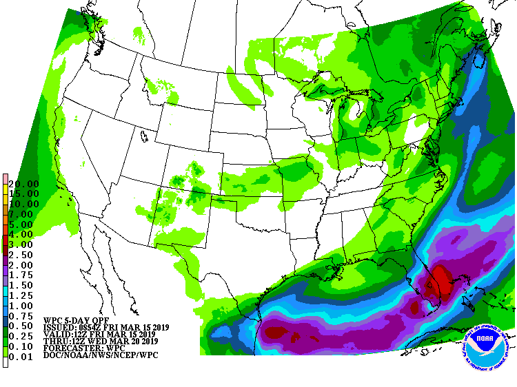
Little or no precipitation will fall during the next 5 days across the western two-thirds of the U.S., although significant river flooding will persist for several days in parts of the western and central Corn Belt. Most of the East will also experience mostly dry weather after Friday’s cold front passage, except for locally heavy showers across Florida’s peninsula.
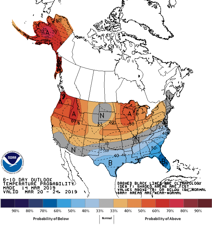
Looking ahead, the 6- to 10-day outlook calls for the likelihood of near- or above-normal temperatures nationwide, except for cooler-than-normal conditions from Texas to the southern Atlantic Coast.
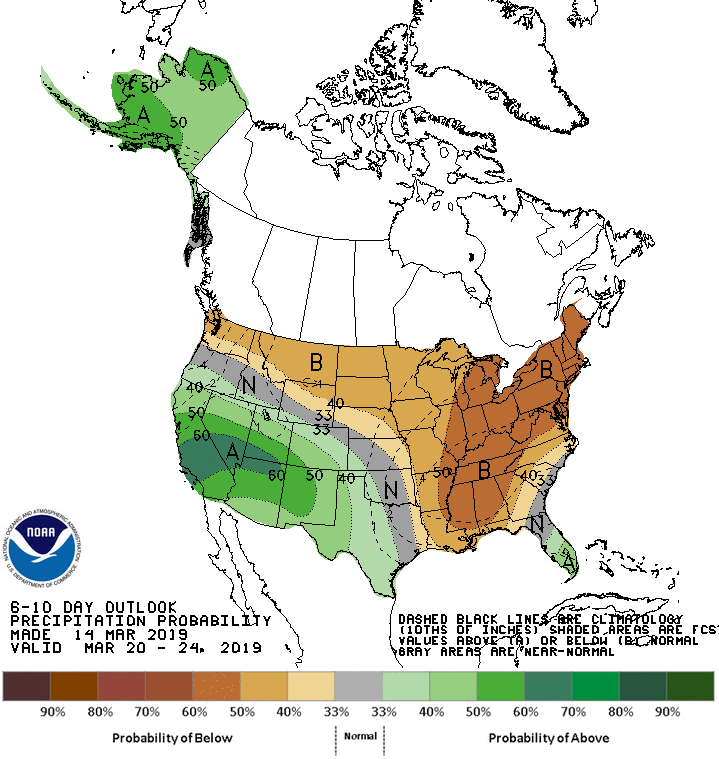
Meanwhile, below-normal precipitation across large sections of the northern and eastern U.S. should contrast with wetter-than-normal weather in southern Florida and from California to the southern High Plains.
Add Comment