Weather
Stormy pattern for much of the Heartland
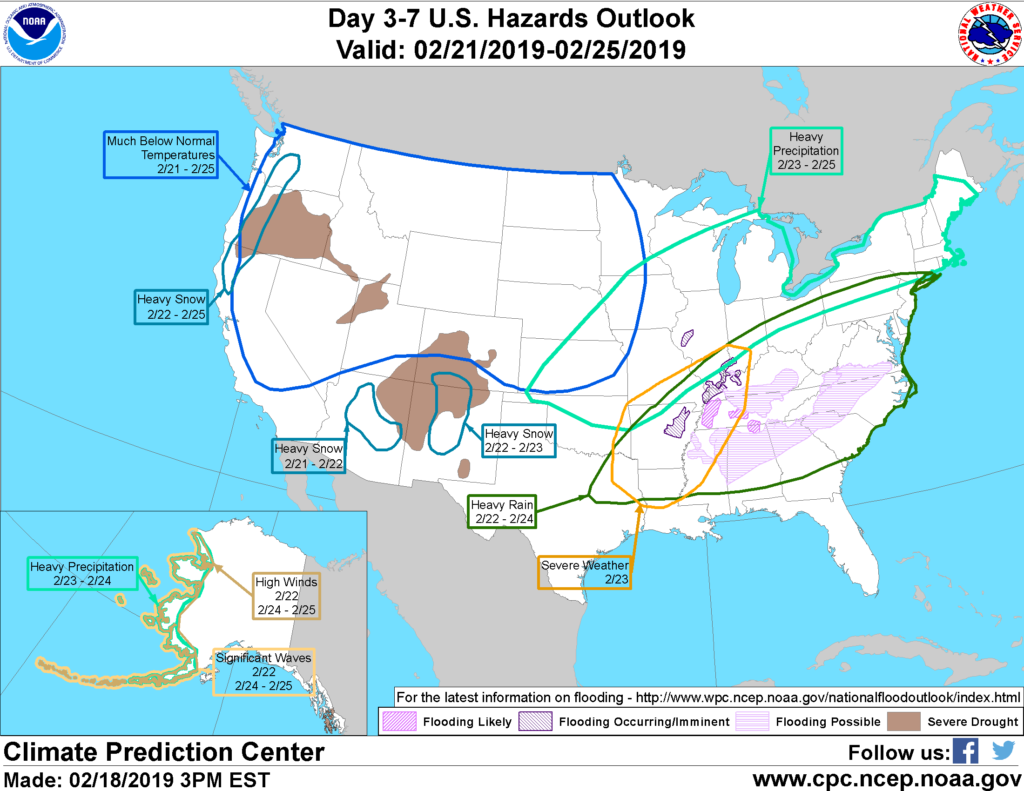
During the next 3 days, a complex and powerful storm system will emerge from the southern Rockies and move northeastward into the Great Lakes region. A large area from the southern Rockies into the upper Midwest will receive heavy snow, while portions of the middle and northern Atlantic States will have to contend with snow, sleet, and freezing rain.
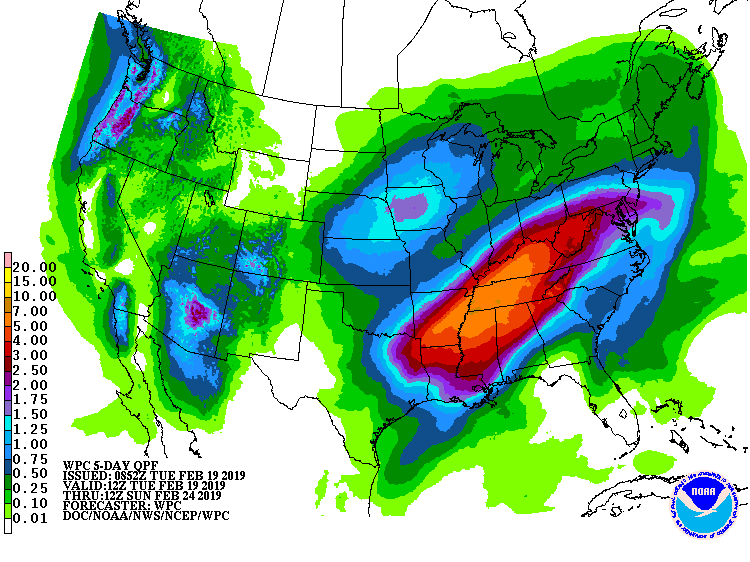
Meanwhile, storm-total rainfall will reach 2 to 5 inches or more from the northern Mississippi Delta into the Tennessee Valley, leading to the likelihood of flooding.
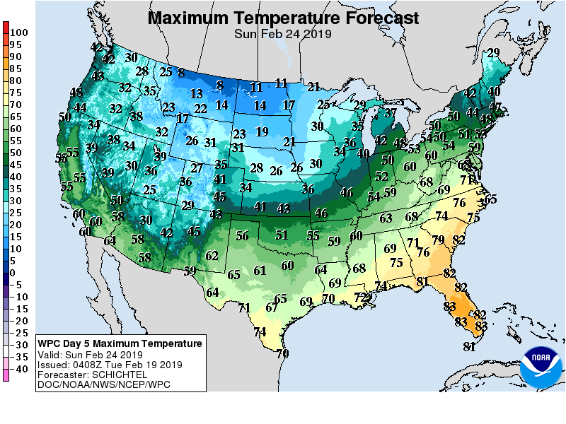
After the storm departs, most areas east of the Mississippi River will experience a few days with above-normal temperatures. Cold conditions will persist, however, across the western half of the U.S.
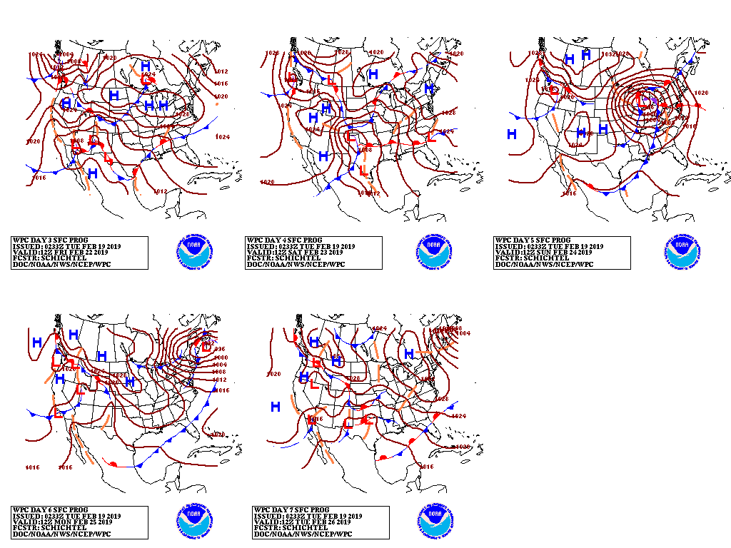
Meanwhile, periods of precipitation will accompany the Western chill.
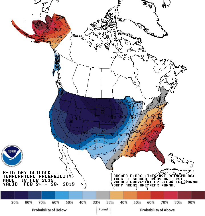
Looking ahead, the 6- to 10-day outlook calls for the likelihood of below-normal temperatures nationwide, except for warmer-than-normal weather in the Southeastern and Mid-Atlantic States.
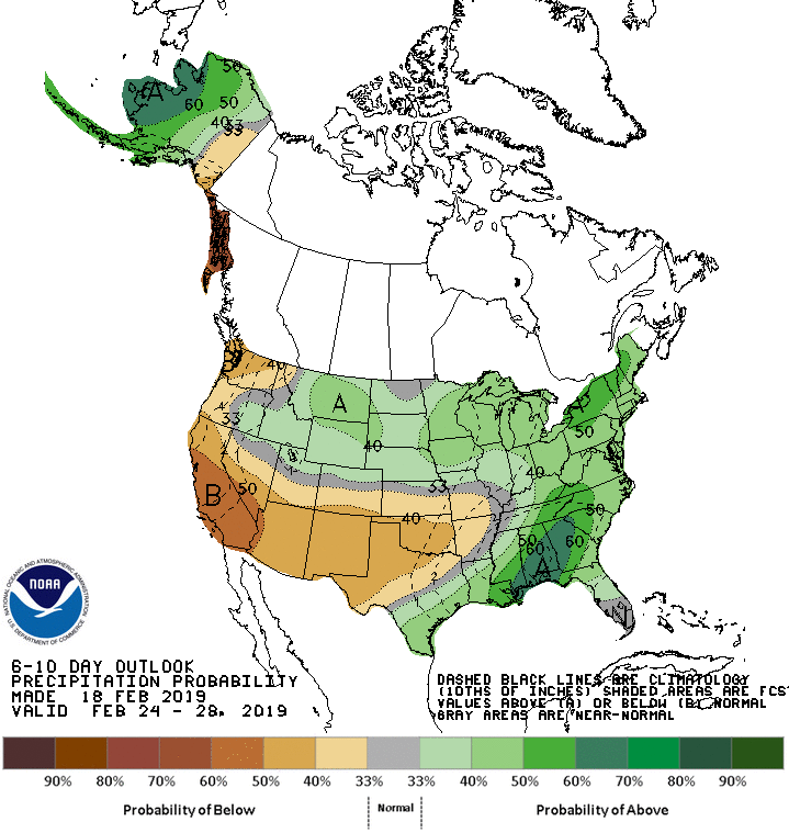
Meanwhile, below-normal precipitation along the Pacific Coast and from southern California to the southern Plains should contrast with wetter-than-normal conditions across much of the northern and eastern U.S.
Add Comment