Weather
A wet and active pattern ahead across the Heartland
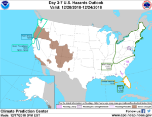 Periods of stormy weather will continue in the Northwest for the next several days. Many other areas of the country, including the Plains and the Southwest, will experience mild, dry weather for the remainder of the week.
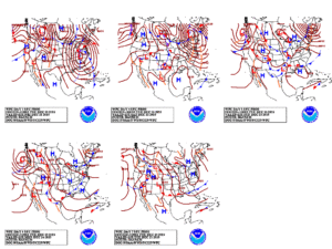 By Thursday, a storm system will begin to take shape across the mid-South and drift northward across the Ohio Valley and the lower Great Lakes region.
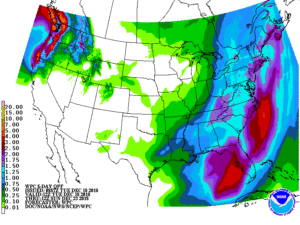 Most of the storm’s precipitation, locally 1 to 2 inches across the eastern one-third of the U.S., will fall as rain, although some wet snow could occur near the northern and western edge of the precipitation shield.
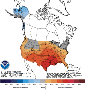 Looking ahead, the 6- to 10-day outlook calls for the likelihood of warmer-than-normal weather nationwide, except for near-normal temperatures across Florida’s peninsula.
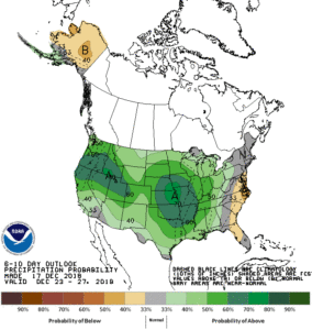 Meanwhile, drier-than-normal conditions in the middle and southern Atlantic States should contrast with near- or above-normal precipitation across the remainder of the country
Add Comment