Weather
Wintry pattern continues for now
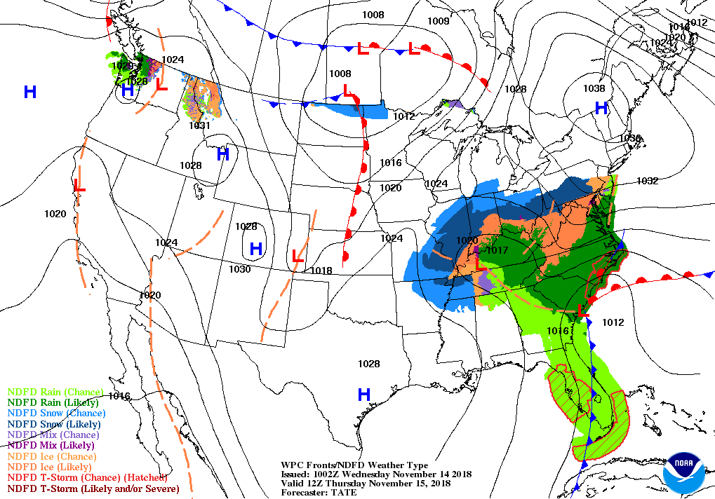 For the remainder of Wednesday, a winter-weather event will unfold across the mid-South and environs, while heavy rain will return to the Southeast.
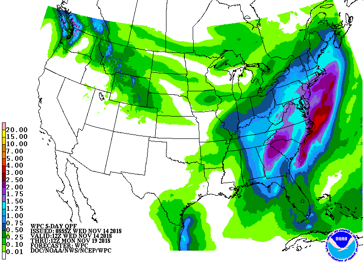 Through Friday, storm-total precipitation will reach 1 to 2 inches in much of the eastern U.S. For inland areas, including the central and northern Appalachians, wintry precipitation (snow, sleet, and freezing rain) could cause travel and electrical disruptions.
 Farther west, a warming trend across the nation’s mid-section will be replaced by cold conditions late in the week. Elsewhere, late-week snow will blanket the northern Rockies, while warm, dry weather will persist in the Far West.
 Looking ahead, the 6- to 10-day outlook calls for near- to below-normal temperatures nationwide, except for warmer-than-normal weather in southern Florida and west of the Rockies. Meanwhile, near- to above-normal precipitation from California to the southern Atlantic Coast will contrast with drier-than-normal conditions across the northern half of the U.S.
Add Comment