Weather
Weather favors Midwestern fall fieldwork, harvest
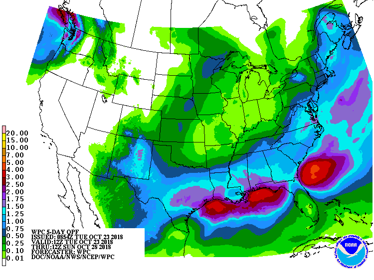 Eastern Pacific Hurricane Willa should reach the Mexican coast late Tuesday. A developing storm system in the southern U.S. will absorb deep tropical moisture associated with Willa’s remnants, resulting in heavy rain (1 to 3 inches or more) in the Gulf and Atlantic Coast States.
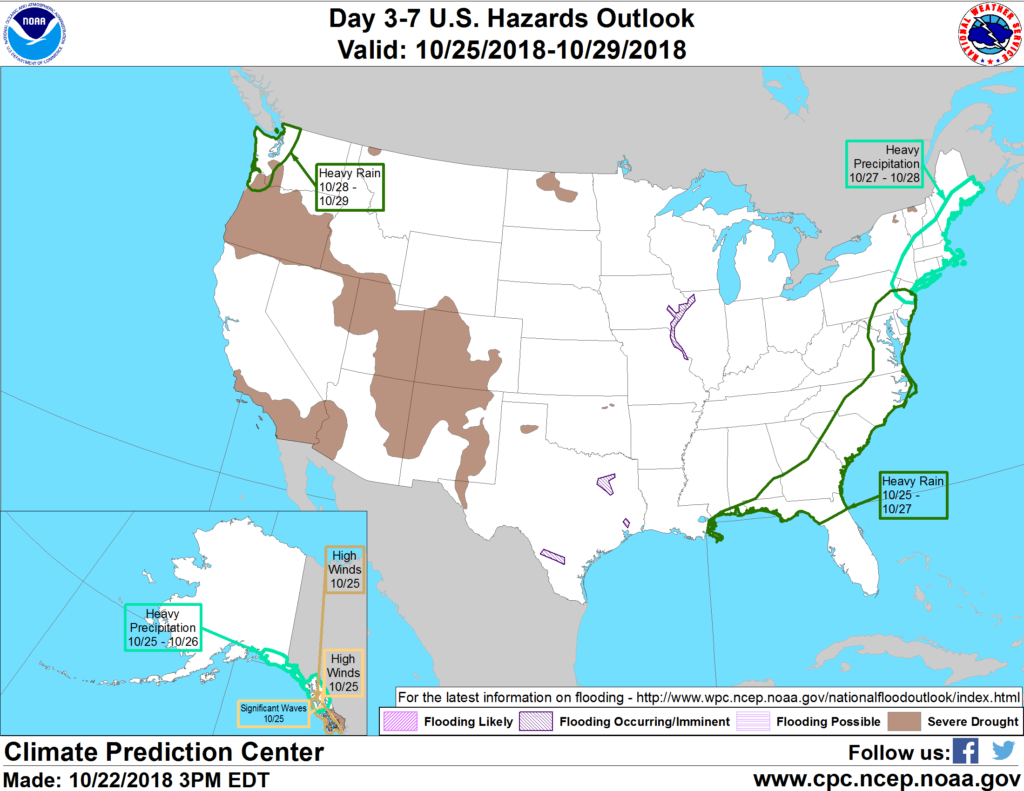
 During the weekend, a significant coastal storm (nor’easter) may hammer portions of the middle and northern Atlantic States with torrential rain, high winds, and heavy surf, while an early-season snowfall may occur in the northern Appalachians. Most of the remainder of the country will experience dry weather, although some light, mid- to late-week precipitation may occur from the central Plains into the upper Midwest and in the Pacific Northwest.
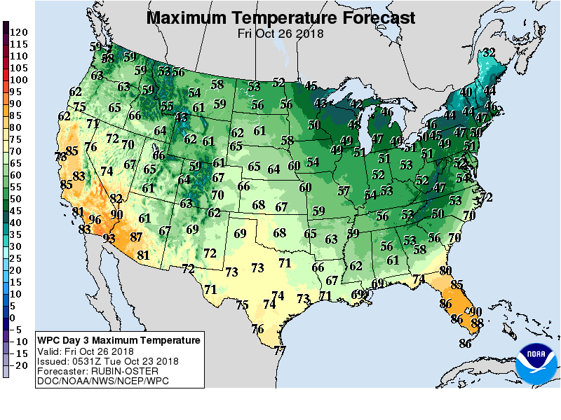 Late-season warmth in the West will gradually overspread the High Plains.
 Looking ahead, the 6- to 10-day outlook calls for near- to below-normal temperatures from the Plains to the East Coast, while warmer-than-normal weather will prevail in the West. Meanwhile, near- to above-normal precipitation across most of the country should contrast with drier-than-normal conditions in California and the Great Basin, as well as the Gulf Coast region.
Add Comment