Weather
A wet, active pattern continues across the Heartland
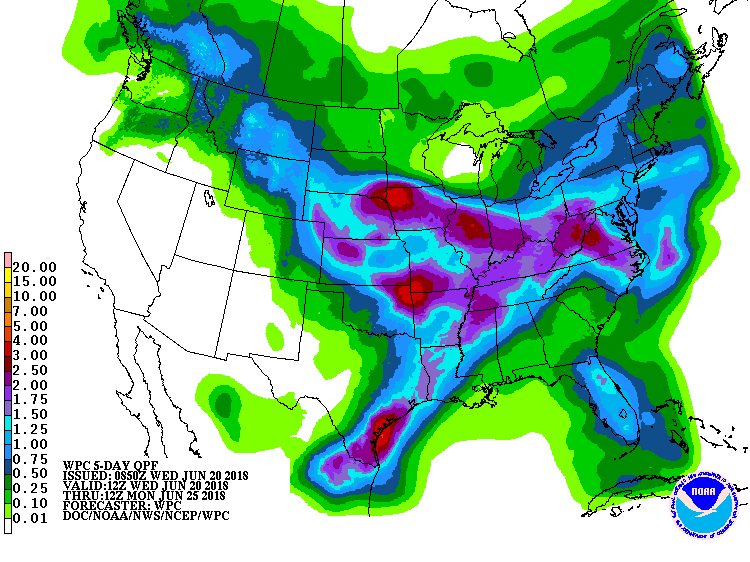 A wet pattern will prevail during the next few days along a west-to-east axis stretching from the central Plains into the Mid-Atlantic region.
 The heaviest rain will occur along a slow-moving cold front that will generally separate hot, humid weather across the South from cool, dry air across the nation’s northern tier. A low-pressure system migrating eastward along the front will further help to focus rainfall, which could total 2 to 4 inches or more from Nebraska to the central Appalachians. Meanwhile, showers will soon subside in the northern Rockies, but will return at week’s end. Elsewhere, dry weather in California and the Southwest will contrast with local downpours (2 to 8 inches or more) in the western Gulf Coast region.
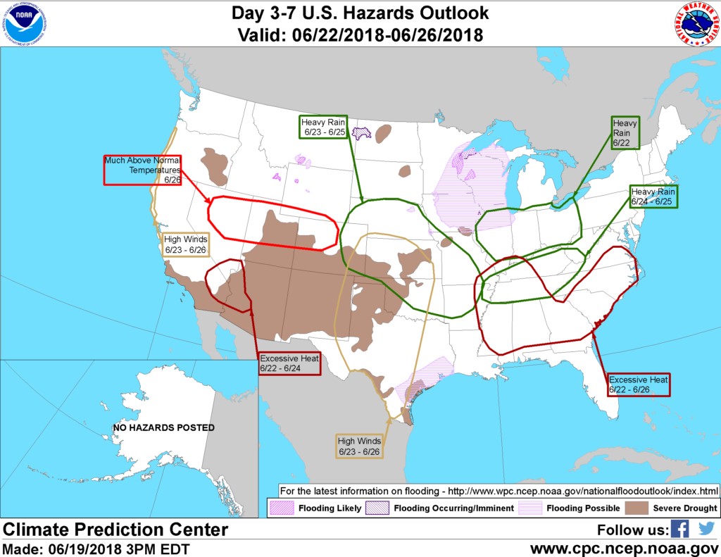 Looking ahead, the 6- to 10-day outlook calls for the likelihood of above-normal temperatures nearly nationwide. Meanwhile, wetter-than-normal weather from the central Plains into the Ohio Valley and much of the eastern U.S. should contrast with near- to below-normal rainfall in several areas, including the West, the northern Plains, the upper Midwest, and the western Gulf Coast region.
Add Comment