Up to a half-inch of rain fell overnight in west central Indiana, including Lafayette and the Haute. Amounts were a quarter-inch or less farther east, including Indy and Muncie. A big ol’ storm system is moving up slowly from the west.
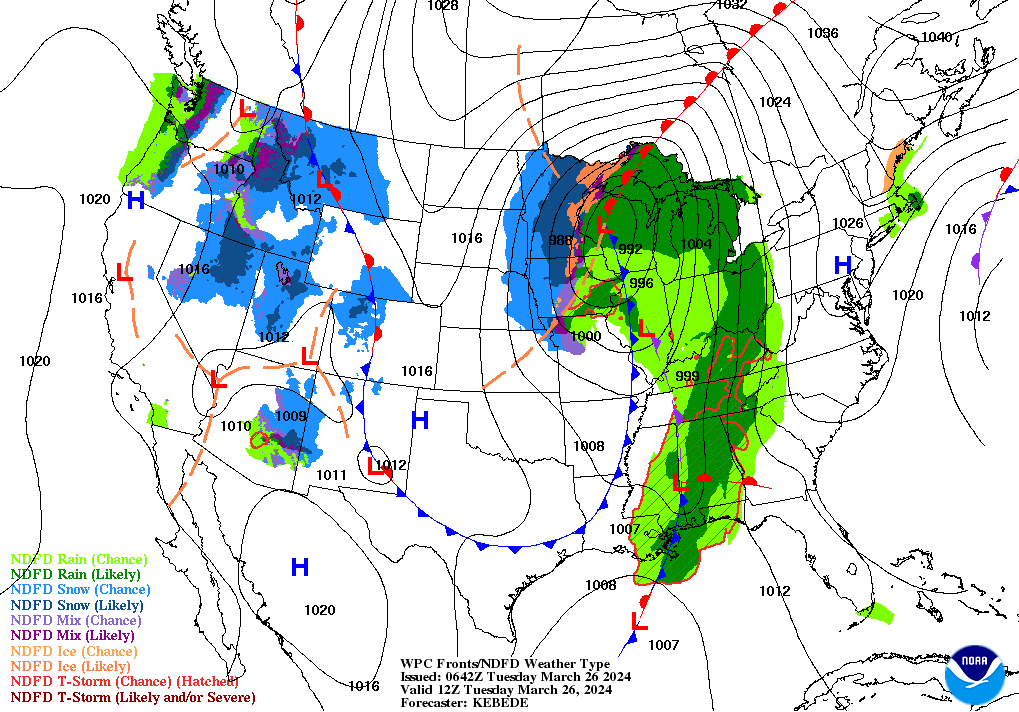
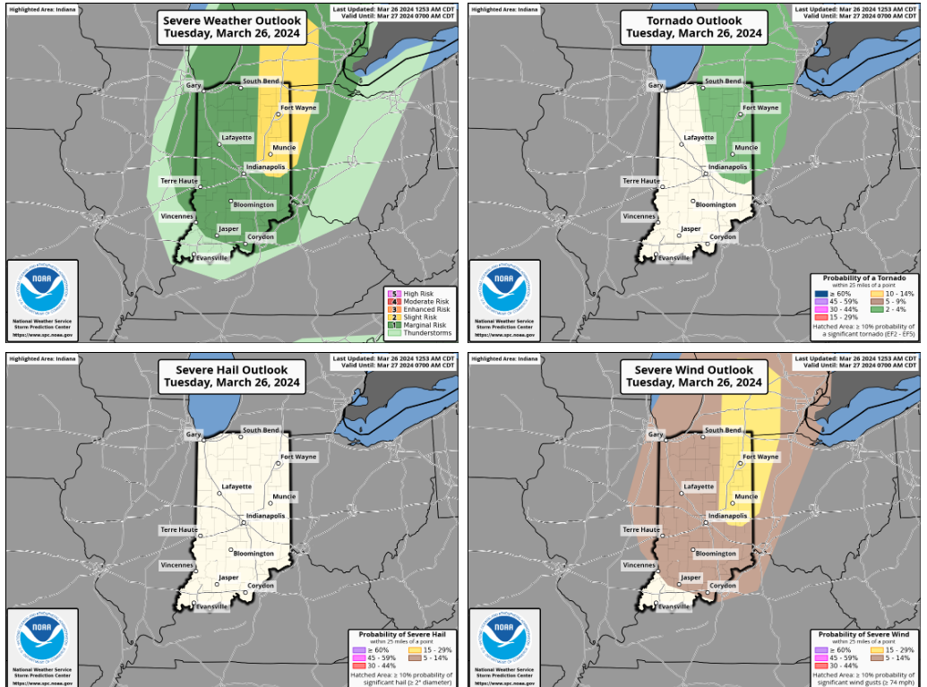
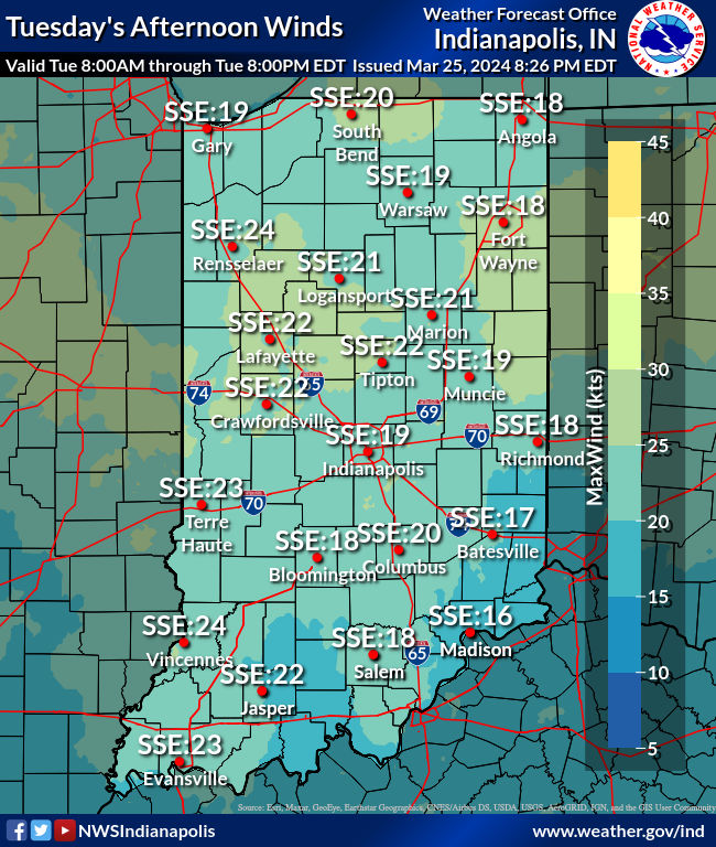
A wind advisory is in effect through 6pm today for the potential of wind gusts around 45-50 mph at times. The cold front will move through during the afternoon (late morning and afternoon in the western third of the state) supporting the potential for additional precipitation. Breaks in the clouds and warm air advection should allow temperatures to warm into the 60s promoting weak destabilization ahead of the front. Expect showers and some thunderstorms.
While instability will be weak, the NWS notes that strong low to mid level flow and steep low-level lapse rates could support isolated damaging wind gusts. In addition, there is a low chance for an isolated tornado with effective bulk shear around 30-40 kts and low-level veering hodographs. Confidence in the tornado threat is fairly low considering the weak instability which will tend to limit the potential for more organized rotating updrafts. In addition, directional shear in the lowest 0-1 km layer is modest.
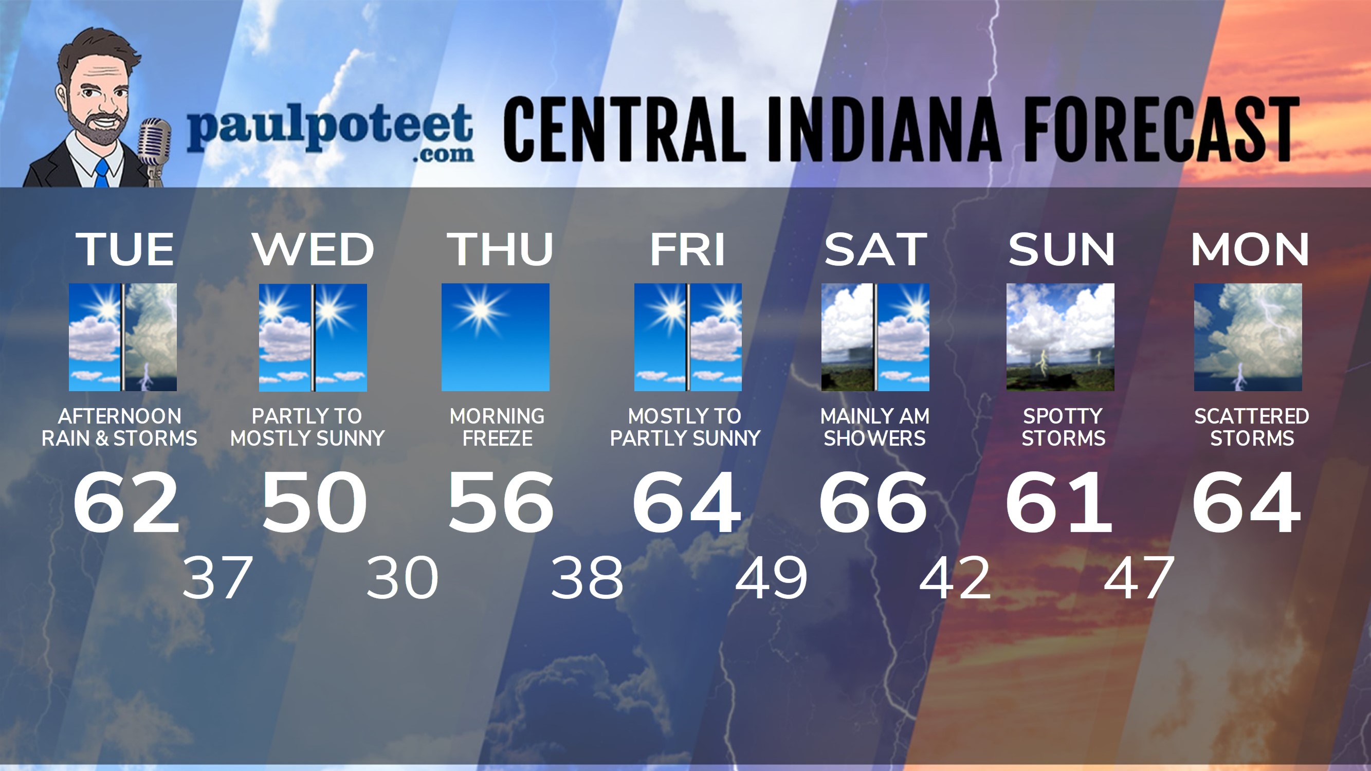
Quiet conditions are expected tonight, and for the rest of the work week. There could be patchy drizzle overnight. Easter Weekend looks mild, but there are daily rain and storms chances for now.
INDY SEVEN DAY FORECAST
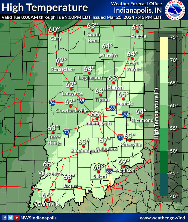
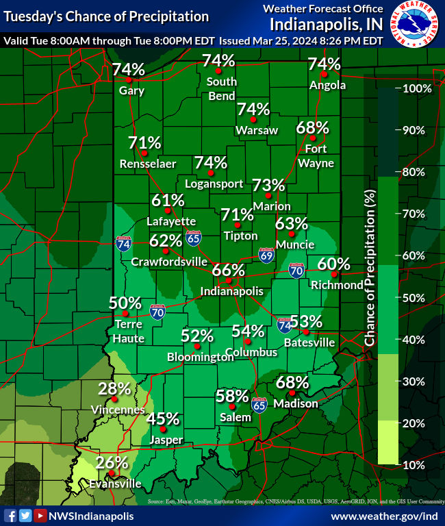
Today: Early morning shower. Another round of afternoon showers and storms that have a risk of being severe. WIND ADVISORY until 6pm, with gusts to 45 mph. Temps fall from the low 60s into the 50s in the afternoon.
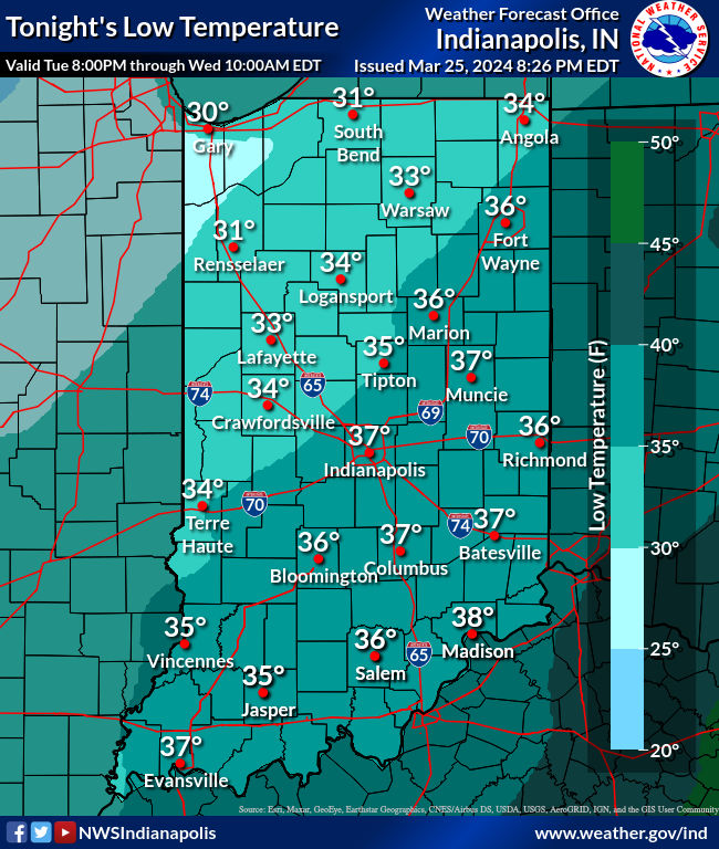
Tonight: Partly cloudy and much cooler. Low 37.
Wednesday: Partly sunny morning. Mostly sunny afternoon. High 50.
Wednesday Night: Clear. Low 30.
Thursday: Sunny. High 56.
Thursday Night: Mostly clear. Low 38.
Friday: Mostly sunny morning. Partly sunny afternoon. High 64.
Friday Night: Mostly cloudy.. Spotty shower overnight. Low 49.
Saturday: Partly to mostly cloudy. Scattered showers, mainly in the morning. High 66.
Saturday Night: Mostly cloudy, with scattered showers. Low 42.
Sunday: Partly to mostly cloudy. Spotty showers or storms. High 61.
Sunday Night:Scattered showers and storms. Low 47.
Monday: Mostly cloudy, with scattered showers and storms. High 64.

Never miss me! Subscribe for free. My Huge Radar has real-time weather tracking, current temperatures, and severe weather watches and warnings. Get detailed Indiana conditions by clicking here. Click here to see my central Indiana 7-Day Forecast. Follow these links to get my forecasts for Lafayette, Muncie, Hendricks County, and Hamilton County. Need a second opinion? Click here for central Indiana National Weather Service forecasts. (Some charts via WeatherBELL.)


