Another round of thunderstorms is expected to begin early this afternoon in central Indiana, and push south/southeast throughout the afternoon and evening. Most storms should remain sub-severe, but there is an isolated risk for large hail and damaging wind gusts.

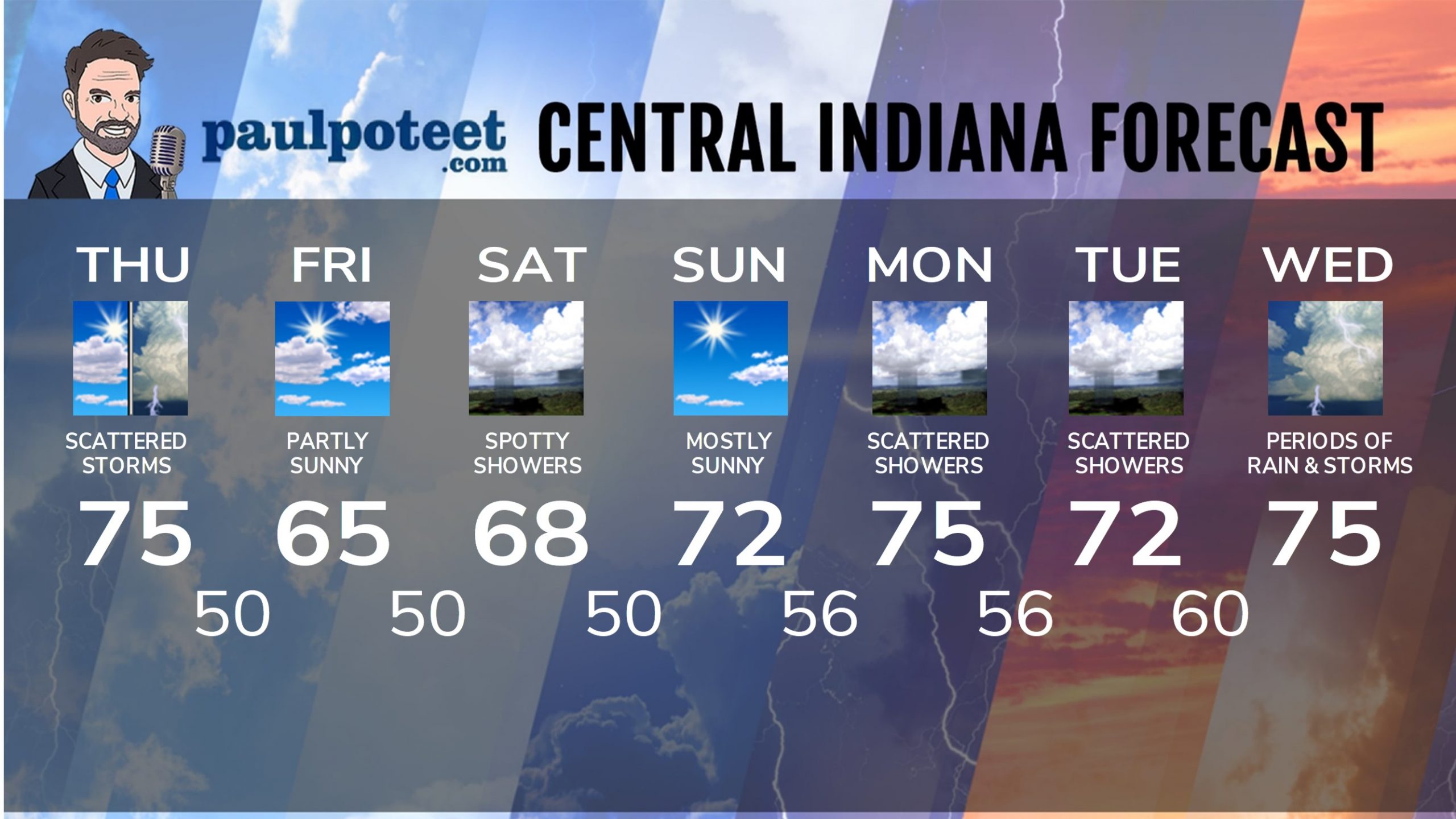
INDY SEVEN DAY FORECAST
Today: Partly to mostly cloudy. Scattered showers and storms, mainly in the afternoon. High 75.
Tonight: Scattered storms ending by late evening. Some clearing overnight. Low 50.
Friday: Partly sunny. High 65.
Friday Night: Partly cloudy, with showers possible after midnight. Low 50.
Saturday: Partly sunny, with spotty showers. High 68.
Saturday Night: Mostly clear. Low 50.
Sunday: Mostly sunny. High 72.
Sunday Night: Partly cloudy. Low 56.
Monday: Partly cloudy. Scattered showers. High 75.
Monday Night: Partly cloudy, with scattered showers. Low 56.
Tuesday: Partly sunny. Scattered showers. High 72.
Tuesday Night: More scattered showers. Low 60.
Wednesday: Periods of showers and storms. High 75.


Never miss me! Subscribe for free. My Huge Radar has real-time weather tracking, current temperatures, and severe weather watches and warnings. Get detailed Indiana conditions by clicking here. Click here to see my central Indiana 7-Day Forecast. Follow these links to get my forecasts for Lafayette, Muncie, Hendricks County, and Hamilton County. Need a second opinion? Click here for central Indiana National Weather Service forecasts. (Some charts via WeatherBELL.)


Leave a Reply